Zavala Island facts for kids

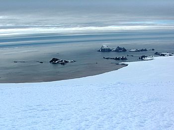
Zavala Island (the right one in the foreground) from Miziya Peak, Livingston Island, with Zed Islands in the background.
|
|

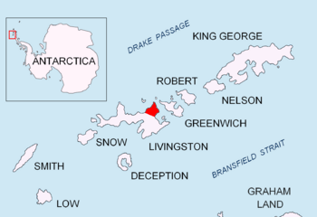
Location of Varna Peninsula in South Shetland Islands
|
|
| Geography | |
|---|---|
| Location | Antarctica |
| Coordinates | 62°28′12″S 60°09′52″W / 62.47000°S 60.16444°W |
| Archipelago | Dunbar Islands |
| Area | 14 ha (35 acres) |
| Length | 0.7 km (0.43 mi) |
| Width | 0.25 km (0.155 mi) |
| Administration | |
| Administered under the Antarctic Treaty System | |
| Demographics | |
| Population | Uninhabited |
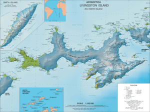
Zavala Island (which is ostrov Zavala in Bulgarian) is a cool, ice-free island. It's part of the Dunbar Islands group, located near the northwest coast of Varna Peninsula on Livingston Island. This whole area is in the South Shetland Islands, which are part of Antarctica.
The island is about 700 meters long and 250 meters wide. That's roughly the length of seven football fields! Its total surface area is about 14 hectares, which is like 14 soccer fields. Long ago, in the early 1800s, people called sealers visited this area. They were hunters who came to catch seals.
Zavala Island got its name from a town in western Bulgaria called Zavala. There's also a mountain with the same name, Zavala Mountain, in Bulgaria.
Where is Zavala Island?
Zavala Island is located at 62°28′12″ South and 60°09′52″ West. This spot is about 1.3 kilometers (less than a mile) east-northeast of Balsha Island. It's also about 750 meters (half a mile) southwest of Aspis Island. If you go 800 meters (about half a mile) north, you'll find Slab Point, and 350 meters (a quarter-mile) west is Organpipe Point.
Scientists and explorers have made detailed maps of this area. For example, a Bulgarian team from the Tangra 2004/05 expedition created a topographic survey. A topographic survey is like making a super detailed map that shows all the hills, valleys, and features of the land. Other countries like Britain (in 1968), Chile (in 1971), and Argentina (in 1980) have also mapped this region. Bulgaria updated its maps in 2005 and 2009.


