Zigzag Mountain facts for kids
Quick facts for kids Zigzag Mountain |
|
|---|---|

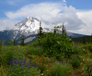
View of Mount Hood from east Zigzag Mountain
|
|
| Highest point | |
| Elevation | 5004+ ft (1525+ m) NAVD 88 |
| Prominence | 480 ft (146 m) |
| Parent peak | Mount Hood |
| Geography | |
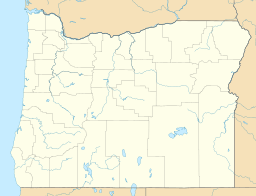
| Location | Clackamas County, Oregon, U.S. |
| Parent range | Cascades |
| Topo map | USGS Government Camp |
Zigzag Mountain is a mountain in Oregon, a state in the United States. It is located in Clackamas County, which is in the northern part of Oregon. This mountain is considered a smaller peak, or a "foothill," of the much larger Mount Hood.
Zigzag Mountain is found about 7 miles (11 km) west-southwest of Mount Hood. It's also about 5 miles (8 km) northwest of a town called Government Camp. To its east is the town of Zigzag, and the Zigzag River flows to its north.
Contents
Mountain Peaks and History
Zigzag Mountain has a main peak that stands over 5,000 feet (1,525 meters) tall. There is also another peak called East Zigzag. This peak is about 4,973 feet (1,516 meters) high.
East Zigzag Lookout
East Zigzag was once home to a special station. This station was a fire lookout post for the United States Forest Service. People used to watch for forest fires from this spot. However, the lookout station was taken down before the year 1970.
How Zigzag Got Its Name
The name "Zigzag" comes from an early Oregon explorer. His name was Joel Palmer. He described a winding, or "zigzagging," path he took. This path led him down from Mount Hood's Zigzag Canyon. The Zigzag Glacier is also found in this canyon. The mountain then took its name from this description.
What the Mountain is Made Of
The top of Zigzag Mountain is covered by certain types of rock. These rocks are called andesite and basalt. They formed during a time period known as the Pliocene epoch. This was millions of years ago.


