Zion, Pennsylvania facts for kids
Quick facts for kids
Zion, Pennsylvania
|
|
|---|---|

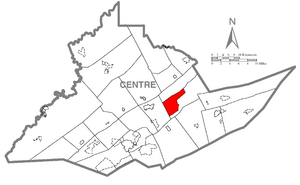
Location within Centre County
|
|
| Country | United States |
| State | Pennsylvania |
| County | Centre |
| Townships | Walker, Spring |
| Area | |
| • Total | 2.88 sq mi (7.46 km2) |
| • Land | 2.88 sq mi (7.46 km2) |
| • Water | 0 sq mi (0.0 km2) |
| Elevation | 1,010 ft (310 m) |
| Population
(2022)
|
|
| • Total | 2,036 |
| • Density | 705/sq mi (272.1/km2) |
| Demonym(s) | Zionist |
| Time zone | UTC-5 (Eastern (EST)) |
| • Summer (DST) | UTC-4 (EDT) |
| ZIP code |
16823
|
| Area code(s) | 814 |
| FIPS code | 42-87320 |
| GNIS feature ID | 1191960 |
Zion is a small community in Centre County, Pennsylvania, United States. It is an unincorporated community and a census-designated place (CDP). This means it's an area identified by the U.S. Census Bureau for statistics, but it doesn't have its own city government.
Contents
Exploring Zion's Location
Zion is found in the middle-northeast part of Centre County. Its exact location is 40°54′57″N 77°40′50″W / 40.91583°N 77.68056°W. The main part of the village is in Walker Township. However, the CDP area stretches into Spring Township.
Natural Surroundings
Zion sits in the Nittany Valley. This valley is nestled between Nittany Mountain to the southeast and a smaller area called Sand Ridge to the north.
Roads and Travel
Two main roads, PA 64 and PA 550, meet in the eastern part of Zion. PA 64 goes northeast for about 12 miles (19 km) to Interstate 80 at Lamar. It also goes southwest for about 12 miles (19 km) to State College. PA 550 heads west about 3 miles (5 km) to Interstate 99. It continues about 5 miles (8 km) to Bellefonte, which is the county seat of Centre County.
Area Size
According to the United States Census Bureau, the Zion CDP covers a total area of 7.46 square kilometers (about 2.88 square miles). All of this area is land.
People of Zion
The census helps us understand the people living in Zion.
Population and Households
As of the 2010 census, there were 2,030 people living in Zion. These people lived in 776 households, and 607 of these were families. The population density was about 155.1 people per square mile (60.0 people per square kilometer). There were 821 housing units in the area.
Community Makeup
Most of the people in Zion were White (98.2%). A small number were Black or African American (0.4%), Native American (0.1%), or Asian (0.2%). About 1.0% of the population identified as two or more races. People of Hispanic or Latino background made up 0.8% of the population.
Family Life
Out of the 776 households, 35.7% had children under 18 living with them. Many households (70.0%) were married couples living together. About 21.7% of households were not families. The average household had 2.61 people, and the average family had 2.96 people.
Age Groups
The population in Zion was spread across different age groups. About 23.4% were under 18 years old. About 7.1% were between 18 and 24. The largest group, 31.1%, was between 25 and 44. People aged 45 to 64 made up 27.8%, and 10.6% were 65 years or older. The average age in Zion was 39 years.
Income Information
The median income for a household in Zion was $57,477. For families, the median income was $59,200. The average income per person in the CDP was $27,810. A small percentage of families (2.9%) and individuals (4.9%) had lower incomes.
Education in Zion
Students in Zion attend schools within the Bellefonte Area School District.
See also
 In Spanish: Zion (Pensilvania) para niños


