İmralı facts for kids

Satellite image of İmralı island in Turkey.
|
|
 |
|
| Geography | |
|---|---|
| Location | Sea of Marmara |
| Coordinates | 40°32′15″N 28°32′06″E / 40.53750°N 28.53500°E |
| Area | 9.98 km2 (3.85 sq mi) |
| Coastline | 19.4 km (12.05 mi) |
| Highest elevation | 217 m (712 ft) |
| Highest point | Türk Tepesi |
| Administration | |
|
Turkey
|
|
| Region | Marmara Region |
| Province | Bursa Province |
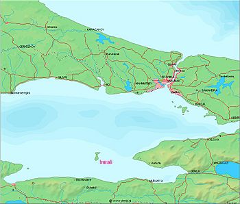
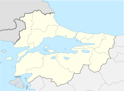
İmralı is a small Turkish prison island. It is located in the southern part of the Sea of Marmara. This island is west of the Armutlu-Bozburun peninsula and is part of Bursa Province.
The island is about 8 kilometers (5 miles) long from north to south. It is about 3 kilometers (1.9 miles) wide. The total area of İmralı is about 9.98 square kilometers (3.85 sq mi). The highest point on the island is Türk Tepesi, which is 217 meters (712 feet) above sea level. Because it is a prison island, it is forbidden to fly over it or fish near its shores.
Contents
A Look at İmralı's Past
Ancient Times
Ancient Roman writers like Pliny the Elder and Strabo called this island Besbicus. Later, it was known as Kalonymos and Kalolimnos. In ancient times, İmralı was part of the Delian League. This was a group of Greek city-states led by Athens. The island is mentioned in Athens' records between 434 and 417 BCE.
Ottoman Control
The Turkish name İmralı comes from Emir Ali. He was one of the first admirals of the Ottoman Empire. In 1308, İmralı became the first island conquered by the new Ottoman Navy. Its location was very important. It allowed the Ottomans to control ships moving through the Sea of Marmara. They set up a naval base there. This helped them cut off the Byzantine Empire's connection to Bursa. Ottoman documents also refer to the island as "Mir Ali." The island was sometimes a safe place for people trying to escape certain government practices.
Life on the Island Before 1923
In 1913, İmralı had about 250 houses, a school, and three monasteries. Around 1,200 people lived there, all of whom were Greek. The people mainly earned money by fishing and farming onions. Most of the onions they grew were sold in Istanbul. There were three Greek villages on the island. They mostly grew grapes, made wine, produced silk, and fished. This continued until the Turkish War of Independence (1919–1923). A well-known person from the island was Kimon Friar. He moved to the United States and became a scholar. He was famous for translating Greek language poetry. After the 1923 forced population exchange between Greece and Turkey, the island became empty. It stayed uninhabited for thirteen years.
İmralı as a Prison Island
In 1936, the Turkish government opened a new prison on İmralı. It was a semi-open prison. Prisoners could earn money by working in farming and fishing. After the 1960 Turkish coup d'état, Adnan Menderes, a former Prime Minister, was held on the island and later died there.
From 1999 to 2009, the prison became a maximum-security facility. For a time, it held only one inmate, Abdullah Öcalan. He was the leader of the PKK. All other prisoners were moved to mainland Turkey. In November 2009, more prisoners were transferred to a new building on the island.
Today, there is a military base on İmralı. The area around the island is a forbidden zone.
Sources
- Brief history
- On the island
- Brief history
- About the name of the island
See also
 In Spanish: Imrali para niños
 | Precious Adams |
 | Lauren Anderson |
 | Janet Collins |


