Strabo facts for kids
Quick facts for kids
Strabo
|
|
|---|---|
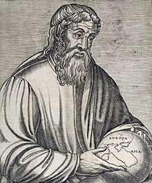
16th-century engraving of Strabo
|
|
| Born | 64 or 63 BC |
| Died | c. AD 24 (aged c. 87) |
| Occupation |
|
Strabo (/ˈstreɪboʊ/; Greek: Στράβων Strábōn; 64 or 63 BC – c. 24 AD) was an important Greek geographer, philosopher, and historian. He lived in Asia Minor (which is now part of Turkey) during a time when the Roman Republic was changing into the powerful Roman Empire.
Contents
Strabo's Life and Travels
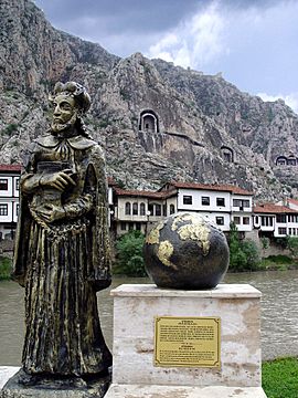
Strabo was born around 64 BC in a city called Amaseia, located in a region called Pontus. This area is now part of Turkey. His family was wealthy and had been involved in politics for a long time. Some of his family members, including his grandfather, had even worked for King Mithridates VI during the Mithridatic Wars.
As these wars ended, Strabo's grandfather helped the Romans by giving them control of some fortresses. Strabo wrote that his family was promised "great things" for their help.
Strabo's life was full of travel. He explored many places, including Egypt and Kush, and went as far west as Tuscany in Italy and south into Ethiopia. He also traveled a lot in Asia Minor and spent time in Rome. Traveling was common for scholars during this period, especially because of the Pax Romana, a time of relative peace under Emperor Augustus. This peace made it safer and easier to travel across the Roman Empire.
He moved to Rome in 44 BC and lived there, studying and writing, until at least 31 BC. Later, around 25 BC, he sailed up the Nile River in Egypt, reaching a place called Philae. After this, there isn't much information about his travels until AD 17.
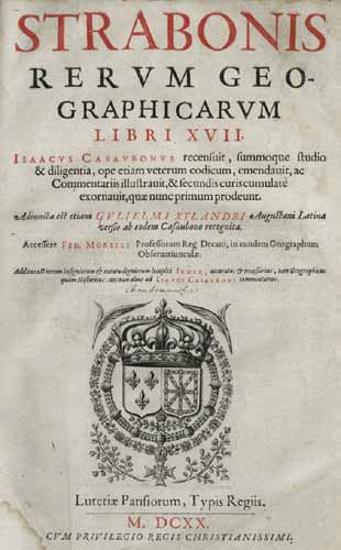
We don't know exactly when Strabo finished his famous book, Geography. However, he mentioned events that happened during the rule of Emperor Tiberius. Some experts think he started writing it around 7 BC, while others believe it was closer to AD 17 or 18. The latest event he mentions is the death of King Juba II in AD 23. He likely worked on Geography for many years, constantly updating and improving it.
Strabo probably stopped writing and died around AD 24, when he was about 87 years old. He was influenced by famous thinkers like Homer, Hecataeus, and Aristotle. Strabo also wrote another major work called Historical Sketches, but almost all of it has been lost.
Strabo's Education
Strabo learned from many different teachers throughout his life, as he traveled around the Mediterranean.
Early Studies
His first studies took place in a city called Nysa (now Sultanhisar, Turkey). Here, he studied with a teacher named Aristodemus, who was an expert in rhetoric (the art of speaking and writing well). Aristodemus was in charge of two schools that focused on rhetoric and grammar. The school in Nysa was especially interested in the works of Homer, the ancient Greek poet. Strabo admired Homer's poetry, likely because of his time with Aristodemus.
Studying in Rome
Around the age of 21, Strabo moved to Rome. There, he studied philosophy with Xenarchus, a respected teacher in Emperor Augustus's court. Xenarchus followed the ideas of Aristotle. Even though Strabo learned from Xenarchus, he later developed his own ideas, leaning more towards Stoicism. In Rome, he also learned grammar from a wealthy and famous scholar named Tyrannion of Amisus. Tyrannion was also an expert on geography, which was very helpful for Strabo's future work.
Stoic Influence
Strabo's last important mentor was Athenodorus Cananites. Athenodorus was a Stoic philosopher who had strong connections with important Roman leaders. He shared his philosophy, knowledge, and contacts with Strabo. Athenodorus's teachings likely led Strabo to shift his own philosophical views towards Stoicism, different from his earlier teachers. Also, Athenodorus had traveled a lot himself, and he gave Strabo valuable information about parts of the Roman Empire that Strabo might not have known about otherwise.
Geographica - Strabo's Famous Book
Strabo is most famous for his large work called Geographica, which means "Geography." This book describes the history of people and places in different parts of the world known during his lifetime.
Even though other writers at the time didn't use Geographica much, many copies of it were saved over time in the Byzantine Empire. It first appeared in Western Europe as a Latin translation around 1469. The first Greek version was published in 1516.
Strabo mentioned earlier Greek astronomers like Eratosthenes and Hipparchus, who used math and astronomy for geography. However, Strabo believed that a descriptive approach was more useful. He wrote his book for leaders and politicians who wanted to understand the people and cultures of different regions, rather than just numbers and measurements.
Because of this, Geographica is a very valuable source of information about the ancient world in Strabo's time, especially when other historical records confirm what he wrote. Strabo traveled widely, saying: "Westward I have journeyed to the parts of Etruria opposite Sardinia; towards the south from the Euxine to the borders of Ethiopia; and perhaps not one of those who have written geographies has visited more places than I have between those limits."
He spent a lot of time in the famous library in Alexandria, taking notes from the works of earlier scholars. The first version of Geographica was published in 7 BC, and the final version was completed no later than AD 23, possibly in the last year of his life. It took some time for scholars to recognize Geographica as an important work.
The city of Alexandria itself is described in detail in the last book of Geographica. Strabo wrote about it as a busy port city with a strong local economy. He noted its beautiful public parks and wide streets that chariots and horsemen could easily use.
Strabo generally supported the Romans in his Geography. While he praised their power in politics and war, he also made an effort to show that the Greeks were superior to Rome in other areas, like culture and knowledge.
In Europe, Strabo was the first to explain that the Danube River changed names at a place called "the cataracts," which is now known as the Iron Gates on the border between Romania and Serbia.
When describing India, a country he never visited, Strabo wrote about small flying reptiles with snake-like bodies and bat-like wings (this sounds like the Indian flying lizard). He also mentioned winged scorpions and other mythical creatures, alongside real animals. Other ancient historians like Herodotus also wrote about similar creatures.
Strabo's Ideas on Geology
Strabo also wrote about geological topics, like volcanoes.
Volcanoes
Strabo observed and wrote about volcanism (volcanic eruptions) in a place called Katakekaumene (which is now Kula in Western Turkey). He described the lava flows he saw there.
See also
 In Spanish: Estrabón para niños
 | Emma Amos |
 | Edward Mitchell Bannister |
 | Larry D. Alexander |
 | Ernie Barnes |


