
Sea of Marmara facts for kids
Quick facts for kids Sea of Marmara |
|
|---|---|
 |
|

Sea of Marmara
Location in Turkey
|
|

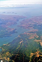
Bathymetry and surrounding relief
|
|
| Location | Europe and Asia |
| Coordinates | 40°40′N 28°00′E / 40.667°N 28.000°E |
| Type | Inland sea |
| Native name | Marmara Denizi (Turkish) |
| Primary inflows | Simav River, Biga Çayı, Nilüfer River |
| Primary outflows | Turkish Straits |
| Catchment area | 11,500 km2 (4,400 sq mi) |
| Basin countries | Turkey |
| Surface area | 11,350 km2 (4,380 sq mi) |
| Average depth | 494 m (1,621 ft) |
| Max. depth | 1,370 m (4,490 ft) |
| Water volume | 3,378 km3 (810 cu mi) |
| Islands | Marmara Island, Avşa, İmralı, Prince Islands, Paşalimanı and Ekinlik Island |
| Settlements | Istanbul, Bursa, İzmit, Tekirdağ, Balıkesir, Çanakkale, and Yalova |

.jpg)

The Sea of Marmara is an inland sea located entirely within Turkey. It acts like a bridge, connecting the Black Sea to the Aegean Sea. This sea also separates the European and Asian parts of Turkey.
The Bosporus strait connects the Sea of Marmara to the Black Sea. The Dardanelles strait connects it to the Aegean Sea. The Bosporus strait also divides Istanbul into its European and Asian sides. The Sea of Marmara is a fairly small sea. It covers an area of about 11,350 square kilometers (4,380 sq mi). It is about 280 kilometers (174 mi) long and 80 kilometers (50 mi) wide. The deepest part of the sea is about 1,370 meters (4,490 ft) deep.
Contents
What's in a Name? The Sea of Marmara
The Sea of Marmara gets its name from Marmara Island. This island is famous for its rich supply of marble. The word "Marmara" comes from the Greek word mármaron, which means "marble."
In ancient times, this sea was known as the Propontis. This old Greek name means "before the sea." It was called this because ancient Greek sailors passed through it to reach the Black Sea, which they called Pontos.
In Greek mythology, there's a story about the Propontis. A big storm on this sea brought the Argonauts back to an island they had just left. This led to a battle where Jason or Heracles accidentally killed King Cyzicus. The king thought they were his enemies.
Geography of the Sea of Marmara
The water in the Sea of Marmara has different levels of saltiness. Near the surface, the water is a bit salty. It has about 22 parts of salt per thousand parts of water. This is saltier than the Black Sea but less salty than most oceans.
However, the water at the bottom of the sea is much saltier. It has about 38 parts of salt per thousand. This is similar to the saltiness of the Mediterranean Sea. This very salty, heavy water stays at the bottom and does not mix much with the water at the surface.
Rivers like the Susurluk, Biga (also known as Granicus), and Gonen Rivers flow into the Sea of Marmara. These rivers bring fresh water, which helps to lower the sea's saltiness. Most of these rivers flow from the Asian side of Turkey, called Anatolia.
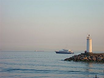
Islands and Coasts
The Sea of Marmara is home to several islands. These include the Prince Islands, Marmara Island, Avşa, and Paşalimanı.
The southern coast of the sea has many deep inlets and bays. Some of the important ones are the Gulf of İzmit, the Gulf of Gemlik, the Gulf of Bandırma, and the Gulf of Erdek.
Earthquakes and the Sea
The North Anatolian Fault runs right under the Sea of Marmara. This fault line is a place where Earth's plates meet. It has caused many large earthquakes in recent years. This means the area around the Sea of Marmara can experience strong tremors.
Towns and Cities by the Sea
Many important towns and cities are located along the coast of the Sea of Marmara. These places are important for trade, tourism, and daily life in Turkey.
| Istanbul Province | Balıkesir Province
Bursa Province Çanakkale Province
|
Kocaeli Province
Tekirdağ Province
|
Yalova Province
|
Gallery
-
The Bosphorus with Istanbul in the background
-
View of Marmara Sea from Istanbul
-
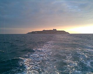
Sea of Marmara approaching Yassıada


See also
 In Spanish: Mar de Mármara para niños
