1843 Wanganui earthquake facts for kids
| UTC time | 1843-07-09 |
|---|---|
| Local date | 8 July 1843 |
| Magnitude | Mw 7+ |
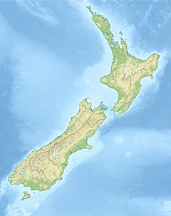
| Epicenter | near Whanganui, North Island 40°00′S 176°03′E / 40.000°S 176.050°E |
| Casualties | 2 deaths |
The 1843 Whanganui earthquake happened on July 8th at 4:45 PM. It was a very strong earthquake, estimated to be a magnitude 7.5. People felt it very strongly, with shaking described as 'Violent' and possibly even 'Extreme' on a scale called the Mercalli intensity scale.
The earthquake's starting point, called the epicenter, was thought to be about 50 kilometers northeast of Whanganui, near Taihape. Scientists at GNS Science believe the epicenter was about 35 kilometers east of Taihape, close to the Hawke's Bay area. This was the first earthquake in New Zealand with a magnitude over 7 that people wrote about. It was also the first time deaths were recorded from an earthquake there.
Why Earthquakes Happen in New Zealand
New Zealand sits on the edge of two huge pieces of the Earth's crust, called tectonic plates. These are the Australian Plate and the Pacific Plate. These plates are always moving, but very slowly.
In the South Island, most of this movement happens along a big crack in the Earth called the Alpine Fault. This fault causes the plates to slide past each other and also push up against each other.
In the North Island, the movement mainly happens where the Pacific Plate slides under the Australian Plate. This area is known as the Kermadec subduction zone. There are also other faults, like the North Island Fault System, where the plates slide sideways.
Scientists don't know of any specific fault that caused the 1843 earthquake.
How Strong Was the Earthquake?
The earthquake was felt across a large part of the North Island. Some reports said the shaking lasted for three minutes near Mokoia.
Scientists estimated its magnitude at 7.5. They figured this out by looking at how big an area experienced very strong shaking, which was rated as 'Severe' or higher.
After the main earthquake, there were many smaller shakes called aftershocks. At least ten aftershocks were reported on the same day. People continued to feel these smaller shakes until January 1845.
What Damage Did It Cause?
The area around Whanganui was hit very hard. The shaking was so strong it was rated as 'Violent' to 'Extreme' on the Mercalli intensity scale.
Many houses were damaged. A brick church in a place called Pūtiki was completely destroyed. The ground near the Whanganui River cracked and spread out. A part of Shakespeare Cliff, a big hill, fell into the river.
Sadly, two people died during the earthquake. Their house was swept away by a landslide that the earthquake caused.
 | Aaron Henry |
 | T. R. M. Howard |
 | Jesse Jackson |


