1934 Pahiatua earthquake facts for kids
| UTC time | 1934-03-05 11:46:22 |
|---|---|
| ISC event | 904826 |
| USGS-ANSS | ComCat |
| Local date | 5 March 1934 |
| Local time | 11:46 p.m. NZDT |
| Magnitude | 7.6 ML |
| Depth | 12 km (7 mi) |
| Epicenter | 40°33′S 176°17′E / 40.55°S 176.29°E |
| Areas affected | New Zealand |
| Max. intensity | IX (Violent) |
| Casualties | 2 deaths (indirect), 1 injured |
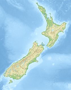
The 1934 Pahiatua earthquake happened late at night on March 5, 1934. It caused a lot of damage in the lower part of New Zealand's North Island. Areas like Wairarapa, Wellington, and Hawke's Bay felt the ground shake the most. Hawke's Bay was still recovering from another big earthquake in 1931. Most of New Zealand felt this tremor.
Even though it's called the Pahiatua earthquake, experts now think it started closer to a place called Horoeka. The shaking was felt far north in Auckland. It was also felt in the northern South Island and along the east coast all the way to Dunedin.
The ground shook very strongly (level VIII on the Mercalli intensity scale) over a large area. This area covered about 8700 square kilometers in the lower North Island. The strongest shaking (level IX, which is Violent) happened south-east of Pahiatua. This was between the small towns of Pongaroa and Bideford.
What Caused the Earthquake?
The eastern part of the North Island sits on something called the Hikurangi Margin. This is where the Pacific Plate is slowly sliding underneath the Australian Plate. This sliding motion isn't perfectly straight. It also involves a side-to-side movement.
This side-to-side movement is handled by a group of faults (cracks in the Earth's crust). These faults are known as the North Island Fault System.
How Strong Was the Earthquake?
This earthquake was very powerful. Scientists estimated its strength to be 7.6 on the surface wave magnitude scale. On another scale, the moment magnitude scale, it was between 7.2 and 7.4.
At first, people thought the earthquake started near Pahiatua. This was because that area had the most damage. But after looking closely at earthquake recordings (seismograms) and where the shaking was felt, experts found something new. They also looked at where the smaller quakes (called aftershocks) happened afterward.
All this information suggested the earthquake actually started closer to Horoeka. Scientists have also studied the ground along the Waipukaka Fault. Their findings suggest this fault was the one that caused the 1934 earthquake.
Damage Caused by the Quake
The earthquake caused the most damage in the Hawke's Bay and northern Wairarapa regions. Today, this area is known as the Tararua District. There was widespread damage from Porangahau to Castlepoint.
Much of this area, especially near the east coast, didn't have many people living there at the time. However, the town of Pahiatua saw a lot of damage. Many buildings that were not built very strongly were badly damaged or fell down completely.
Sadly, two people who were already unwell passed away. One person was injured and needed to go to the hospital. The earthquake also caused many small landslides along the cliffs from Cape Turnagain to Castlepoint. The ground surface itself was also changed in several places.
 | Audre Lorde |
 | John Berry Meachum |
 | Ferdinand Lee Barnett |


