Abraham Lake facts for kids
Quick facts for kids Abraham Lake |
|
|---|---|

Lake on the North Saskatchewan River
|
|
| Location | Clearwater County, Alberta |
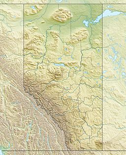
| Coordinates | 52°13′25″N 116°25′38″W / 52.22361°N 116.42722°W |
| Type | Reservoir |
| Primary inflows | North Saskatchewan River |
| Primary outflows | North Saskatchewan River |
| Basin countries | Canada |
| Max. length | 32 km (20 mi) |
| Max. width | 3.3 km (2.1 mi) |
| Surface area | 53.7 km2 (20.7 sq mi) |
| Surface elevation | 1,340 m (4,400 ft) |
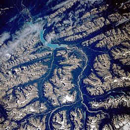
Abraham Lake, also known as Lake Abraham, is a large, man-made lake in Alberta, Canada. It is the biggest reservoir in Alberta. This beautiful lake is located in the "Kootenay Plains area of the Canadian Rockies' front range". It was created on the North Saskatchewan River in western Alberta.
What is Abraham Lake Like?
Abraham Lake covers an area of about 53.7 square kilometers (20.7 square miles). It is also about 32 kilometers (20 miles) long. Even though it is man-made, the lake has a stunning blue color. This color is similar to other lakes in the Rocky Mountains that were formed by glaciers.
The blue color comes from something called rock flour. This is tiny, powdery rock dust. It is created when glaciers grind rocks into very fine particles. When sunlight hits these tiny particles in the water, it makes the lake look bright blue.
Several mountains surround Abraham Lake. Abraham Mountain, Elliott Peak, and the Cline River Heliport are on the western side. Mount Michener is located on the eastern shore. Mount Ernest Ross sits at the southern end of the lake.
How Was Abraham Lake Created?
Abraham Lake was formed in 1972 by a company called TransAlta (formerly Calgary Power Company). They built a large structure called the Bighorn Dam. This dam was built on the upper part of the North Saskatchewan River.
The dam's construction flooded the Kootenay Plains area. This area was home to the Bighorn Stoney Indigenous people. The flooding changed their way of life, as they relied on hunting and fur trapping. Their cabins, graves, and pastures were covered by the new lake.
The lake now stretches along the David Thompson Highway. This highway runs between Saskatchewan River Crossing and Nordegg.
The Government of Alberta held a contest in February 1972 to name the new lake. Students from all over the province suggested names. They were asked to think about history, important people, and the area's geography. The lake was named after Silas Abraham. He lived in the Saskatchewan River valley in the 1800s.
The Amazing Frozen Bubbles
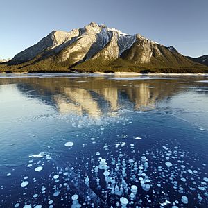
Abraham Lake is famous for a cool natural event that happens in winter. When the lake freezes, you can see trapped bubbles under the ice. These bubbles look like stacks or layers.
This happens because plants at the bottom of the lake decay. As they break down, they release a gas called methane. This methane gas rises to the surface. As the lake starts to freeze, the bubbles get trapped in the ice. They stop moving, creating a unique visual effect.
The combination of these frozen bubbles and the clear blue water makes Abraham Lake a popular spot. Many photographers and nature lovers visit to see this amazing sight. The amount of ice on the lake changes throughout the winter. It usually freezes by late December, but sometimes it freezes later, like in January.
 | William M. Jackson |
 | Juan E. Gilbert |
 | Neil deGrasse Tyson |


