
Abtwil, Aargau facts for kids
Quick facts for kids
Abtwil
|
||
|---|---|---|
 |
||
|
||

Abtwil
Location in Switzerland

Abtwil
Location in Canton of Aargau
|
||
| Country | Switzerland | |
| Canton | Aargau | |
| District | Muri | |
| Area | ||
| • Total | 4.14 km2 (1.60 sq mi) | |
| Elevation | 536 m (1,759 ft) | |
| Population
(Dec 2020 )
|
||
| • Total | 954 | |
| • Density | 230.4/km2 (596.8/sq mi) | |
| Postal code |
5646
|
|
| Surrounded by | Sins (AG), Hohenrain (LU), Ballwil (LU) | |

Abtwil is a small town, also called a municipality, in Switzerland. It's located in the Muri district within the canton of Aargau. It's right next to the border of the Lucerne canton.
Contents
Abtwil's Past: A Look at Its History
People have lived in the Abtwil area for a very long time! We know this because Roman and Alamanni artifacts have been found here. There are even two old Alamanni cemeteries in a place called Altchile.
The village of Abtwil was first officially mentioned in the year 1256. Back then, it was called Apwiler. During the Middle Ages, a group called the Knights Hospitaller of Hohenrain had control over the village.
In 1256, a powerful count named Gottfried von Habsburg-Laufenburg tried to challenge the Knights' rights, but he wasn't successful. Four farmhouses in Abtwil stayed with the Knights until 1805.
Before 1798, Abtwil was part of a larger area called the High Court of Meienberg. This court was under the Habsburgs until 1415. Then, from 1415 to 1424, it was controlled by Lucerne. After 1424, it became part of the Swiss Confederacy.
Exploring Abtwil's Geography

Abtwil covers an area of about 4.14 square kilometers (about 1.6 square miles). A big part of this land, almost 70%, is used for farming. Forests cover about 22% of the area. The remaining land, about 8%, has buildings and roads.
Most of the built-up area is for homes and other buildings. Roads and other transportation take up a smaller part. In the forested areas, most of the land is covered with thick forests. Some smaller areas have orchards or groups of trees.
For farming, about 42% of the land is used for growing crops. Another 26% is used for pastures where animals graze. A small part is used for orchards or vineyards.
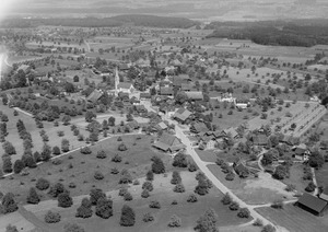
Abtwil is located in the Muri district, at the southern base of a hill called the Lindenberg. The municipality includes the main village of Abtwil, which is a haufendorf (an old type of village built without a clear plan). It also includes a smaller settlement called Altchile.
Abtwil's Coat of Arms
The blazon (official description) of Abtwil's coat of arms is: Azure a Crosier Or issuant from Base with a Ribbon Argent. This means it shows a golden shepherd's crook (called a crosier) coming up from the bottom, on a blue background, with a silver ribbon.
This design is a type of canting coat of arms. This means the picture on the coat of arms gives a hint about the name. The German word for abbot is Abt, and the coat of arms shows an abbot's crosier!
Who Lives in Abtwil? Demographics
Abtwil has a population of 954 people. About 7% of the people living here are from other countries. Over the last 10 years, the population has grown by about 12.5%.
Most people in Abtwil speak German, about 97%. Italian is the second most common language, and Albanian is third.
Let's look at the age groups in Abtwil:
- About 12% of the population are children aged 0 to 9 years old.
- About 17% are teenagers aged 10 to 19.
- Among adults, about 11% are in their 20s.
- About 15% are in their 30s.
- About 22% are in their 40s.
- About 12.5% are in their 50s.
- For older adults, about 5% are in their 60s, 3% are in their 70s, and a small number are 80 or older.
In 2000, there were 240 private homes and apartments in Abtwil. On average, there were 2.8 people living in each home. In 2008, about 42% of the homes were single-family houses.
In the 2007 Swiss federal election, the most popular political party in Abtwil was the SVP. They received about 43% of the votes. Other popular parties included the CVP, the FDP, and the SP.
Here's how Abtwil's population has changed over time:
| Historical population | ||
|---|---|---|
| Year | Pop. | ±% |
| 1836 | 392 | — |
| 1900 | 325 | −17.1% |
| 1950 | 342 | +5.2% |
| 1970 | 297 | −13.2% |
| 2000 | 674 | +126.9% |
Abtwil's Economy: How People Work
In 2007, Abtwil had a very low unemployment rate, less than 1%. This means almost everyone who wanted a job had one.
The economy of Abtwil is divided into three main parts:
- Primary Sector: This includes jobs like farming and forestry. In 2005, about 45 people worked in this sector, with 18 businesses.
- Secondary Sector: This involves manufacturing and construction. About 73 people worked in this sector, with 8 businesses.
- Tertiary Sector: This includes services like shops, offices, and healthcare. About 56 people worked in this sector, with 14 businesses.
Many people who live in Abtwil travel to other towns for work. In 2000, about 78% of the working residents commuted outside Abtwil. At the same time, about 51 people traveled into Abtwil for their jobs. Most people (about 60%) used a private car to get to work, while a smaller number (about 6%) used public transportation.
Religion in Abtwil
Based on the 2000 census, most people in Abtwil are Roman Catholic, making up about 73% of the population. About 12% belong to the Swiss Reformed Church. A very small number of people belong to the Christian Catholic faith.
Learning in Abtwil: Education
Many adults in Abtwil have a good education. About 85% of people aged 25-64 have finished either non-mandatory high school or have gone on to higher education, like a university.
In the 2008/2009 school year, there were 69 students attending primary school in Abtwil.
Images for kids
-
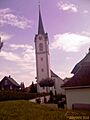
Church in Abtwil
See also
 In Spanish: Abtwil para niños
