Agery, South Australia facts for kids
Quick facts for kids AgerySouth Australia |
|||||||||||||||
|---|---|---|---|---|---|---|---|---|---|---|---|---|---|---|---|
| Established | 24 May 1999 (locality) | ||||||||||||||
| Postcode(s) | 5558 | ||||||||||||||
| Elevation | 104 m (341 ft) | ||||||||||||||
| LGA(s) | Yorke Peninsula Council | ||||||||||||||
| Region | Yorke and Mid North | ||||||||||||||
| County | Daly | ||||||||||||||
| State electorate(s) | Narungga | ||||||||||||||
| Federal Division(s) | Grey | ||||||||||||||
|
|||||||||||||||
| Footnotes | Adjoining localities | ||||||||||||||
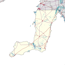
Agery is a small place, also called a locality, in the Australian state of South Australia. It is found on the Yorke Peninsula. Agery is about 17 kilometers (10.5 miles) south-east of the town of Moonta. The name Agery comes from an Aboriginal word, ngadjali. This word means "pipe clay."
Contents
What is Agery's History?
Agery has a history that goes back many years. It was once a busy little community.
Early Buildings and Services
- Agery School: The school in Agery first opened its doors in 1880. It taught local children for over 100 years. The school finally closed in 1982.
- Agery Post Office: A post office was also opened in Agery in December 1890. This helped people send and receive mail.
- Agery Methodist Church: A church, originally known as the New Wesleyan Chapel, was built in 1885. It was a place for people to gather until 1970.
What Natural Features Does Agery Have?
Agery is home to a special natural area. This area helps protect local plants and animals.
Agery Reserve
- A Small Nature Spot: Agery Reserve is a small nature area. It covers about 3.3 hectares (about 8 acres).
- Mallee Scrub: This reserve is filled with mallee scrub. Mallee is a type of Australian bushland. It has many small eucalyptus trees.
- Managed by the National Trust: The reserve is looked after by the Moonta Branch of the National Trust of South Australia. They work to protect important natural and historical places.
How is Agery Governed?
Like all places in Australia, Agery is part of different government areas. These areas help manage services for the people who live there.
Local and National Government
- Local Council: Agery is part of the Yorke Peninsula Council. This is the local government body. They look after local services like roads and rubbish collection.
- State Government: For state-level decisions, Agery is in the electoral district of Narungga. People in this district vote for a representative in the state parliament.
- Federal Government: At the national level, Agery is in the federal division of Grey. This division elects a representative to the Australian Parliament in Canberra.
Black History Month on Kiddle
Outstanding African-American Social Activists
 | Frances Mary Albrier |
 | Whitney Young |
 | Muhammad Ali |

All content from Kiddle encyclopedia articles (including the article images and facts) can be freely used under Attribution-ShareAlike license, unless stated otherwise. Cite this article:
Agery, South Australia Facts for Kids. Kiddle Encyclopedia.

