Aiguille Peak facts for kids
Quick facts for kids Aiguille Peak |
|
|---|---|

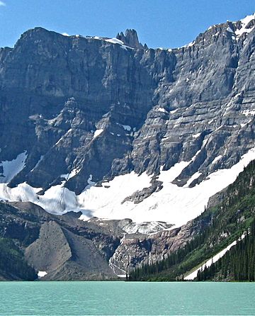
Aiguille Peak from Chephren Lake
|
|
| Highest point | |
| Elevation | 3,001 m (9,846 ft) |
| Prominence | 206 m (676 ft) |
| Geography | |
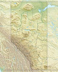
| Location | Alberta / British Columbia, Canada |
| Parent range | Waputik Range |
| Topo map | NTS 82N/15 |
| Climbing | |
| First ascent | 1952 by Mr. and Mrs. J.D. Mendenhall |
Aiguille Peak is a cool mountain located right on the border between Alberta and British Columbia in Canada. You can find it inside the beautiful Banff National Park. It got its name in 1915 from a person named Arthur O. Wheeler. The word "Aiguille" is French for "needle," which makes sense because the peak looks like a sharp, pointy needle! It's also a special word climbers use for a mountain top that's very sharp.
How Aiguille Peak Was Formed
Aiguille Peak is made of a type of rock called sedimentary rock. This rock was formed a very, very long time ago. Imagine ancient shallow seas where layers of sand, mud, and tiny bits of sea creatures settled. Over millions of years, these layers got squished and hardened into rock.
Later, during a huge event called the Laramide orogeny, these rocks were pushed up. This was like a giant slow-motion collision that lifted and folded the Earth's crust. This is how Aiguille Peak and many other mountains in the Rocky Mountains were created.
Weather at Aiguille Peak
The weather at Aiguille Peak is usually very cold. It's in a subarctic climate zone. This means winters are long and snowy, and summers are short and mild.
Temperatures can drop really low, sometimes even below -20 °C. When you add the wind, it can feel even colder, like -30 °C or less!
The water from melting snow and rain on the peak flows in two main directions. On the east side, it drains into the Mistaya River. On the west side, it flows into smaller streams that eventually join the Blaeberry River.
 | Frances Mary Albrier |
 | Whitney Young |
 | Muhammad Ali |


