Aird Uig facts for kids
Quick facts for kids Aird Uig
|
|
|---|---|
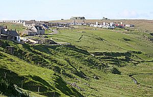
 Buildings at Aird Uig |
|
| Language | Scottish Gaelic English |
| OS grid reference | NB048379 |
| Civil parish | |
| Council area | |
| Lieutenancy area | |
| Country | Scotland |
| Sovereign state | United Kingdom |
| Post town | ISLE OF LEWIS |
| Postcode district | HS2 |
| Dialling code | 01851 |
| Police | Northern |
| Fire | Highlands and Islands |
| Ambulance | Scottish |
| EU Parliament | Scotland |
| UK Parliament |
|
| Scottish Parliament |
|
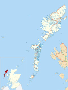
Aird Uig (which in Gaelic is Àird Ùig) is a small village. It is found on the Isle of Lewis. This island is part of the Outer Hebrides in Scotland. Aird Uig is located within the area called Uig. You can reach it by taking the C40 minor road. This road connects to the B8011 at Timsgarry. The village also includes a large area of shared land. This land is used for grazing animals.
Aird Uig has two different parts. The south end is a traditional crofting community. A croft is a small farm, often with shared land. The north end has old army buildings. Many of these have been turned into homes. The main building and shop for soldiers are now the Gallan Head Hotel & Restaurant.
History of Aird Uig
People first settled in Aird Uig in 1825. These were crofters who had to leave their homes. They came from a nearby place called Carnish. Aird Uig was chosen because it was very remote. The land was also hard to farm. This meant landowners were not interested in it.
Between 1954 and 2010, the Royal Air Force (RAF) used a special site here. Later, NATO also used it. This site at Gallan Head was a RADAR station. It was called RAF Aird Uig. Now, the local community wants to open the old base to the public. They hope to make it an observatory. It could also be a gallery and a place to listen for whales.
Cool Places to See
Taigh a’ Bheannaich
Taigh a’ Bheannaich means "House of Blessings". It is the ruins of an old church. You can find it on a small piece of land. This land is called Druim Bheannaich. It is located to the west of Loch a’ Bheannaich.
RAF Aird Uig Radar Station
Royal Air Force Aird Uig was a radar station. A radar station uses radio waves to detect objects. This station was built as part of the ROTOR programme. This was a plan to protect Britain from air attacks. The RAF operated it from 1954 to 1974. After ROTOR, the RAF still used the site. It was a communications and radar site until 2000. Its duties then moved to RAF Buchan. This base is near Peterhead in Aberdeenshire.
After the RAF left, NATO took over the site. It became a communications hub for them. The military completely left the site in 2010.
 | William Lucy |
 | Charles Hayes |
 | Cleveland Robinson |


