Aitana (mountain) facts for kids
Quick facts for kids Aitana |
|
|---|---|

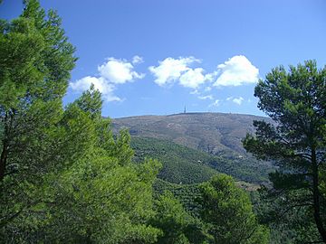
Aitana peak and the antenna of EVA
|
|
| Highest point | |
| Peak | Aitana |
| Elevation | 1,558 m (5,112 ft) |
| Dimensions | |
| Length | 8 km (5.0 mi) E/W |
| Width | 3 km (1.9 mi) N/S |
| Area | 20 km2 (7.7 sq mi) |
| Geography | |
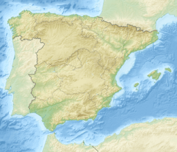
| Location | Marina Baixa, Alcoià and Comtat, Valencian Community |
| Parent range | Baetic System |
| Geology | |
| Type of rock | Limestone |
Aitana is a large mountain range in the eastern part of Spain. It's located in the Valencian Community, specifically in the northern part of Alicante province. The highest point of Aitana is 1,558 meters (about 5,112 feet) above sea level. This makes it the tallest spot in the entire province!
Contents
Geography of Aitana
The Aitana mountain range covers a huge area of 2,000 hectares. That's about 20 square kilometers! It's also quite close to the Mediterranean Sea, only about ten miles away. Besides the main Aitana peak, there are other important peaks here. These include Penya Alta (1,506 m), Penya Catxa (1,467 m), El Mulero (1,308 m), and Alt del Carrascar (1,208 m).
The top of Aitana has also been a famous finish line for a big bike race. This race is called the Vuelta a España, which is a multi-stage bicycle race. The climb up to Alto de Aitana is very long, about 22.3 kilometers (13.8 miles). It's a tough climb with an average slope of 6%.
Climbing to the Top of Aitana
There are several ways to hike to the top of Aitana. You can usually visit almost any time of year. Just be careful during winter if there's snow. One popular hiking path is about 18 kilometers (11 miles) long, going there and back.
The path is often split into three main parts:
Puerto Tudons to Font de l’Arbre
You can reach Font de l’Arbre by car from a town called Confrides. This part of the route is 7 kilometers long on a narrow track. The first 4 kilometers start on road CV-770 with a long climb. To your right, you'll see the big walls of the Sierra de Aitana. To your left, there are pine trees and holly oaks. You'll get amazing views of the valley and nearby towns. You might also see old, unused farm terraces.
After a short downhill walk, you'll reach the first stop: La Font de l’Arbre. Here, you can see old stone structures. These were once used to store snow, which would then be cut into ice blocks for towns below. La Font de l’Arbre is a nice picnic spot with wooden tables and a barbecue. There's also a spring with fresh, clear water. It’s a great place to rest because the trees give shade in summer and let sunlight through in winter. You can also spot some old farmhouses and a hostel from here.
Font de l’Arbre to Font de la Forata
The next part of the journey is 3 kilometers long. It goes from Font de l’Arbre to Font de la Forata. This section is a steady, gentle climb. The path runs between pine trees on one side and the mountain walls on the other. The trail is easy to follow and clearly marked.
La font de la Forata is a flat, grassy area with small streams of water. From here, you can clearly see the summit of Aitana. There's a tall antenna right at the very top. A little to the left, you'll see the Pas de La Rabosa. The hiking trail goes through this narrow opening in the mountain. You can also reach Benifato from here by following another path called PR-CV 21.
Font de la Forata to Summit of Aitana
The path to Pas de La Rabosa continues along a special trail. It's called the Passet de La Rabosa botanical trail. You'll see wooden signs that tell you about the unique plants here. These plants have learned to survive the strong winds and cold winters of the mountains.
The pass is very close now. You'll climb a bit over loose rocks that have fallen from the mountain. Be careful, but it's not too hard. You can get to the other side of Aitana through a small gap between the rocks, called Pas de la Rabosa. The views from here are truly amazing!
Aitana Pas de la Rabosa. After crossing the pass, you'll follow a path along some deep cracks in the ground. These are known as the chasms of Partagás. They are a natural wonder! These cracks are about 15 or 20 meters (50-65 feet) wide. They can be more than 100 meters (328 feet) deep! They were formed over a very long time by rain and melting snow. Water mixed with carbon dioxide in the air creates a weak acid. This acid slowly dissolves the limestone rock, carving out these amazing chasms.
Aitana in the Vuelta a España (since 2001)
Aitana has been a challenging finish line for the Vuelta a España bike race several times. Here's a look at some of those races:
| Year | Stage | Start of stage | Distance (km) | Category | Stage winner | Leader |
|---|---|---|---|---|---|---|
| 2016 | 20 | Benidorm | 184 | HC | ||
| 2009 | 8 | Alzira | 204.7 | HC | ||
| 2004 | 9 | Xàtiva | 170 | HC | ||
| 2001 | 15 | Valencia | 207.2 | HC |
See Also
 In Spanish: Sierra de Aitana para niños
- Mountains of the Valencian Community
 | Delilah Pierce |
 | Gordon Parks |
 | Augusta Savage |
 | Charles Ethan Porter |


