Akatarawa Saddle facts for kids
Quick facts for kids Akatarawa Saddle |
|
|---|---|

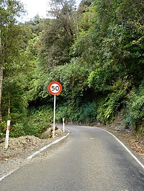
Akatarawa Road in 2005
|
|
| Elevation | 450 m (1,476 ft) |
| Traversed by | Akatarawa Road |
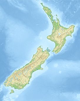
| Location | Wellington, North Island, New Zealand |
| Range | Tararua Range |
| Coordinates | 40°56′54″S 175°6′30″E / 40.94833°S 175.10833°E |
The Akatarawa Saddle is a special place in the Wellington Region of New Zealand. It is a mountain pass, which means it's a lower point between two mountains that people can travel through. This saddle is about 450 meters (or 1,476 feet) above sea level. It sits on the North Island of New Zealand.
The Akatarawa Road goes right over this saddle. This road connects Upper Hutt in the southeast to Waikanae in the northwest. It passes through the southern part of the Tararua Range mountains.
Rivers and Water Flow
The Akatarawa Saddle is a natural dividing line for water.
- Water that flows south from the saddle goes into the Akatarawa River.
- The Akatarawa River then joins the Hutt River.
- Finally, the Hutt River flows into the Cook Strait, which is the sea between New Zealand's North and South Islands.
On the other hand, water that flows north from the saddle ends up in the Tasman Sea. This sea is located between New Zealand and Australia. So, the saddle acts like a natural split, sending water to two different oceans!
History of the Road
People have been interested in using the Akatarawa Saddle for a long time.
Early Railway Ideas
Around 1911, engineers looked at the area. They hoped to find a good path for a railway line. This railway would connect Upper Hutt and Waikanae. They thought it could be about 5 miles (or 8 kilometers) shorter than the main railway line, called the North Island Main Trunk. However, building a railway here would have needed a very long tunnel. Because of this, the railway idea didn't happen.
Building the Road
Even though a railway wasn't built, a road was still very useful.
- The Akatarawa Road was mostly ready for cars by 1922.
- However, there were some delays. It was hard to get enough concrete to finish all the work.
- The bridges along the road were finally completed in 1923.
This road made it much easier for people to travel between Upper Hutt and Waikanae.


