Albany metropolitan area, Georgia facts for kids
Quick facts for kids
Albany metropolitan area
|
|
|---|---|
| Albany, Ga, metropolitan statistical area | |

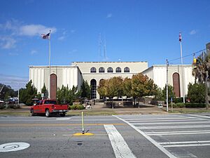
Dougherty Judicial Building
|
|
| Country | |
| State | |
| Largest city | Albany |
| Area | |
| • Total | 1,591 sq mi (4,120 km2) |
| Population
(2023)
|
|
| • Total | 145,508 |
| • Density | 92/sq mi (36/km2) |
| Time zone | UTC-5 (CST) |
| • Summer (DST) | UTC-4 (CDT) |
| Area code(s) | 229 |
The Albany metropolitan area is a group of five counties in Georgia, USA. It's officially called the Albany metropolitan statistical area by the U.S. government. This area includes the city of Albany and the surrounding counties of Baker, Dougherty, Lee, Terrell, and Worth. In 2023, about 145,508 people lived here.
Contents
Where is the Albany Area?
The Albany metropolitan area is located in the southern part of Georgia. It covers about 1,591 square miles.
Main Cities and Towns
The biggest city in this area is Albany. Other important towns include:
People Living Here
In 2020, about 148,922 people lived in the Albany metropolitan area. By 2022, this number was estimated to be around 146,387.
The people living in the Albany area come from many different backgrounds. In 2022, about:
- 39% were White
- 52% were African American
- 1% were Asian
- 3% were from two or more races
- 3% were Hispanic or Latino
The average income for a household in the area was about $48,376 in 2022. This means that half of the households earned more than this amount, and half earned less.
Getting Around
You can travel to and from the Albany area by air or by road.
Air Travel
- Southwest Georgia Regional Airport
Main Roads
- U.S. Route 19
- U.S. Route 82
 | Audre Lorde |
 | John Berry Meachum |
 | Ferdinand Lee Barnett |

