
Baker County, Georgia facts for kids
Quick facts for kids
Baker County
|
||
|---|---|---|

|
||
|
||

Location within the U.S. state of Georgia
|
||
 Georgia's location within the U.S. |
||
| Country | ||
| State | ||
| Founded | December 12, 1825 | |
| Named for | John Baker | |
| Seat | Newton | |
| Largest city | Newton | |
| Area | ||
| • Total | 349 sq mi (900 km2) | |
| • Land | 342 sq mi (890 km2) | |
| • Water | 7.2 sq mi (19 km2) 2.1%% | |
| Population
(2020)
|
||
| • Total | 2,876 | |
| • Density | 8/sq mi (3/km2) | |
| Time zone | UTC−5 (Eastern) | |
| • Summer (DST) | UTC−4 (EDT) | |
| Congressional district | 2nd | |

Baker County is a place in Georgia, USA. In 2020, about 2,876 people lived there. This makes it one of the smallest counties in Georgia by population. Its main town and county seat (the place where the county government is) is Newton. Newton is also the only city in Baker County.
Baker County was started on December 12, 1825. It was formed from a part of Early County. The county is named after Colonel John Baker, who was a hero in the American Revolutionary War.
Baker County is part of the larger Albany area, which is called a metropolitan statistical area. This means it's connected to the economy and community of Albany.
The Baker County Courthouse (Georgia) is a very old and important building. It is listed on the National Register of Historic Places, which means it's a special historical site. Three other important places in Newton are also on this list: Notchaway Baptist Church and Cemetery, Pine Bloom Plantation, and Tarver Plantation.
Contents
Exploring Baker County's Geography
Baker County covers a total area of about 349 square miles (900 square kilometers). Most of this area, about 342 square miles (886 square kilometers), is land. The rest, about 7.2 square miles (18.6 square kilometers), is water. This means about 2.1% of the county is covered by water.
The eastern part of Baker County is located near the lower Flint River. The western part of the county is near Ichawaynochaway Creek. Both of these waterways are part of the larger Apalachicola-Chattahoochee-Flint River Basin, which is a big river system.
Main Roads in Baker County
These are some of the important roads that go through Baker County:
 State Route 37
 State Route 91
 State Route 200
 State Route 216
 State Route 253
Nearby Counties
Baker County shares its borders with several other counties:
- Dougherty County, Georgia to the northeast
- Mitchell County, Georgia to the east
- Decatur County, Georgia to the southwest
- Early County, Georgia to the west
- Miller County, Georgia to the west
- Calhoun County, Georgia to the northwest
Towns and Settlements
The City of Newton
- Newton is the only official city in Baker County. It's also the county seat.
Small Communities
Baker County also has several smaller, unincorporated communities. These are places where people live but are not officially organized as cities or towns.
Historic Ghost Towns
Some places that used to be towns in Baker County are now "ghost towns," meaning they are no longer populated.
- Cheevertown
- Dewsville
Population Changes Over Time
| Historical population | |||
|---|---|---|---|
| Census | Pop. | %± | |
| 1830 | 1,253 | — | |
| 1840 | 4,226 | 237.3% | |
| 1850 | 8,120 | 92.1% | |
| 1860 | 4,985 | −38.6% | |
| 1870 | 6,843 | 37.3% | |
| 1880 | 7,307 | 6.8% | |
| 1890 | 6,144 | −15.9% | |
| 1900 | 6,704 | 9.1% | |
| 1910 | 7,973 | 18.9% | |
| 1920 | 8,298 | 4.1% | |
| 1930 | 7,818 | −5.8% | |
| 1940 | 7,344 | −6.1% | |
| 1950 | 5,952 | −19.0% | |
| 1960 | 4,543 | −23.7% | |
| 1970 | 3,875 | −14.7% | |
| 1980 | 3,808 | −1.7% | |
| 1990 | 3,615 | −5.1% | |
| 2000 | 4,074 | 12.7% | |
| 2010 | 3,451 | −15.3% | |
| 2020 | 2,876 | −16.7% | |
| 2023 (est.) | 2,743 | −20.5% | |
| U.S. Decennial Census 1790-18801890-1910 1920-1930 1930-1940 1940-1950 1960-1980 1980-2000 2010 2020 |
|||
The population of Baker County has changed a lot over the years. In 1830, there were only 1,253 people. The population grew quite a bit in the early years. However, in recent times, the number of people living in Baker County has been decreasing. In 2020, there were 2,876 people living there.
Education in Baker County

The Baker County School System is in charge of the public schools in the county. This district makes sure that students in Baker County get a good education.
Images for kids
-
The official seal of Baker County, Georgia.
-
Georgia State Route 37 sign.
-
Georgia State Route 91 sign.
-
Georgia State Route 200 sign.
-
Georgia State Route 216 sign.
-
Georgia State Route 253 sign.
-
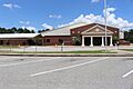
A school building in the Baker County School System.


See also
 In Spanish: Condado de Baker (Georgia) para niños
