Miller County, Georgia facts for kids
Quick facts for kids
Miller County
|
|||
|---|---|---|---|

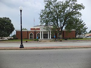
Miller County Courthouse in Colquitt
|
|||
|
|||

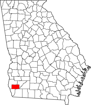
Location within the U.S. state of Georgia
|
|||
 Georgia's location within the U.S. |
|||
| Country | |||
| State | |||
| Founded | 1856 | ||
| Seat | Colquitt | ||
| Largest city | Colquitt | ||
| Area | |||
| • Total | 284 sq mi (740 km2) | ||
| • Land | 282 sq mi (730 km2) | ||
| • Water | 1.2 sq mi (3 km2) 0.4%% | ||
| Population
(2020)
|
|||
| • Total | 6,000 | ||
| • Density | 21/sq mi (8/km2) | ||
| Time zone | UTC−5 (Eastern) | ||
| • Summer (DST) | UTC−4 (EDT) | ||
| Congressional district | 2nd | ||
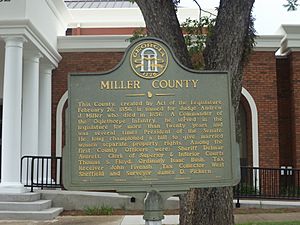
Miller County is a county located in the southwestern part of Georgia, a state in the United States. In 2020, about 6,000 people lived here. The main town and county seat is Colquitt. The county was started on February 26, 1856. It was named after Andrew Jackson Miller, who was the president of the Medical College of Georgia.
Contents
Exploring Miller County's Geography
Miller County covers a total area of about 284 square miles. Most of this area, around 282 square miles, is land. The remaining 1.2 square miles is water, which is about 0.4% of the total area.
Rivers and Waterways in Miller County
Most of Miller County is part of the Spring Creek area. This creek flows into the larger Apalachicola-Chattahoochee-Flint River Basin, often called the ACF River Basin. A small part in the northeast is in the Ichawaynochaway Creek area. The southeastern part of the county is located near the Lower Flint River. All these waterways are part of the same big river system.
Major Roads and Highways
Several important roads run through Miller County. These highways help people travel to and from different parts of the county and beyond.
 U.S. Route 27
 State Route 1
 State Route 39
 State Route 45
 State Route 91
 State Route 91 Spur
 State Route 273
 State Route 310
Neighboring Counties
Miller County shares its borders with four other counties in Georgia:
- Baker County to the northeast
- Decatur County to the southeast
- Seminole County to the southwest
- Early County to the northwest
Communities in Miller County
Miller County has a few different types of communities where people live.
Cities in Miller County
- Colquitt is the only official city in the county. It is also the county seat.
Other Populated Areas
- Boykin is a census-designated place. This means it's a community that the U.S. Census Bureau recognizes for gathering population data.
- Babcock is an unincorporated community. This means it's a small area where people live, but it doesn't have its own local government like a city does.
Population and People of Miller County
| Historical population | |||
|---|---|---|---|
| Census | Pop. | %± | |
| 1860 | 1,791 | — | |
| 1870 | 3,091 | 72.6% | |
| 1880 | 3,720 | 20.3% | |
| 1890 | 4,275 | 14.9% | |
| 1900 | 6,319 | 47.8% | |
| 1910 | 7,986 | 26.4% | |
| 1920 | 9,565 | 19.8% | |
| 1930 | 9,076 | −5.1% | |
| 1940 | 9,998 | 10.2% | |
| 1950 | 9,023 | −9.8% | |
| 1960 | 6,908 | −23.4% | |
| 1970 | 6,397 | −7.4% | |
| 1980 | 7,038 | 10.0% | |
| 1990 | 6,280 | −10.8% | |
| 2000 | 6,383 | 1.6% | |
| 2010 | 6,125 | −4.0% | |
| 2020 | 6,000 | −2.0% | |
| 2023 (est.) | 5,747 | −6.2% | |
| U.S. Decennial Census 1790-1880 1890-1910 1920-1930 1930-1940 1940-1950 1960-1980 1980-2000 2010 2020 |
|||
The population of Miller County has changed over the years. In 2020, there were 6,000 people living in the county. These people lived in 2,333 households, which are like homes or families living together. There were also 1,556 families in the county.
Different Backgrounds in Miller County
People from many different backgrounds live in Miller County. The U.S. Census helps us understand the mix of people.
| Race / Ethnicity (NH = Non-Hispanic) | Pop 2000 | Pop 2010 | Pop 2020 | % 2000 | % 2010 | % 2020 |
|---|---|---|---|---|---|---|
| White alone (NH) | 4,456 | 4,237 | 3,949 | 69.81% | 69.18% | 65.82% |
| Black or African American alone (NH) | 1,845 | 1,697 | 1,748 | 28.90% | 27.71% | 29.13% |
| Native American or Alaska Native alone (NH) | 11 | 14 | 9 | 0.17% | 0.23% | 0.15% |
| Asian alone (NH) | 2 | 23 | 26 | 0.03% | 0.38% | 0.43% |
| Pacific Islander alone (NH) | 5 | 0 | 1 | 0.08% | 0.00% | 0.02% |
| Other race alone (NH) | 0 | 0 | 5 | 0.00% | 0.00% | 0.08% |
| Mixed race or Multiracial (NH) | 20 | 61 | 126 | 0.31% | 1.00% | 2.10% |
| Hispanic or Latino (any race) | 44 | 93 | 136 | 0.69% | 1.52% | 2.27% |
| Total | 6,383 | 6,125 | 6,000 | 100.00% | 100.00% | 100.00% |
In 2020, most people in Miller County were White (65.82%) or Black/African American (29.13%). A smaller number of people were of other races or identified as being of mixed races. About 2.27% of the population was Hispanic or Latino.
Education in Miller County
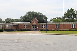
The Miller County School District is in charge of the public schools in Miller County. These schools provide education for all the children living in the county.
See also
 In Spanish: Condado de Miller (Georgia) para niños
 | Leon Lynch |
 | Milton P. Webster |
 | Ferdinand Smith |


