Aldgate, South Australia facts for kids
Quick facts for kids AldgateAdelaide, South Australia |
|||||||||||||||
|---|---|---|---|---|---|---|---|---|---|---|---|---|---|---|---|

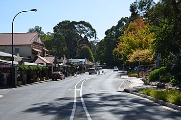
Aldgate main street
|
|||||||||||||||
| Established | 1882 | ||||||||||||||
| Postcode(s) | 5154 | ||||||||||||||
| Elevation | 304 m (997 ft) | ||||||||||||||
| Location | 21 km (13 mi) south east of Adelaide via |
||||||||||||||
| LGA(s) | Adelaide Hills Council | ||||||||||||||
| Region | Adelaide Hills | ||||||||||||||
| State electorate(s) | Heysen | ||||||||||||||
| Federal Division(s) | Mayo | ||||||||||||||
|
|||||||||||||||
Aldgate is a small village in South Australia. It is also a suburb of Adelaide. You can find it about 21 kilometers south-east of the Adelaide city centre, nestled in the beautiful Adelaide Hills.
Contents
Aldgate's Interesting History
Aldgate started as a small settlement. Its story began with a famous hotel.
How Aldgate Began
In 1864, a well-known hotel owner named Richard D. Hawkins opened an inn. He called it the Aldgate Pump. Hawkins had moved to South Australia from London, England, in 1842. He already owned other hotels nearby.
He put a pump outside his new hotel. This pump became very popular. People would stop there to give water to their horses and oxen (bullock teams). These animals pulled carts through the area. By 1870, a small town had grown around the hotel. Hawkins once said that about 60,000 people visited his hotel each year! The hotel was even called "one of the best decorated of its kind." It had "magnificent chandeliers."
Where the Name Aldgate Comes From
The hotel, the pump, and later the town, were all named after Aldgate in London. The word "Aldgate" comes from an old English word, ealdgate. This means "old gate."
In 1882, a company called the Hills Land and Investment Company divided up land in the Aldgate area. They created plots for people to settle. They officially named the town after the famous hotel.
Aldgate in the 21st Century
Aldgate has faced some challenges, like its drainage system. This system has caused big flooding problems on the main street. One of the worst floods happened on November 8, 2005. It flooded many businesses and caused a lot of damage.
Recently, there has been a project to improve the drainage system in Aldgate. This work helps prevent future floods.
The main intersection in Aldgate was also upgraded in 2009 and 2010. This included Mount Barker Road, Strathalbyn Road, and Kingsland Road. During these roadworks, the original pump was moved. It was put back in May 2011. Now, it sits on a special stand on the footpath.
A new fire station for the Aldgate Country Fire Service was finished in August 2009.
Aldgate's Railway Past
The Adelaide-Wolseley railway line goes through Aldgate. Aldgate used to have passenger train services. These services ran from Adelaide on the Bridgewater railway line. They started in 1883 and stopped in 1987. Another train service, the Mount Gambier railcar, stopped in 1990.
When the station closed, it had three platforms. One was a long side platform. The other two were an island platform. The island platform was taken down in the 1990s. The side platform is still there, but trains don't use it anymore. The railway station building is now a community center called The Hut Community Centre.
Special Heritage Places in Aldgate
Aldgate has many sites that are important for their history. These are called "heritage-listed" sites. They are protected because they tell us about the past. Some of these places are:
- Aldgate Crafts Shop
- Aldgate Pump Hotel (which you read about in the history section)
- Raywood: This includes a historic house, garden, chapel, driveway, and gates.
- Stangate House and Garden: This beautiful property was given to the National Trust of South Australia in 1975.
- Wairoa: This is another historic home and garden. It was home to Marbury School from 1972 to 2004.
How Aldgate is Governed
Aldgate is part of the Adelaide Hills Council. This is its local government area. For federal elections, Aldgate is in the Division of Mayo. For state elections, it is in the electoral district of Heysen.
Images for kids
 | Roy Wilkins |
 | John Lewis |
 | Linda Carol Brown |


