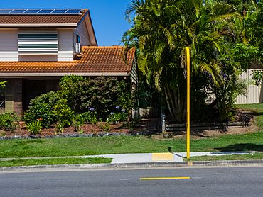
Algester, Queensland facts for kids
Quick facts for kids AlgesterBrisbane, Queensland |
|||||||||||||||
|---|---|---|---|---|---|---|---|---|---|---|---|---|---|---|---|

Ridgewood Road, Algester
|
|||||||||||||||
| Population | 9,020 (2021 census) | ||||||||||||||
| • Density | 2,510/km2 (6,500/sq mi) | ||||||||||||||
| Established | 1968 | ||||||||||||||
| Postcode(s) | 4115 | ||||||||||||||
| Area | 3.6 km2 (1.4 sq mi) | ||||||||||||||
| Time zone | AEST (UTC+10:00) | ||||||||||||||
| Location | 19.4 km (12 mi) S of Brisbane CBD | ||||||||||||||
| LGA(s) | City of Brisbane (Calamvale Ward) |
||||||||||||||
| State electorate(s) | Algester | ||||||||||||||
| Federal Division(s) | Rankin | ||||||||||||||
|
|||||||||||||||
Algester is a lively suburb located in the southern part of Brisbane, Queensland, Australia. It's known for its friendly community and green spaces. In 2021, about 9,020 people called Algester home.
Contents
Where is Algester Located?
Algester is about 18 kilometers (11 miles) south-west of Brisbane's city center. It sits right on the southern edge of the City of Brisbane area. Nearby suburbs include Calamvale and Parkinson.
The name "Algester" comes from the English town of "Alcester". For a short time in the 1970s, people sometimes called it "Ridgewood Heights." This was because of a big housing development with that name. But officially, it has been known as Algester since 1972.
A Look Back: Algester's History
Algester became its own suburb in 1972. Before that, it was part of Acacia Ridge. The suburb got its name from a main road in the area. This road was named "Alcester" around 1910 by a local family.
In 1968, a company called Leighton Properties planned a new housing area. They wanted to call it 'Ridgewood Heights'. Even though a main road still has that name, the Queensland Place Names Board decided on 'Algester' in 1972.
Back then, Algester Road and Dalmeny Street were just unsealed roads. They were the only way into the suburb, which was mostly untouched bushland. The first house built in the area was at what is now 133 Dalmeny Street. Early residents saw lots of native Australian plants and animals. Algester grew a lot from the mid-1970s onwards and continues to develop.
Schools and Community Buildings
- Algester State School opened its doors on January 24, 1977. It started with about 200 students.
- The Anglican Church of the Holy Spirit began in 1977. At first, the church community met in the Algester State School library. Later, they bought land and built a church. The first service in the new church was held on August 9, 1981.
- The Islamic Society of Algester started in 1990. As more Muslim families moved to southern Brisbane, they needed a place to gather. In 1997, they bought a house to use as a mosque and community center. They plan to build a new, larger mosque.
- St Stephen's Catholic Primary School welcomed its first students on January 26, 2004. It started with Prep to Year 3 and slowly added more grades up to Year 6.
In July 2007, there was a major oil pipeline leak in Algester. Some residents had to leave their homes for a short time to stay safe.
Who Lives in Algester?
Algester has grown steadily over the years.
- In 2006, about 7,368 people lived here.
- By 2011, the population grew to 8,262. Most people (58.5%) were born in Australia. Other common birthplaces included New Zealand, England, China, the Philippines, and India.
- In 2021, the population reached 9,020 people.
Most people in Algester speak English at home. Other languages spoken include Mandarin, Cantonese, Spanish, Hindi, and Vietnamese.
Learning in Algester
Algester has two primary schools:
- Algester State School is a government primary school for students from Prep to Year 6. It's located at 19 Endiandra Street. It also has a special education program.
- St Stephen's School is a Catholic primary school for students from Prep to Year 6. You can find it at 156 Ridgewood Road.
There isn't a high school directly in Algester. Students usually go to Calamvale Community College in the nearby suburb of Calamvale.
Community Places
The Anglican Church of the Holy Spirit is located at 362 Algester Road. While it's still known as the Algester church, its exact location is now within the suburb of Calamvale.
Famous Faces from Algester
- Karmichael Hunt – A well-known Australian athlete who played rugby league for the Brisbane Broncos.
- Kym Tollenaere – An Australian softball catcher who represented her country.
 | Dorothy Vaughan |
 | Charles Henry Turner |
 | Hildrus Poindexter |
 | Henry Cecil McBay |


