Allt-fawr facts for kids
Quick facts for kids Allt-fawr |
|
|---|---|

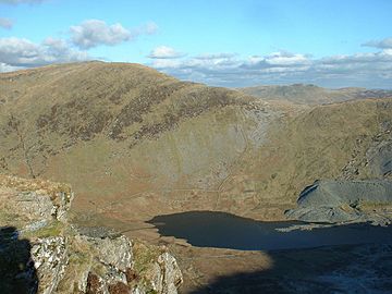
Allt Fawr from the Rhosydd quarry
|
|
| Highest point | |
| Elevation | 698 m (2,290 ft) |
| Prominence | 243 m (797 ft) |
| Parent peak | Moelwyn Mawr |
| Listing | Marilyn, Hewitt, Nuttall |
| Naming | |
| English translation | big slope |
| Language of name | Welsh |
| Geography | |
| Parent range | Snowdonia |
| OS grid | SH681474 |
| Topo map | OS Landranger 115 |
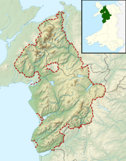
Allt-fawr is a mountain located in Snowdonia, a beautiful national park in North Wales. It's part of a group of mountains called the Moelwynion. Its name, "Allt-fawr," means "big slope" in Welsh, which makes sense because it's quite a large mountain!
This mountain stands tall near the edge of Snowdonia National Park. From its slopes, you can look down on the town of Blaenau Ffestiniog. This area is famous for its many slate quarries. You can also see the Tanygrisiau reservoir and a power station nearby.
Contents
What Makes Allt-fawr Special?
Allt-fawr is unique because of its connection to the history of slate mining. The mountain has huge quarries on its sides.
Oakeley Quarry
On the northern side of Allt-fawr, you'll find the Oakeley Quarry. This was once the biggest underground slate mine in the world! Imagine how much slate was dug out from under the mountain.
Cwmorthin Quarry
On the southern side of Allt-fawr is another large mine called the Cwmorthin Quarry. Both the Oakeley and Cwmorthin mines are connected deep inside the mountain.
Underground Tunnels and Collapses
Over many years, miners dug out vast spaces and tunnels under Allt-fawr. Sometimes, these underground workings collapsed. You can still see signs of these collapses on the mountain's surface today. It shows just how much activity happened beneath the ground!
 | Bessie Coleman |
 | Spann Watson |
 | Jill E. Brown |
 | Sherman W. White |


