Alto Río Senguer facts for kids
Quick facts for kids
Alto Río Senguer
|
|
|---|---|
| Country | |
| Province | Chubut |
| Department | Río Senguer |
| Elevation | 715 m (2,346 ft) |
| Population | |
| • Total | 1,454 |
| Time zone | UTC−3 (ART) |
| CPA base |
U9033
|
| Dialing code | +54 2945 |
| Climate | Csc/Dsc |
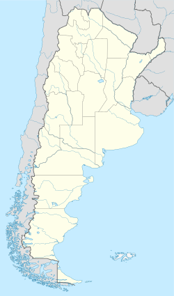
Alto Río Senguer, or Alto Río Senguerr, is a cool town in Chubut Province, Argentina. It's located right along the northern bank of the Senguerr River. The word "rio" means "river" in Spanish! This town is the main center for the Río Senguer Department.
Alto Río Senguer was officially started on September 1, 1943. But people lived there even earlier. The very first permanent home was built around 1915. It was built by a settler from Germany. Because of him, the village used to be called Schultz Pass.
Contents
Discover Alto Río Senguer
Alto Río Senguer is a small town with about 1,454 people. It sits at an elevation of 715 meters (about 2,346 feet) above sea level. The town is led by a Mayor. The current mayor is Javier Enrique Maraboli.
Where is Alto Río Senguer?
The small village of Aldea Apeleg is just a few miles north of Alto Río Senguer. To the west, you'll find the amazing Patagonian Andes. This area has thick forests, tall snowy mountains, and beautiful lakes. Two of these lakes are Fontana and La Plata.
If you head south from the town, you'll see huge, flat lands without trees. These are called "pampas". The town is also located west of National Route 40, which is a very long highway in Argentina.
What's the Weather Like?
Alto Río Senguer gets a lot of rain. Summers can be warm, with temperatures sometimes reaching 30°C (86°F). Winters are quite tough. You can expect lots of frost and snow during June, July, and August. The climate here is a mix of a continental climate and a Mediterranean climate. This means it has short, warm, and dry summers, but cold and somewhat snowy winters.
What Do People Do There?
For a long time, the main way people made a living in Alto Río Senguer was by raising sheep. They also raised cattle, but not as much. There were also sawmills around the town, which cut wood.
Today, tourism is also very important!
- Fishing: Many people love to go fishing in the nearby lakes, Fontana and La Plata. The rivers and streams are full of a type of trout called Salvelinus fontinalis.
- Hunting: There are special private areas where people can hunt red deer and European wild boar.
- Other Activities: Depending on the season, you can also enjoy watching birds, going for hikes, or riding horses. The town has places for tourists to stay, like hotels or guesthouses.
See also
 In Spanish: Alto Río Senguer para niños
 | Georgia Louise Harris Brown |
 | Julian Abele |
 | Norma Merrick Sklarek |
 | William Sidney Pittman |


