
Ambergris Caye facts for kids

Ambergris Caye photographed from the International Space Station
|
|

Ambergris Caye
Location in Belize
|
|
| Geography | |
|---|---|
| Location | Caribbean Sea |
| Coordinates | 18°0′50.21″N 87°55′51.74″W / 18.0139472°N 87.9310389°W |
| Administration | |
|
Belize
|
|
| District | Belize District |
| Largest settlement | San Pedro Town (pop. 13,381) |
Ambergris Caye (pronounced am-BUR-gris KEE) is the biggest island in Belize. It's located in the Caribbean Sea, northeast of the country's main land.
This island is about 40 kilometers (25 miles) long from north to south. It's also about 1.6 kilometers (1 mile) wide. Over time, people have changed parts of the island. This started when coconut farms were planted in the 1600s. Still, much of the island has white coral sand and mangrove forests in its middle.
The eastern side of Ambergris Caye is right next to the northern part of the Belize Barrier Reef. This reef is a very special place, recognized by UNESCO.
Long ago, the Maya people lived on Ambergris Caye. They left behind cool red pottery. Many people think the Maya dug a water channel called "Boca Bacalar Chico." This channel separates the island from Mexico. But it's also possible that a hurricane made the channel naturally.
San Pedro Town is the largest town on Ambergris Caye. There are also smaller villages and resorts. These places help the island's growing tourism business. People especially love ecotourism and scuba diving here. Even though the island is part of the Belize District, the closest land is in the Corozal District.
What's in a Name?
The name "Ambergris" comes from an old French phrase meaning "gray amber". Ambergris is a rare substance that comes from sperm whales. In the past, it was very valuable. It was used in some perfumes to make the smell last longer.
In the 1600s, whalers (people who hunted whales) used islands like Ambergris Caye as bases. Even though sperm whales don't usually live in Belizean waters, they still swim through the area often. This is likely how the island got its unique name.
Fun for Visitors
Tourism on Ambergris Caye started in the early 1970s. It grew a lot towards the end of the 1900s. The main reasons people visit are the Belize Barrier Reef and the beautiful beaches. This barrier reef is the second largest in the world. Only the Great Barrier Reef in Australia is bigger!
You can get to Ambergris Caye by plane or helicopter from Belize City. Small airlines like Tropic Air and Maya Island Air fly there. Astrum Helicopters also offers rides to the airstrip and resorts. Many fast boats also travel to the island. You can even take a boat from Chetumal in Mexico.
Ambergris Caye is often called "Isla Bonita," which means 'The Beautiful Island' in English. This nickname comes from Madonna's famous 1987 song "La Isla Bonita." The song mentions a place called San Pedro. Even though Madonna said the song isn't about a real place, the nickname stuck! The island is known for its amazing turquoise waters. These waters match the island's friendly Caribbean feel.
Since the island is small, most people get around using golf carts. It's a fun way to explore!
San Pedro Day is a special celebration held every year on June 27.
Secret Beach Fun
Most of Ambergris Caye is protected as a national park or wildlife area. This means there isn't much land available for building. North of San Pedro Town, you'll find Belize Secret Beach. It's one of the most popular beach spots in Belize.
People often call it "San Pedro's worst kept secret." This is because the Secret Beach area hasn't been built up a lot yet. But it's becoming more and more popular with both tourists and locals. It feels remote and peaceful, but it also has some nice places to eat and relax. Secret Beach also has cool cenotes (natural sinkholes), other sinkholes, and caves to explore.
Gallery
-
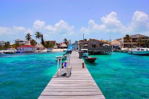
Beach at San Pedro
-
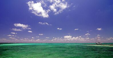
Azure water off the coast of Ambergris Caye
-
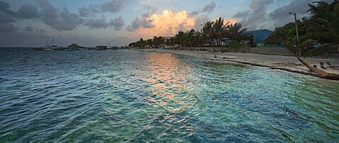
Dusk on Ambergris Caye
-
View of the Barrier Reef in the distance
-
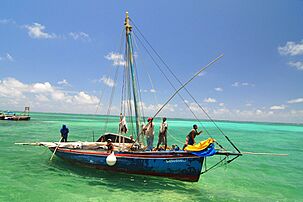
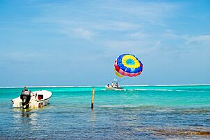
Fishing off the coast of Ambergris Caye
-
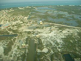
Road near San Pedro
-
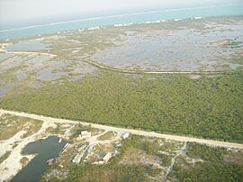
Houses in San Pedro and mangrove swamp
-
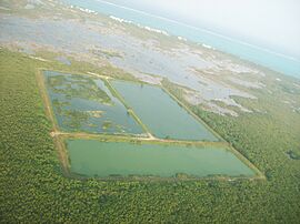
Manmade ponds


See also
 In Spanish: Cayo Ambergris para niños
