
Amiens, Queensland facts for kids
Quick facts for kids AmiensQueensland |
|||||||||||||||
|---|---|---|---|---|---|---|---|---|---|---|---|---|---|---|---|

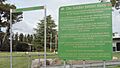
Information board about the Pikedale soldier settlements, Amiens, 2015
|
|||||||||||||||

Amiens
Location in Queensland
|
|||||||||||||||
| Population | 343 (2021 census) | ||||||||||||||
| • Density | 6.609/km2 (17.12/sq mi) | ||||||||||||||
| Postcode(s) | 4380 | ||||||||||||||
| Area | 51.9 km2 (20.0 sq mi) | ||||||||||||||
| Time zone | AEST (UTC+10:00) | ||||||||||||||
| Location |
|
||||||||||||||
| LGA(s) | Southern Downs Region | ||||||||||||||
| State electorate(s) | Southern Downs | ||||||||||||||
| Federal Division(s) | Maranoa | ||||||||||||||
|
|||||||||||||||
Amiens is a small country area in the Southern Downs Region of Queensland, Australia. It is known for its history as a place where soldiers settled after World War I. In 2021, about 343 people lived in Amiens.
Contents
History of Amiens

Soldier Settlements
After World War I, many soldiers returned home. The government wanted to help them start new lives. They offered land in places like Amiens for soldiers to become farmers. These areas were called "soldier settlements." Amiens was one of these special settlements in the Granite Belt area.
How Amiens Got Its Name
The name Amiens comes from a famous battlefield in northern France. Australian soldiers fought bravely there in 1918. A surveyor named George Grant suggested this name in 1920. It was a way to remember the important battles of World War I.
The Amiens Railway Line
Building a railway line to Amiens started in 1919. It opened on 7 June 1920. This line helped farmers transport their goods. On 26 July 1920, Edward, Prince of Wales (who later became king) officially opened the line. He even rode on a special train along it! The railway line closed on 28 February 1974. Now, fruit and vegetables are carried by road.

Early Churches and Schools
A Methodist church opened in Amiens on 15 October 1921. It had been moved from another town. Later, in 1945, it moved again to Severnlea.
Pikedale Soldier's Settlement State School opened on 10 March 1919. In 1920, its name changed to Amiens State School.
On 1 July 1923, St Denys' Anglican Church opened. It was named after St Denys, a patron saint of France. St Patrick's Catholic Church was also established in 1964.
Farming Challenges
The plan for the soldier settlers was to grow fruit. But fruit trees take many years to grow and produce fruit. The soldiers needed money right away to pay back government loans. So, many farmers started growing vegetables instead. This helped them earn money more quickly.
Community Hall
On 26 June 1926, the Amiens Memorial School of Arts and Hall opened. It was a place for community events, like the yearly agricultural show and dances. In the 1980s, the hall was moved to Storm King Dam. It is now used as a recreation centre.
Population of Amiens
In 2016, Amiens had 293 people living there. By 2021, the population grew to 343 people.
Special Places in Amiens
Amiens has some important historical sites. One of these is:
- 17 Trevethan Lane: St Denys Anglican Church
What Amiens Produces

Amiens is a farming area known for growing fruit and vegetables. The Granite Belt region often gets hail, which can damage crops. To protect the fruit, many orchards use special nets called hail nets. These nets are designed to let hail fall between the rows of trees, keeping the fruit safe.
Education in Amiens

Amiens State School is a government primary school. It teaches students from Prep to Year 6. The school is located at 1337 Amiens Road. In 2018, about 39 students attended the school.
There is no high school in Amiens. Students usually go to Stanthorpe State High School in Stanthorpe for secondary education.
Places to Visit
Churches
- St Denys Anglican Church is at 17 Trevethan Lane. It is part of the Stanthorpe Parish.
- St Patrick's Catholic Church is at 10 Goldfields Road.
Other Attractions
- The Amiens Legacy Centre is at 17 Goldfield Road. The Amiens History Association runs it. You can learn about the area's history there.
- The Robert Channon Winery also hosts music events in their Swigmore Hall.
Images for kids
-
Information board about the Pikedale soldier settlements, Amiens, 2015
