An Socach (Glen Ey) facts for kids
Quick facts for kids An Socach |
|
|---|---|
 |
|
| Highest point | |
| Elevation | 944 m (3,097 ft) |
| Prominence | 188 m (617 ft) |
| Listing | Munro, Marilyn |
| Naming | |
| English translation | The projecting place |
| Language of name | Gaelic |
| Geography | |
| Location | Aberdeenshire, Scotland |
| Parent range | Grampian Mountains |
| OS grid | NO079799 |
| Topo map | OS Landranger 43 |
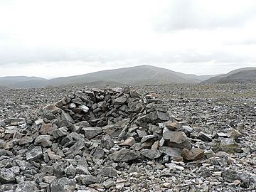
An Socach is a mountain in Scotland. It is located about 5 kilometers (3 miles) west of the A93 road. This road goes from Perth to Braemar. An Socach stands tall at 944 meters (3,097 feet) above sea level. It is a popular spot for hikers.
An Socach: A Scottish Mountain
An Socach is part of the Grampian Mountains in Scotland. It is known as a Munro. A Munro is a Scottish mountain that is over 914.4 meters (3,000 feet) high. An Socach is also a Marilyn. A Marilyn is a hill in the British Isles that has a drop of at least 150 meters (492 feet) on all sides.
What's in a Name?
The name "An Socach" comes from a Scottish Gaelic word. It might mean "the projecting place." This name could describe the mountain's shape. Some people think it looks like a snout or a beak. Other ideas suggest the name means "the sow."
Finding the Top
An Socach has a long, rounded shape. It can be a bit tricky to find the very highest point. The true summit is actually at the western end of the mountain. Some maps might show a slightly lower eastern peak as the highest. But the real top is 944 meters (3,097 feet) high.
How to Climb An Socach
There are a couple of ways to climb An Socach.
- One way is from Glen Ey to the north. This route is longer.
- Another way is from the top of the Glenshee Ski Centre to the east. This path involves going down into a place called Baddoch Burn. This means you will have to climb up again later. So, this route requires more uphill walking than the Glen Ey path.
 | Delilah Pierce |
 | Gordon Parks |
 | Augusta Savage |
 | Charles Ethan Porter |

