Anakie Siding, Queensland facts for kids
Quick facts for kids Anakie SidingQueensland |
|||||||||||||||
|---|---|---|---|---|---|---|---|---|---|---|---|---|---|---|---|

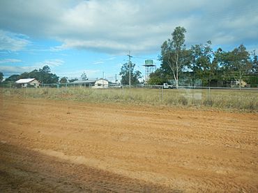
Outskirts of Anakie, 2013
|
|||||||||||||||
| Population | 155 (2021 census) | ||||||||||||||
| • Density | 0.2698/km2 (0.699/sq mi) | ||||||||||||||
| Postcode(s) | 4702 | ||||||||||||||
| Area | 574.4 km2 (221.8 sq mi) | ||||||||||||||
| Time zone | AEST (UTC+10:00) | ||||||||||||||
| Location |
|
||||||||||||||
| LGA(s) | Central Highlands Region | ||||||||||||||
| State electorate(s) | Gregory | ||||||||||||||
| Federal Division(s) | Flynn | ||||||||||||||
|
|||||||||||||||
Anakie Siding is a small rural area in the Central Highlands Region of Queensland, Australia. It's home to the town of Anakie. This area is famous for its sapphire mining. In 2021, about 155 people lived in Anakie Siding.
Contents
Exploring Anakie's Location
Anakie town is located just south of the Capricorn Highway. It is about 44 kilometres (27 miles) west of Emerald.
The town of Anakie is on the Central Western railway line. This line runs from Rockhampton west to Longreach. Anakie has its own railway station.
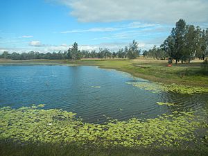
South-east of the town, you can find a billabong. A billabong is a small lake or pond that forms in a river channel. It is usually left behind when the main river changes its course.
In the north-west part of Anakie Siding, there is a mountain range called The Three Sisters Range. It goes north into Sapphire Central. Some peaks in this range are as high as 370 metres (1,210 feet) above sea level.
A Look Back at Anakie's Past
In the mid-1800s, large farming areas called pastoral runs were mapped out. These included Anakie Downs. Over time, these properties were bought and sold.
By 1878, people were thinking about building a railway line west from Emerald Downs. This line would pass through the Anakie Downs area. A small rail siding was added to the new line by November 1884.
Anakie Provisional School first opened on July 27, 1885. It later became Anakie State School in 1909. Sometimes, the school had to close for a while if there weren't enough students.
The Anakie Post Office opened in 1894. Before that, a smaller "receiving office" had been open since 1885.
By 1902, the area became well-known for its sapphire mines. These mines were about 8 miles from the Anakie railway station. Miners found beautiful blue, red, and yellow sapphires. They also found other gems like garnets and zircons.
Anakie was once part of a larger area called The Gemfields. This area also included the towns of Sapphire and Rubyvale. However, in April 2020, the government changed the boundaries. The Gemfields was split into three new areas: Anakie Siding, Sapphire Central, and Rubyvale. Anakie Siding now covers an area of about 574.4 square kilometres (221.8 square miles).
Who Lives in Anakie?
In 2021, the area of Anakie Siding had a population of 155 people.
Getting Around Anakie
You can travel to and from Anakie by bus. Greyhound buses run west from Rockhampton along the Capricorn Highway.
The town of Emerald, about 44 kilometres (27 miles) east, has an airport. You can catch regular flights from Emerald to Brisbane and other places.
The Queensland Rail's Spirit of the Outback train service also stops at Anakie. This train runs twice a week, and it will stop if you ask.
Learning in Anakie
Anakie State School is a government primary school for students from Prep to Year 6. It is located at 1 School Lane. In 2017, the school had 83 students.
The school has a special cattle club. Students in this club attend local agricultural shows. They enter competitions to judge cattle.
There are no secondary schools in Anakie itself. The closest high school is Emerald State High School in Emerald.
 | Bayard Rustin |
 | Jeannette Carter |
 | Jeremiah A. Brown |


