Anderson, Alaska facts for kids
Quick facts for kids
Anderson
|
|
|---|---|

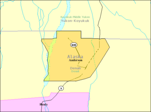
Detailed map of Anderson
|
|
| Motto(s):
"Home of the Anderson Grizzlies"
|
|

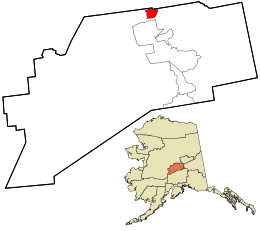
Location in Denali Borough and the state of Alaska.
|
|
| Country | United States |
| State | Alaska |
| Borough | Denali |
| Incorporated | June 2, 1962 |
| Area | |
| • Total | 44.99 sq mi (116.51 km2) |
| • Land | 42.20 sq mi (109.30 km2) |
| • Water | 2.79 sq mi (7.22 km2) |
| Elevation | 515 ft (157 m) |
| Population
(2020)
|
|
| • Total | 177 |
| • Density | 4.19/sq mi (1.62/km2) |
| Time zone | UTC-9 (Alaska (AKST)) |
| • Summer (DST) | UTC-8 (AKDT) |
| ZIP code |
99744
|
| Area code | 907 |
| FIPS code | 02-03220 |
| GNIS feature ID | 1398245 |
Anderson is a small city in the Denali Borough, Alaska, United States. It is the only official city in the borough. In 2020, about 177 people lived there. The city is named after one of the first people to settle in the area.
Contents
History of Anderson
Early Beginnings
Anderson is named after Arthur Anderson. He was one of the first people, called homesteaders, who settled in this area in the late 1950s. A homesteader is someone who gets land from the government to build a home and farm.
In 1959, Arthur Anderson divided his land into smaller pieces. He sold most of these pieces to people who worked at Clear Air Force Station. This station was a special radar base built to detect missiles. An elementary school was built in Anderson in 1961. The city officially became a city on June 2, 1962.
In the 1960s, a road was built connecting Anderson to Nenana. A ferry boat helped people cross the Tanana River at Nenana. This ferry linked them to the highway system that went to Fairbanks. In 1968, a bridge replaced the ferry. Later, in 1972, the George Parks Highway was finished. This new highway made it easier to travel directly to places like Anchorage.
Anderson Today
In March 2007, the city tried a new idea to get more people to live there. They offered free land to anyone who was interested. This was similar to the old Homestead Act.
For several years, Anderson hosted a fun event called the Anderson Bluegrass Festival. It was held every July at Riverside Park. This festival was the city's main attraction for visitors. The festival stopped in 2012, but a similar music festival started in 2015 in the same spot.
Geography and Location
Anderson is located in Alaska, near the northern edge of the Denali Borough. It is north of Healy and south of Nenana. The city is about 75 miles (121 km) southwest of Fairbanks.
The town of Anderson is situated between the Alaska Railroad tracks and the Nenana River. The George Parks Highway is about 5.5 miles (8.9 km) east of the town. Clear Air Force Station is also within the city limits, about 5.5 miles (8.9 km) south. This station is home to the 213th Space Warning Squadron.
Anderson is about 289 miles (465 km) north of Anchorage, Alaska's largest city. It is also 81 miles (130 km) southwest of Fairbanks. The city covers an area of about 44.99 square miles (116.51 km²). Most of this area is land, with some water.
People often visit Anderson because it's a bit "out of the way." Some visitors stop to camp or enjoy the Nenana River at Riverside Park.
Population of Anderson
| Historical population | |||
|---|---|---|---|
| Census | Pop. | %± | |
| 1970 | 362 | — | |
| 1980 | 517 | 42.8% | |
| 1990 | 628 | 21.5% | |
| 2000 | 367 | −41.6% | |
| 2010 | 246 | −33.0% | |
| 2020 | 177 | −28.0% | |
| U.S. Decennial Census | |||
Anderson first appeared in the U.S. Census in 1970, after it became a city in 1962.
The population of Anderson has changed over the years. In 1970, there were 362 people. The population grew to 628 people by 1990. However, it has decreased since then. In 2000, there were 367 residents. By 2010, the population was 246, and in 2020, it was 177 people.
Education in Anderson
Students from kindergarten through 12th grade in Anderson attend Anderson School. This school is managed by the Denali Borough School District.
See also
 In Spanish: Anderson (Alaska) para niños
 | Claudette Colvin |
 | Myrlie Evers-Williams |
 | Alberta Odell Jones |


