Anderson River (Indiana) facts for kids
Quick facts for kids Anderson River |
|
|---|---|

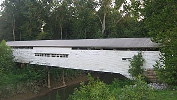
A covered bridge over the river, along the Perry/Spencer county line
|
|
| Physical characteristics | |
| Main source | Johnson Township, Crawford County, Indiana 815 ft (248 m) 38°18′57″N 86°36′51″W / 38.3158333°N 86.6141667°W |
| River mouth | Confluence with the Ohio River at Troy, Indiana 390 ft (120 m) 37°59′55″N 86°48′34″W / 37.9986111°N 86.8094444°W |
| Length | 50 mi (80 km) |
| Basin features | |
| Progression | Anderson River → Ohio → Mississippi → Gulf of Mexico |
| GNIS ID | 450631 |
The Anderson River is a river about 50 mi (80 km) long in southern Indiana, United States. It is a smaller river that flows into a larger one. This type of river is called a tributary.
The Anderson River flows into the Ohio River. The Ohio River then joins the mighty Mississippi River. This means the Anderson River is part of the huge water system, or watershed, of the Mississippi River. All the water from this area eventually flows into the Gulf of Mexico.
Contents
Where the Anderson River Flows
The Anderson River starts in western Crawford County. This area is part of the beautiful Hoosier National Forest.
Journey Through Indiana
From its start, the river generally flows towards the south. It travels through southeastern Dubois County. Then, it forms the border between Perry and Spencer counties. You can find it flowing east of the town of Saint Meinrad.
Joining the Ohio River
The Anderson River's journey ends when it meets the Ohio River. This meeting point is just downstream from the town of Troy. The place where two rivers join is called a confluence.
Other Branches of the River
Near where the Anderson River meets the Ohio River, it collects water from another stream. This stream is called the Middle Fork Anderson River. The Middle Fork flows entirely within Perry County.
 | Valerie Thomas |
 | Frederick McKinley Jones |
 | George Edward Alcorn Jr. |
 | Thomas Mensah |

