Apollo Bay facts for kids
Quick facts for kids Apollo BayVictoria |
|||||||||||||||
|---|---|---|---|---|---|---|---|---|---|---|---|---|---|---|---|
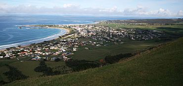
Apollo Bay township and bay from Mariners Lookout to the north-east
|
|||||||||||||||
| Population | 1,790 (2021 census) | ||||||||||||||
| Postcode(s) | 3233 | ||||||||||||||
| Elevation | 15.0 m (49 ft) | ||||||||||||||
| Location |
|
||||||||||||||
| LGA(s) | Colac Otway Shire | ||||||||||||||
| State electorate(s) | Polwarth | ||||||||||||||
| Federal Division(s) | Wannon | ||||||||||||||
|
|||||||||||||||
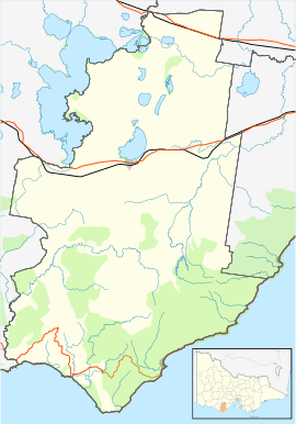
Apollo Bay is a beautiful coastal town in southwestern Victoria, Australia. It's located on the eastern side of Cape Otway, right by the Barham River and along the famous Great Ocean Road. In 2021, about 1,790 people lived here.
This town is a very popular spot for tourists in Victoria. It hosts exciting yearly events like the Apollo Bay Seafood Festival, Winter Wild, and the Great Ocean Road Running Festival.
During winter and spring, you might even spot southern right whales near the coast! They come to this area to have their babies and raise them in the warmer, calm waters. Sometimes, humpback whales can also be seen swimming by.
Contents
History of Apollo Bay
Apollo Bay is part of the traditional lands of the Gadubanud people, also known as the King Parrot people. They lived along the Cape Otway coast for a very long time. In the early 1800s, sealers and whalers from Sydney started visiting the area. One local Indigenous name for this place was 'Krambruk'.
The bay got its current name in 1845. A captain named Loutit sheltered his ship, the Apollo, here during a storm.
The first European settlers arrived in the 1850s. They were timber cutters who set up sawmills. Even though the bay was quite sheltered, there wasn't a proper pier. So, they would float logs out to sea to load them onto ships. A town plan for Apollo Bay was made in 1853, and it was first called Middleton. In the 1860s, land for farming became available. By the mid-1870s, the first town blocks were sold.
The Middleton post office opened in 1873, with mail delivered every two weeks. A school started in 1880. In 1881, the town and post office were renamed Krambruk. This name was changed back to Apollo Bay in 1898. For a long time, the only way to reach the area was by sea. However, a coach service from Birregurra to Apollo Bay began in 1889.
The first pier at Point Bunbury was destroyed by a storm, and so was a second one built there. Because of this, the "Long Pier" was built in a more sheltered spot in 1892.
The original town plan showed Pascoe Street as the main road. But many buildings were built on Collingwood Street, which then became the main shopping area of Apollo Bay. When the road to the town was improved in 1927, and the Great Ocean Road was finished in 1932, Apollo Bay became a popular place for tourists and an important fishing port.
In 1932, a coastal ship called the Casino sank while trying to dock at the town jetty. Many ships had been wrecked along the Cape Otway coastline before this.
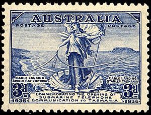
In 1936, a special underwater cable was laid from Apollo Bay to Stanley. This cable provided the very first telephone connection between mainland Australia and Tasmania. The Apollo Bay Telegraph station closed in 1963 and is now a museum.
Climate in Apollo Bay
Apollo Bay has an oceanic climate. This means it has mild summers and wet winters.
| Climate data for Apollo Bay | |||||||||||||
|---|---|---|---|---|---|---|---|---|---|---|---|---|---|
| Month | Jan | Feb | Mar | Apr | May | Jun | Jul | Aug | Sep | Oct | Nov | Dec | Year |
| Mean daily maximum °C (°F) | 21.9 (71.4) |
21.8 (71.2) |
20.1 (68.2) |
18.0 (64.4) |
15.7 (60.3) |
13.6 (56.5) |
13.1 (55.6) |
14.0 (57.2) |
15.8 (60.4) |
17.6 (63.7) |
19.2 (66.6) |
20.6 (69.1) |
17.6 (63.7) |
| Mean daily minimum °C (°F) | 13.9 (57.0) |
14.6 (58.3) |
12.8 (55.0) |
11.5 (52.7) |
9.5 (49.1) |
8.3 (46.9) |
7.3 (45.1) |
7.9 (46.2) |
8.9 (48.0) |
9.5 (49.1) |
10.6 (51.1) |
12.2 (54.0) |
10.6 (51.1) |
| Average precipitation mm (inches) | 52.5 (2.07) |
50.3 (1.98) |
67.9 (2.67) |
82.0 (3.23) |
100.3 (3.95) |
109.3 (4.30) |
117.9 (4.64) |
128.4 (5.06) |
109.6 (4.31) |
98.5 (3.88) |
80.0 (3.15) |
64.1 (2.52) |
1,063.4 (41.87) |
| Average precipitation days | 8.6 | 8.1 | 10.8 | 13.5 | 16.2 | 16.3 | 18.0 | 18.7 | 16.8 | 15.2 | 12.8 | 10.7 | 165.7 |
Events and Festivals in Apollo Bay
Apollo Bay hosts several fun events and festivals throughout the year:
- Winterwild
- Great Ocean Road Running Festival
- Apollo Bay Seafood Festival
- Apollo Bay and Otway District Agricultural Show
- The Apollo Bay Music Festival (this festival was held from 1993 to 2013). A poster for the 1999 festival was even featured on an postage stamp by Australia Post in 2006.
Sports in Apollo Bay
Apollo Bay is home to various sports clubs:
- Apollo Bay Surf Lifesaving Club: This club started in 1952. It helps keep people safe at the beach and is part of Life Saving Victoria.
- Apollo Bay Sailing Club: This club offers sailing opportunities for people of all ages and skill levels.
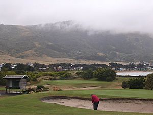
- Apollo Bay Golf Club: You can find this golf club on Nelson Street.
- Apollo Bay and Otways Riding Club: For those who love horses and riding.
- Apollo Bay Football Netball Club: This club has been part of the Colac & District Football and Netball League since 1972.
Apollo Bay has also been a stop for the Great Victorian Bike Ride six times (in 1991, 1996, 2000, 2004, 2009, and 2016). It even hosted the rest day for the last four of those visits!
Famous People from Apollo Bay
Some notable people who grew up or were born in Apollo Bay include:
- Neil Melville – an actor who spent his childhood here.
- Sid O'Neil, Ted O'Neil, and Michael Fitzgerald – members of the rock band The Vasco Era.
- H. A. Willis – an essayist who spent his early childhood in Apollo Bay.
 | Kyle Baker |
 | Joseph Yoakum |
 | Laura Wheeler Waring |
 | Henry Ossawa Tanner |


