Arastradero Creek facts for kids
Quick facts for kids Arastradero Creek |
|
|---|---|

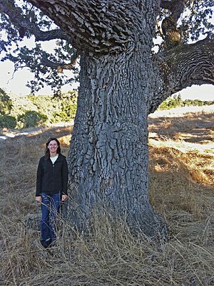
Joan Dudney stands by an ancient valley oak near Arastradero Lake. This tree is over 300 years old. It is an acorn granary for acorn woodpeckers (Melanerpes formicivorus).
|
|
|
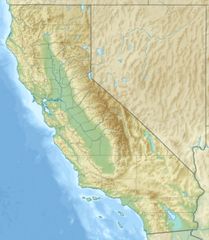
Location of the mouth of Arastradero Creek in California
|
|
| Country | United States |
| State | California |
| Region | Santa Clara County |
| Cities | Palo Alto, California, Los Altos Hills, California |
| Physical characteristics | |
| Main source | Palo Alto Foothills of the Santa Cruz Mountains Palo Alto 820 ft (250 m) 37°22′04″N 122°10′29″W / 37.36778°N 122.17472°W |
| River mouth | Confluence with Matadero Creek Los Altos Hills 262 ft (80 m) 37°23′03″N 122°09′58″W / 37.38417°N 122.16611°W |
| Basin features | |
| Tributaries |
|
Arastradero Creek is a stream in California. It flows for about 2.4 miles (3.9 km). The creek starts in the Palo Alto foothills of the Santa Cruz Mountains. It flows mostly north and northeast. Almost all of Arastradero Creek is protected. It runs through the Pearson–Arastradero Preserve. Finally, its waters join Matadero Creek and flow towards San Francisco Bay.
Contents
Creek Name History
The name "Arastradero" comes from Spanish. "Arrastre" means dragging. It was used for a type of ore mill where heavy weights dragged over ore. "Arrastradero" means a place where dragging happens. In old Spanish times, wood was dragged along Arastradero Road. This wood was used to help build the Santa Clara Mission.
Creek's Path and Water Sources
The Juan Bautista de Anza Trail follows Arastradero Creek. You can find this trail at Gate A of the Pearson–Arastradero Preserve. The preserve's visitor center is at 1530 Arastradero Road.
The creek flows past Sobey Pond. Further downstream, it reaches Arastradero Lake. This lake is man-made. It was once a pond for ranch animals. After Arastradero Lake, the Arastradero Creek Trail goes up along the creek. It almost reaches the creek's source. This source is on the northern edge of Palo Alto's Foothills Park.
When the creek reaches Arastradero Road, another small creek joins it. This creek is called Mayfly Creek. It flows only during certain times of the year. Arastradero Creek then turns east. It flows along the road into Los Altos Hills. It meets Matadero Creek where Arastradero Road and Page Mill Road cross.
Nature and Protecting the Creek
The Arastradero Preserve has a special program. It works to restore the natural environment. Grassroots Ecology is a group that helps manage the preserve. They get volunteers from high schools and local companies. These volunteers help restore the habitat and learn about nature.
Their main goal is to remove harmful plants. These include yellow star thistle and poison hemlock. They replace them with plants that naturally grow in the area. In 2006, another group called Acterra helped uncover parts of the creek. This is called "daylighting" a stream. They also work to keep the creek stable. They plant special plants along the creek banks.
Projects also focus on planting native oak trees. They protect young oaks and remove eucalyptus trees. Eucalyptus trees can be a fire danger. To help animals, volunteers put up nesting boxes for birds. They also add bat houses and brush piles. The Santa Clara Valley Audubon Society helps with bird houses. They also lead bird walks.
In 2005, the City of Palo Alto received money to "daylight" Mayfly Creek. This creek was buried under a horse ranch. "Daylighting" means uncovering a stream that was hidden in a pipe. Mayfly Creek was named after the mayfly insect. Mayflies were the first insects to return to the uncovered creek. The creek's path was rebuilt. Thousands of native plants were planted along its banks. Volunteers continue to help restore this area. They build small dams to slow water flow. They also remove bad plants and add native ones. This work has made the area much healthier for nature.
Fun Activities at the Preserve
The Pearson–Arastradero Preserve has about 10.3 miles (16.6 km) of trails. You can go hiking, biking, and horseback riding. Some trails are "seasonal." This means they close when it rains a lot. This helps protect them from damage.
Arastradero Lake is about a twenty-minute walk from the parking lot. You can fish there all year. However, you cannot use boats or swim in the lake. The California Department of Fish and Game warns people to be careful. This is because mountain lions (Puma concolor) live in the area.
Images for kids
 | Leon Lynch |
 | Milton P. Webster |
 | Ferdinand Smith |


