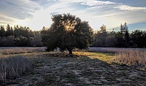
Palo Alto, California facts for kids
Quick facts for kids
Palo Alto, California
|
|||||
|---|---|---|---|---|---|
|
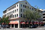
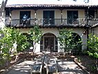
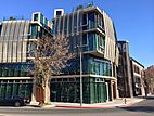
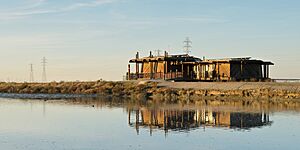
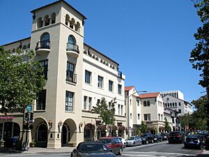
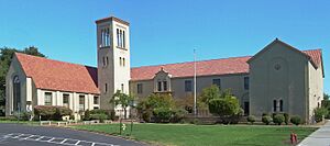
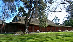
Baylands Nature Preserve, Ramona Street Architectural District, Palo Alto High School, Palo Alto History Museum, Palo Alto Circle
|
|||||
|
|||||
| Etymology: from Spanish palo alto, meaning 'tall stick' | |||||
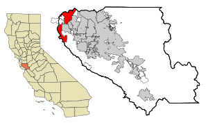
Location in Santa Clara County and California
|
|||||
| Country | United States | ||||
| State | California | ||||
| County | Santa Clara | ||||
| Incorporated | April 23, 1894 | ||||
| Named for | El Palo Alto | ||||
| Government | |||||
| • Type | Council-Manager | ||||
| • Body | City council members:
Mayor Greer Stone
Vice Mayor Ed Lauing Pat Burt Greg Tanaka Vicki Veenker Lydia Kou Julie Lythcott-Haims |
||||
| Area | |||||
| • Total | 26.00 sq mi (67.35 km2) | ||||
| • Land | 24.10 sq mi (62.41 km2) | ||||
| • Water | 1.91 sq mi (4.94 km2) 7.38% | ||||
| Elevation | 30 ft (9 m) | ||||
| Population
(2020)
|
|||||
| • Total | 68,572 | ||||
| • Density | 2,871.52/sq mi (1,047.35/km2) | ||||
| Demonym(s) | Palo Altan | ||||
| Time zone | UTC−8 (Pacific) | ||||
| • Summer (DST) | UTC−7 (PDT) | ||||
| ZIP Codes |
94301-94306 & 94309
|
||||
| Area code | 650 | ||||
| FIPS code | 06-55282 | ||||
| GNIS feature IDs | 277572, 2411362 | ||||
Palo Alto is a city in Santa Clara County, California, in the San Francisco Bay Area. Its name comes from a tall redwood tree called El Palo Alto. In Spanish, "Palo Alto" means "tall stick."
The city was started in 1894 by Leland Stanford and his wife, Jane Stanford. They founded Stanford University to honor their son, Leland Stanford Jr., who passed away at age 15. Palo Alto has grown a lot since then. It is now next to cities like East Palo Alto and Mountain View. In 2020, about 68,572 people lived there. Palo Alto is known for being an expensive place to live. Many of its residents have a high level of education.
Palo Alto is a major city in Silicon Valley. This means it's home to many important technology companies. Companies like HP, VMware, and PARC have their main offices here. Other famous tech companies like Apple, Google, Facebook, and Tesla also started or had offices in Palo Alto. Even big companies like Ford Motor Company and Lockheed Martin have research centers in the city.
Contents
- Discovering Palo Alto's Past
- Palo Alto's Location and Environment
- People and Homes in Palo Alto
- Palo Alto's Economy and Businesses
- City Services and Utilities
- Education in Palo Alto
- Libraries and Media
- Getting Around Palo Alto
- Sister Cities
- Places to Visit in Palo Alto
- Famous People from Palo Alto
- See also
Discovering Palo Alto's Past
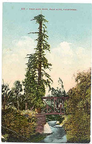
Before Europeans arrived, the Ohlone people lived on the San Francisco peninsula. The Puichon Ohlone group lived in the Palo Alto area. The first Europeans to see this area were from the Portola expedition in 1769. This group of explorers was looking for Monterey Bay. They camped by a tall redwood tree, which later became known as El Palo Alto.
In 1777, Father Junipero Serra started the Mission Santa Clara de Asis. Its northern border was the San Francisquito Creek. This land included what is now Palo Alto. The area was controlled by Spain, then by Mexico after it became independent in 1821.
After the Mexican–American War in 1846, the United States took control of California. Land grants given by Mexico were supposed to be recognized. One such grant, Rancho Rinconada del Arroyo de San Francisquito, covered parts of northern Palo Alto. Another, Rancho Rincon de San Francisquito, covered most of modern Palo Alto and Stanford University.
How Palo Alto Was Created
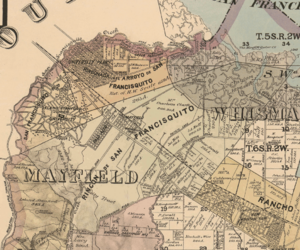
The town of Mayfield started in 1855. It grew around a stagecoach stop near what is now California Avenue. In 1863, a railroad line reached Mayfield. This connected it to San Francisco.
In 1875, a French financier named Peter Coutts bought land in Mayfield. He called his property Ayrshire Farm. Later, in 1876, Leland Stanford began buying land nearby for his horse farm. He called it the Palo Alto Stock Farm. Stanford bought Ayrshire Farm in 1882.
In 1884, Leland and Jane Stanford decided to build a university to honor their son. They wanted the university's entrance to be in Mayfield. However, Mayfield said no to their request. So, the Stanfords decided to create a new town. This new town would not allow saloons.
In 1887, their friend Timothy Hopkins bought 740 acres (3.0 km2) for the new town. This area is now a historic district. The Stanfords built Stanford University and a train stop for the new town. This community was first called University Park. But in 1894, it officially became Palo Alto.
Palo Alto's Growth Over Time
On July 2, 1925, Palo Alto and Mayfield joined together. This meant Palo Alto now had two main downtown areas. One is along University Avenue, and the other is along California Avenue.
Palo Alto kept growing by adding more land. This included the Stanford Shopping Center area in 1953. Large areas of land west of Foothill Expressway were added between 1959 and 1968. This includes Foothills Park and Arastradero Preserve. The last big additions were Barron Park in 1975 and marshlands in 1979.
Many of Stanford University's first teachers lived in the Professorville neighborhood. This area is now a historic district. It has many old homes from the 1890s. The garage where Hewlett Packard started in 1939 is at 367 Addison Avenue. It has been restored. The Palo Alto Chinese School is the oldest Chinese school in the Bay Area. Palo Alto is also home to the second oldest opera company in California, the West Bay Opera.
An early large business was the Bayside Canning Company. It opened a cannery in Mayfield in 1918. It became one of the biggest canneries in the world in the 1920s. It closed in 1949.
Palo Alto also has a long baseball history. The Palo Alto Oaks are a summer baseball club that started in 1950. They have a rich history in the community.
Palo Alto's Location and Environment
Palo Alto is in the southeastern part of the San Francisco Peninsula. The city has two main land areas. The southern part, west of Interstate 280, is hilly and rural. It includes Pearson–Arastradero Preserve and Foothills Park. The city reaches up to Skyline Boulevard in the Santa Cruz Mountains.
The northern part is more crowded. It is bordered by San Francisquito Creek to the north. The San Francisco Bay is to the northeast. Mountain View and Los Altos are to the east and southeast. Stanford University is to the southwest and west. Major roads like the Bayshore Freeway and El Camino Real cross this area.
The city covers about 25.8 square miles (67 km2). Most of this is land, with about 1.9 square miles (4.9 km2) being water. The official elevation is 30 feet (9 m) above sea level. However, some parts of the city are much higher in the mountains.
Waterways and Nature
Several creeks flow through Palo Alto towards the San Francisco Bay. These include Adobe Creek, San Francisquito Creek, and Matadero Creek. Arastradero Creek flows into Matadero Creek. Barron Creek now flows into Adobe Creek.
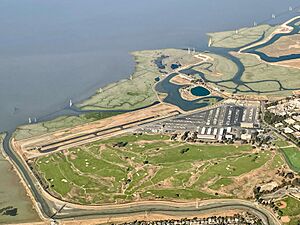
Palo Alto has important natural areas. These include estuarine (bay), riparian (riverbank), and oak forest habitats. You can see many of these in Foothills Park. The Charleston Slough has a rich marsh. It is a feeding ground for many shorebirds and other wildlife.
Weather in Palo Alto
Palo Alto has a Mediterranean climate. This means it has mild, somewhat wet winters and warm, dry summers. In summer, fog often rolls in at night. This helps keep the air warm from the day. It's rare for the night temperature to be above 60°F (16°C).
In January, temperatures are usually between 39°F (4°C) and 58°F (14°C). In July, they range from 56°F (13°C) to 79°F (26°C). The highest temperature ever recorded was 108°F (42°C) in September 2022. The lowest was 20°F (-7°C) in January 1949 and December 1990. Temperatures reach 90°F (32°C) about 12 days a year. They drop to 32°F (0°C) or lower about 14 days a year.
Palo Alto gets about 15.12 inches (384 mm) of rain each year. This is because the Santa Cruz Mountains create a "rain shadow". It rains on about 56 days a year. Snow is very rare in the city. However, a small amount fell in January 1962. Snow sometimes dusts the highest parts of Palo Alto near Skyline Ridge.
| Climate data for Palo Alto, California, 1991–2020 normals, extremes 1922–present | |||||||||||||
|---|---|---|---|---|---|---|---|---|---|---|---|---|---|
| Month | Jan | Feb | Mar | Apr | May | Jun | Jul | Aug | Sep | Oct | Nov | Dec | Year |
| Record high °F (°C) | 75 (24) |
84 (29) |
85 (29) |
98 (37) |
100 (38) |
107 (42) |
105 (41) |
101 (38) |
108 (42) |
100 (38) |
89 (32) |
75 (24) |
108 (42) |
| Mean maximum °F (°C) | 66.2 (19.0) |
70.9 (21.6) |
75.9 (24.4) |
84.2 (29.0) |
88.6 (31.4) |
93.6 (34.2) |
93.3 (34.1) |
92.4 (33.6) |
91.5 (33.1) |
86.9 (30.5) |
74.4 (23.6) |
65.8 (18.8) |
97.9 (36.6) |
| Mean daily maximum °F (°C) | 57.8 (14.3) |
60.7 (15.9) |
65.5 (18.6) |
69.6 (20.9) |
73.3 (22.9) |
78.5 (25.8) |
79.4 (26.3) |
78.7 (25.9) |
79.6 (26.4) |
74.0 (23.3) |
63.7 (17.6) |
57.6 (14.2) |
69.9 (21.0) |
| Daily mean °F (°C) | 48.4 (9.1) |
51.0 (10.6) |
54.6 (12.6) |
57.4 (14.1) |
61.4 (16.3) |
65.6 (18.7) |
67.6 (19.8) |
67.0 (19.4) |
66.3 (19.1) |
61.2 (16.2) |
53.1 (11.7) |
48.1 (8.9) |
58.5 (14.7) |
| Mean daily minimum °F (°C) | 39.0 (3.9) |
41.3 (5.2) |
43.6 (6.4) |
45.3 (7.4) |
49.5 (9.7) |
52.7 (11.5) |
55.7 (13.2) |
55.3 (12.9) |
53.0 (11.7) |
48.4 (9.1) |
42.5 (5.8) |
38.6 (3.7) |
47.1 (8.4) |
| Mean minimum °F (°C) | 30.6 (−0.8) |
32.5 (0.3) |
35.1 (1.7) |
38.0 (3.3) |
41.6 (5.3) |
46.1 (7.8) |
48.6 (9.2) |
49.7 (9.8) |
46.1 (7.8) |
40.4 (4.7) |
33.5 (0.8) |
29.7 (−1.3) |
28.1 (−2.2) |
| Record low °F (°C) | 20 (−7) |
20 (−7) |
22 (−6) |
31 (−1) |
33 (1) |
40 (4) |
40 (4) |
44 (7) |
37 (3) |
32 (0) |
26 (−3) |
20 (−7) |
20 (−7) |
| Average precipitation inches (mm) | 2.95 (75) |
3.18 (81) |
2.19 (56) |
0.97 (25) |
0.44 (11) |
0.10 (2.5) |
0.00 (0.00) |
0.03 (0.76) |
0.07 (1.8) |
0.64 (16) |
1.60 (41) |
2.95 (75) |
15.12 (385.06) |
| Average precipitation days (≥ 0.01 in) | 10.0 | 10.1 | 8.2 | 5.2 | 2.5 | 0.7 | 0.0 | 0.2 | 0.5 | 2.5 | 6.2 | 9.7 | 55.8 |
| Source 1: NOAA | |||||||||||||
| Source 2: XMACIS2 (mean maxima/minima 1981–2010) | |||||||||||||
People and Homes in Palo Alto
| Historical population | |||
|---|---|---|---|
| Census | Pop. | %± | |
| 1900 | 1,658 | — | |
| 1910 | 4,486 | 170.6% | |
| 1920 | 5,900 | 31.5% | |
| 1930 | 13,652 | 131.4% | |
| 1940 | 16,774 | 22.9% | |
| 1950 | 25,475 | 51.9% | |
| 1960 | 52,287 | 105.2% | |
| 1970 | 56,040 | 7.2% | |
| 1980 | 55,225 | −1.5% | |
| 1990 | 55,900 | 1.2% | |
| 2000 | 58,598 | 4.8% | |
| 2010 | 64,403 | 9.9% | |
| 2020 | 68,572 | 6.5% | |
| U.S. Decennial Census | |||
In 2020, Palo Alto had a population of 68,572 people. The city is very diverse. About 48.5% of residents were White, and 35.4% were Asian. About 7.4% of the population was Hispanic or Latino.
Most people in Palo Alto live in homes. In 2010, there were 26,493 households. About 32.6% of these had children under 18. The average household had 2.41 people. The median age in Palo Alto was 41.9 years.
Housing in Palo Alto
North of Oregon Expressway, Palo Alto has older homes. Many were built in the early 1900s. South of Oregon Expressway, homes were mostly built after World War II. Many of these are Joseph Eichler-designed houses.
Homes in Palo Alto can be very expensive. In 2007, the average home sold for $1.2 million. By 2009, it was $1.4 million. Palo Alto is one of the most expensive cities in the United States. It is also considered the most expensive college town.
Historically, some policies made it hard for certain groups to buy homes in Palo Alto. This led to different neighborhoods developing differently. For example, areas like East Palo Alto faced challenges in getting loans for homes. This caused unequal development compared to other parts of the city.
Palo Alto's Economy and Businesses
Palo Alto is a key economic center in Silicon Valley. Over 7,000 businesses are located here. They employ more than 98,000 people. In the 1950s, Stanford University started focusing on technology. They offered programs in physics and electrical engineering. This helped the area grow into a tech hub.
Many famous tech companies are in the Stanford Research Park. This park is on Page Mill Road. Nearby, Sand Hill Road in Menlo Park is known for venture capitalists. These are people who invest in new companies.
Some big tech companies that started in Palo Alto have moved. Google is now in Mountain View. Facebook is in Menlo Park. PayPal is in San Jose. In 2021, Tesla, Inc. moved its main office to Texas.
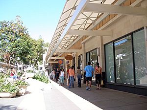
Palo Alto has many shops and restaurants. The Stanford Shopping Center is a large outdoor mall. Downtown Palo Alto, around University Avenue, also has many places to eat and shop. The first street-level Apple Store opened in Palo Alto. The first West Coast Whole Foods Market was also here.
Major Employers in Palo Alto
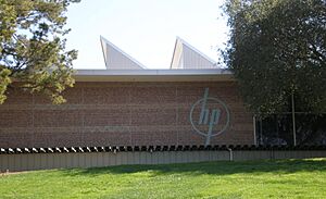
Here are some of the top employers in Palo Alto:
| # | Employer | # of Employees |
|---|---|---|
| 1 | Hewlett-Packard | 14,673 |
| 2 | SAP Labs | 14,164 |
| 3 | VMware | 10,720 |
| 4 | Stanford Health Care | 5,500 |
| 5 | Stanford University | 4,060 |
| 6 | Veteran's Affairs Palo Alto Health Care System | 4,400 |
| 7 | Varian Medical Systems | 3,490 |
| 8 | Cooley LLP | 2,324 |
| 9 | Palantir Technologies | 2,026 |
| 10 | Wilson Sonsini Goodrich & Rosati | 1,701 |
City Services and Utilities
Palo Alto has its own city-run utility company, City of Palo Alto Utilities (CPAU). It provides water, electricity, gas, and wastewater services. Most other cities in northern California get these services from Pacific Gas and Electric Company (PG&E).
The city manages its own electric power system. It also gets water from its own sources and from the Hetch Hetchy system in San Francisco. Palo Alto is part of a group of cities that work together to generate electricity.
Palo Alto has discussed providing fiber optic internet to all homes. This would offer very fast internet connections.
The city's fire department offers advanced medical help. They are the only fire department in Santa Clara County that regularly takes patients to the hospital. The police department is located in City Hall.
Education in Palo Alto
Public Schools
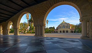
The Palo Alto Unified School District serves most students in Palo Alto. The student-teacher ratio is about 14.9 students per teacher. This is lower than in many nearby areas. Students attend one of two high schools: Gunn High School or Palo Alto High School. There are also three middle schools: JLS, Greene, and Fletcher.
Some parts of Palo Alto are served by the Los Altos School District and Mountain View–Los Altos Union High School District.
Private Schools
Palo Alto has many private schools for different age groups:
- Athena Academy – for dyslexic students in grades 1-8.
- Bowman School – a Montessori school from Pre-K to 12th grade.
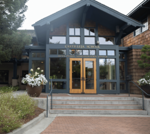
- Castilleja School – an all-girls school for grades 6-12.
- Challenger School – a K-8 school.
- Esther B. Clark School – for children with learning or behavior challenges.
- Fusion Academy Palo Alto – a small, one-on-one school for grades 6-12.
- Gideon Hausner Jewish Day School – a K-8 Jewish school.
- The Girls' Middle School – an independent, all-girls school for grades 6-8.
- Kehillah Jewish High School – a high school with both regular and Jewish studies.
- Keys School – a co-ed, independent K-8 school.
- Living Wisdom School – a K-8 school.
- Meira Academy – an Orthodox Jewish all-girls high school.
- Sand Hill School – a K-7 school.
- St. Elizabeth Seton Catholic School – a Catholic school from preschool to eighth grade.
- Silicon Valley International School – a bilingual school with a K-5 campus in Palo Alto.
- Stratford School – a K-8 school.
- Tru School – a K-5 school.
Weekend Schools
- Palo Alto Chinese School – the oldest Chinese school in the Bay Area.
Higher Education
Palo Alto University is in Palo Alto. It focuses on psychology studies.
The main campus of Stanford University is right next to Palo Alto. Some of the university's land is also within Palo Alto city limits.
Libraries and Media
The Palo Alto City Library has five branches. They have over 265,000 items. The Mitchell Park Library is the largest. The former Main Library is now called the Rinconada branch. The Palo Alto Children's Library is also nearby. There are smaller branches downtown and in College Terrace.
Palo Alto has several local newspapers. The Palo Alto Daily Post comes out six days a week. The Palo Alto Daily News is published five days a week. The Palo Alto Weekly is a weekly newspaper.
There are also local radio stations like KDOW (business news) and KZSU (Stanford University's station).
Getting Around Palo Alto
Roads and Highways
Palo Alto has two major highways: Highway 101 and Interstate 280. El Camino Real (SR 82) is a main road that runs through the city. There are no parking meters in Palo Alto. City parking lots are free but have time limits during weekdays.
Air Travel
Palo Alto Airport (KPAO) is a busy airport for smaller planes. Many people fly from the Central Valley to work in Palo Alto.
For bigger flights, the closest airports are San Jose International Airport (SJC), about 15 miles (24 km) southeast, and San Francisco International Airport (SFO), about 21 miles (34 km) north.
Train Service
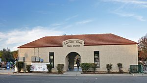
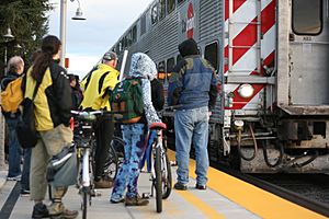
Passenger trains are run by Caltrain. They travel between San Francisco and San Jose. Palo Alto has two regular Caltrain stations: the main Palo Alto Station downtown and the California Avenue station. The Palo Alto station is the second busiest on the Caltrain line. A third station, Stanford, is used for special events like football games.
Bus Services
The Palo Alto Transit Center is a major bus hub. The Santa Clara Valley Transportation Authority (VTA) provides bus service within the South Bay. San Mateo County Transit District (SamTrans) buses serve areas to the north. Stanford University Free Shuttle (Marguerite) offers free bus service around Stanford and to the transit center. The Palo Alto Free Shuttle also runs frequently. The Dumbarton Express connects Palo Alto to the East Bay.
Biking and Walking
Biking is very popular in Palo Alto. About 9.5% of residents bike to work. This is one of the highest percentages in the Bay Area. The city is flat, and many streets are quiet and tree-lined, making them safe for cyclists. Palo Alto was one of the first cities to create "bicycle boulevards" like Bryant Street. These streets are designed to be safer for bikes.
Walking is also easy in Palo Alto. Most streets have sidewalks, except for the Barron Park neighborhood. The city has many trees, which provide shade and make walking pleasant. About 4.8% of residents walk to work.
Sister Cities
 Albi, France, since 1994
 Linköping, Sweden, since 1987
 Oaxaca, Mexico, since 1964
 Enschede, Netherlands, since 1980
 Palo, Philippines, since 1963
 Tsuchiura, Japan, since 2009
 Heidelberg, Germany, since 2017
In 1989, Palo Alto received a wooden sculpture called Foreign Friends from Linköping, Sweden. It showed a man, woman, dog, and bird on a bench. The sculpture was meant to be climbed on and last for 10-25 years. It was removed in 1995 and later destroyed in 2000.
Places to Visit in Palo Alto
Historic Buildings and Architecture
- Frenchman's Tower was built in 1876.
- Former Palo Alto Community House: Designed by Julia Morgan, now a restaurant called MacArthur Park.
- Lou Henry Hoover Girl Scout House: The oldest scout meeting house still in use in the United States.
- Packard's garage: Where Hewlett-Packard started in 1939.
- Ramona Street Architectural District: A block of buildings designed by Pedro Joseph de Lemos.
- Saint Thomas Aquinas Church: The oldest church in Palo Alto.
- Woman's Club of Palo Alto: Built in 1916, now listed on the National Register of Historic Places.
Nature and Outdoor Fun
- Arastradero Preserve
- Elizabeth F. Gamble Garden: A public botanical garden.
- Esther Clark Park: A small park with oak trees and grasslands.
- Foothills Nature Preserve
- Palo Alto Baylands Nature Preserve
Museums, Art, and Entertainment
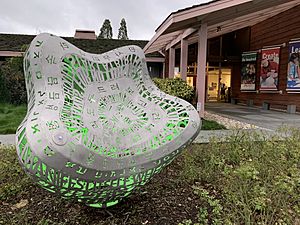
- Palo Alto Art Center
- Pacific Art League
- Stanford Shopping Center
- University Avenue (Downtown Palo Alto)
- Palo Alto Children's Theatre
- Palo Alto Players
- Stanford Theatre
- Palo Alto Junior Museum and Zoo
- The Foster Museum
- Winter Lodge Ice Skating Rink
Famous People from Palo Alto
See also
 In Spanish: Palo Alto para niños
 | William M. Jackson |
 | Juan E. Gilbert |
 | Neil deGrasse Tyson |


