Barron Creek facts for kids
Quick facts for kids Barron Creek |
|
|---|---|
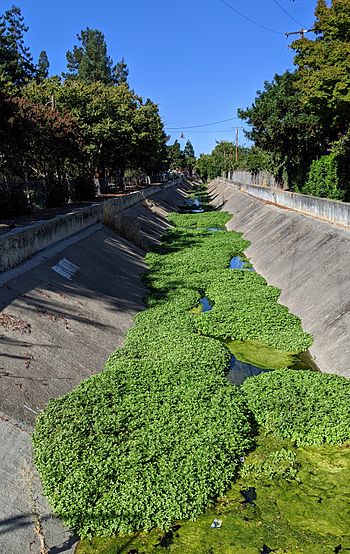
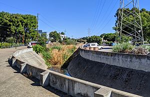
Barron Creek looking downstream from Cowper Street, Palo Alto
|
|
| Other name(s) | Dry Creek |
| Country | United States |
| State | California |
| Region | Santa Clara County |
| Cities | Los Altos Hills, Palo Alto, California |
| Physical characteristics | |
| Main source | Los Altos Hills, California 350 ft (110 m) 37°22′19″N 122°08′05″W / 37.37194°N 122.13472°W |
| River mouth | Confluence with Adobe Creek just south of U.S. Highway 101 Palo Alto, California 10 ft (3.0 m) 37°26′02″N 122°06′33″W / 37.43389°N 122.10917°W |
Barron Creek is a stream about 5.8-mile-long (9.3 km) in Santa Clara County, California. It starts in the hills of Los Altos Hills. The creek flows north through Los Altos Hills and Palo Alto.
It then joins Adobe Creek near U.S. Highway 101. From there, its water continues to the San Francisco Bay. It passes through the Palo Alto Flood Basin before reaching the bay.
Contents
Barron Creek's Past: A Look Back in Time
In 1844, a large piece of land called Rancho La Purisima Concepcion was sold. It was bought by Juana Briones de Miranda. Her family had traveled with early Spanish explorers.
Juana Briones had a special house made of wood, rammed earth, and adobe bricks. It is located in Palo Alto and Los Altos Hills. A historical marker shows where it stands today. The house was named a California State Historical Landmark in 1954.
In the 1800s, people often built their homes near creeks. Juana Briones's adobe house was built close to Barron Creek.
In 1853, Elisha Crosby bought land that became Mayfield Farm. This area later became known as Barron Park. It was named after Edward Barron.
Barron Creek's Journey: Where Does the Water Go?
Barron Creek collects water from an area of about 3 square miles (7.8 km2). It begins at about 350 feet (110 m) high in Los Altos Hills. Barron Creek is the most changed creek in its area.
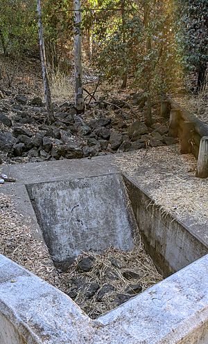
About 67% of its path is "hardened." This means much of it flows through a concrete channel. This helps control floods. During heavy storms, a special channel called the Barron Creek Diversion Channel is used. It sends extra water to Matadero Creek to prevent flooding.
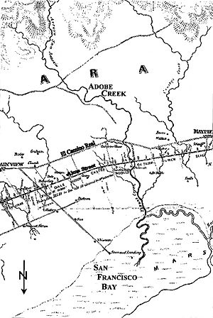
Barron Creek was once called Dry Creek. On old maps from 1862 and 1899, it flowed into Matadero Creek. But in the 1940s, its path was changed. It now flows into Adobe Creek near the Bayshore Highway.
The creek is 5.8 miles (9.3 km) long. It starts in Los Altos Hills near La Paloma Road. It flows north, picking up water from smaller streams. After crossing Foothill Expressway, it goes underground near Gunn High School.
The creek reappears in a small flood control area near Bol Park Bike Path. It then goes underground again. Downstream from El Camino Real, the creek flows in a concrete channel. This helps manage water flow and prevent floods.
In the 1800s, the marshlands near the San Francisco Bay ended closer to Palo Alto. This is why old maps show creeks stopping before reaching the bay.
Wildlife in Barron Creek
Not many native fish have been found in Barron Creek. This is especially true in the parts of the creek that are not affected by tides. While other nearby creeks like Adobe Creek and Matadero Creek used to have Steelhead trout, Barron Creek does not have many fish.
Exploring Barron Creek: Trails and Fun
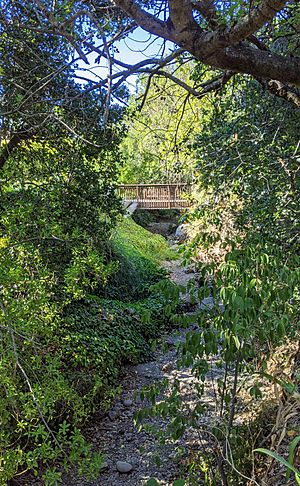
You can best see Barron Creek at the Sedimentation Basin. This area is located between Gunn High School and the Regional Bikepath. The bikepath crosses the creek on a bridge in the middle of the basin.
 | May Edward Chinn |
 | Rebecca Cole |
 | Alexa Canady |
 | Dorothy Lavinia Brown |


