
Mountain View, California facts for kids
Quick facts for kids
Mountain View, California
|
|||
|---|---|---|---|
.jpg)
City Hall and Performing Arts Center
|
|||
|
|||

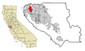
Location within Santa Clara County
|
|||

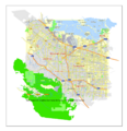
Mountain View city map, California, U.S.
|
|||
| Country | United States | ||
| State | California | ||
| County | Santa Clara | ||
| Incorporated | November 7, 1902 | ||
| Government | |||
| • Type | Council–manager | ||
| Area | |||
| • Total | 12.236 sq mi (31.691 km2) | ||
| • Land | 11.958 sq mi (30.971 km2) | ||
| • Water | 0.278 sq mi (0.719 km2) 2.26% | ||
| Elevation | 105 ft (32 m) | ||
| Population
(2020)
|
|||
| • Total | 82,376 | ||
| • Estimate
(2022)
|
81,059 | ||
| • Rank | US: 439th CA: 103rd |
||
| • Density | 6,780/sq mi (2,617/km2) | ||
| Time zone | UTC–8 (Pacific (PST)) | ||
| • Summer (DST) | UTC–7 (PDT) | ||
| ZIP Codes |
94035, 94039, 94040, 94041, 94042, 94043
|
||
| Area code(s) | 650 | ||
| FIPS code | 06-49670 | ||
| GNIS feature IDs | 0277611, 2411186 | ||
| Sales tax | 9.125% | ||


Mountain View is a city in Santa Clara County, California, United States. It is part of the San Francisco Bay Area. The city gets its name from the beautiful views of the Santa Cruz Mountains. In 2020, about 82,376 people lived there.
Mountain View played a big role in the early days of Silicon Valley. Many high technology companies are located here. In 1956, William Shockley started the first company in Silicon Valley to make silicon parts for electronics. Today, Mountain View is home to the main offices of huge tech companies like Google and Alphabet Inc.. Other well-known companies like Intuit, 23andMe, LinkedIn, and Samsung also have offices here. The NASA Ames Research Center is also in Mountain View.
| Top - 0-9 A B C D E F G H I J K L M N O P Q R S T U V W X Y Z |
Mountain View's Past: A Look at Its History


Long ago, the land where Mountain View now stands was home to the native Ohlone people. Spanish missionaries later used the land for sheep.
In 1842, a large piece of land was given to Francisco Estrada by the Mexican governor. This land later became parts of Mountain View and Sunnyvale.
European-Americans settled the area in 1852. It started as a stop for stagecoaches. By the early 1900s, it was a place where fruits and grains were shipped. It was also a center for printing religious books.
The first settlers were often buried in an old cemetery. This cemetery is now the site of the city library and Pioneer Park.
Early Settlers and Community Leaders
Reverend Henry Merrill Henderson moved to Mountain View in 1852 with his family. He was the first Baptist minister in town. He traveled by horseback to preach in nearby areas.
Later that year, Seligman Weilheimer and his brother Samuel came from Germany. They opened the first large general store in the settlement in 1856.
William Bubb bought land to farm in 1851. He became an important leader in the town. His family later became very successful.
Growth with Aerospace and Electronics
After 1931, the U.S. Navy built Moffett Field nearby. This brought many workers and new jobs to the area. After World War II, more people moved to Mountain View. This was because aerospace and electronics industries grew. The city's population grew a lot between 1950 and 1960.
From 1929 to 1994, Moffett Field Naval Air Station was active in Mountain View. In 1940, the National Advisory Committee for Aeronautics (now NASA Ames Research Center) was based here. This greatly influenced the growth of aerospace and electronics.
Today's Economy in Mountain View
Today, technology is the main part of Mountain View's economy. You can hardly see any signs of the city's farming past.
The city manager, Kevin Duggan, helped build a strong relationship with Google, Inc. He arranged long-term leases for Google and other tech companies. These leases now bring in millions of dollars each year for the city. The downtown area, Castro Street, also improved thanks to special tax rules.
In 2016, people in Mountain View voted for a rule about how much rent landlords can charge. This was to help with housing costs.
Mountain View's Location and Surroundings
Mountain View covers about 12.2 square miles (31.7 square kilometers). Most of this is land, with a small part being water.
The city is next to Palo Alto and the San Francisco Bay to the north. Los Altos is to the south. Moffett Federal Airfield and Sunnyvale are to the east.
Mountain View is located on the San Francisco Peninsula. It's at the northern end of State Route 85, where it meets U.S. Route 101. State Route 82 follows the old El Camino Real through the city.
The Santa Cruz Mountains are to the west. These mountains give the city its name. They separate Mountain View from the Pacific Ocean.
Exploring Mountain View's Neighborhoods
Most of Mountain View has homes where people live. Business parks are mainly in the North Shoreline area, north of Highway 101.
The Blossom Valley area has five smaller neighborhoods. These include Springer Meadows and Varsity Park. Many homes here were built in the 1950s and 1960s on old fruit farms.
The Cuernavaca neighborhood is near the Sunnyvale border. It used to be a cherry orchard and then a golf course. Now, it has homes, many with red tiled roofs in a Spanish style.
The Monta Loma neighborhood has many ranch-style and mid-century modern homes. These were built by famous architects like Joseph Eichler.
Environmental Cleanup Efforts
Because Mountain View was a center for making computer chips, it has some areas that needed cleaning up. These are places where old factories might have left behind harmful waste. The Environmental Protection Agency (EPA) has a list of these sites. There are seven such sites in Mountain View. These sites are being cleaned up to make them safe.
=Mountain View's Weather
Mountain View has a warm, dry summer climate. Winters are cool and wet. The city is close to the Pacific Ocean, which helps keep the weather mild all year.
| Climate data for Moffett Federal Airfield, Mountain View, California | |||||||||||||
|---|---|---|---|---|---|---|---|---|---|---|---|---|---|
| Month | Jan | Feb | Mar | Apr | May | Jun | Jul | Aug | Sep | Oct | Nov | Dec | Year |
| Record high °F (°C) | 77 (25) |
84 (29) |
85 (29) |
98 (37) |
100 (38) |
107 (42) |
105 (41) |
101 (38) |
105 (41) |
100 (38) |
89 (32) |
75 (24) |
107 (42) |
| Mean daily maximum °F (°C) | 59.0 (15.0) |
61.8 (16.6) |
65.0 (18.3) |
68.0 (20.0) |
71.7 (22.1) |
75.9 (24.4) |
76.9 (24.9) |
76.9 (24.9) |
77.7 (25.4) |
74.1 (23.4) |
65.5 (18.6) |
58.9 (14.9) |
69.3 (20.7) |
| Daily mean °F (°C) | 50.7 (10.4) |
53.1 (11.7) |
55.8 (13.2) |
58.4 (14.7) |
62.1 (16.7) |
65.8 (18.8) |
67.7 (19.8) |
68.0 (20.0) |
67.5 (19.7) |
63.6 (17.6) |
55.9 (13.3) |
50.5 (10.3) |
59.9 (15.5) |
| Mean daily minimum °F (°C) | 42.2 (5.7) |
44.5 (6.9) |
46.7 (8.2) |
48.9 (9.4) |
52.5 (11.4) |
55.7 (13.2) |
58.5 (14.7) |
59.0 (15.0) |
57.3 (14.1) |
53.1 (11.7) |
46.3 (7.9) |
42.1 (5.6) |
50.6 (10.3) |
| Record low °F (°C) | 21 (−6) |
20 (−7) |
22 (−6) |
31 (−1) |
33 (1) |
40 (4) |
43 (6) |
44 (7) |
37 (3) |
34 (1) |
26 (−3) |
20 (−7) |
20 (−7) |
| Average precipitation inches (mm) | 3.06 (78) |
3.31 (84) |
2.49 (63) |
0.98 (25) |
0.48 (12) |
0.09 (2.3) |
0 (0) |
0.03 (0.76) |
0.15 (3.8) |
0.76 (19) |
1.96 (50) |
2.95 (75) |
16.26 (412.86) |
| Average precipitation days | 10 | 10.5 | 9.6 | 5.2 | 2.6 | 0.7 | 0.2 | 0.2 | 1.5 | 4.1 | 8.3 | 11.1 | 63.9 |
Economy: Tech Hub of Silicon Valley
.jpg)
Mountain View is a key city in Silicon Valley. Many famous tech companies have their main offices or large branches here. As of 2024, companies like Google and Intuit are headquartered in Mountain View.
The city has rules about minimum wage. In 2017, the city council decided to make the minimum wage $15 per hour. This applied to employees who worked two or more hours a week. Since then, the minimum wage has gone up each year. As of January 2024, it is $18.75 per hour.
Top Employers in Mountain View
Here are some of the biggest employers in the city:
| # | Employer | # of Employees | Percentage |
|---|---|---|---|
| 1 | Google/Alphabet | 30,600 | 22.8% |
| 2 | El Camino Hospital | 3,200 | 2.4% |
| 3 | Intuit | 3,060 | 2.3% |
| 4 | 2,500 | 1.9% | |
| 5 | Microsoft | 2,300 | 1.7% |
| 6 | Pure Storage | 1,600 | 1.2% |
| 7 | Nuro | 1,000 | 0.7% |
| 8 | Waymo | 900 | 0.7% |
| 9 | Synopsys | 900 | 0.7% |
| 10 | Mountain View Whisman School District | 600 | 0.4% |
People of Mountain View: Demographics
| Historical population | |||
|---|---|---|---|
| Census | Pop. | %± | |
| 1880 | 250 | — | |
| 1930 | 3,308 | — | |
| 1940 | 3,946 | 19.3% | |
| 1950 | 6,563 | 66.3% | |
| 1960 | 30,889 | 370.7% | |
| 1970 | 54,132 | 75.2% | |
| 1980 | 58,655 | 8.4% | |
| 1990 | 67,460 | 15.0% | |
| 2000 | 70,708 | 4.8% | |
| 2010 | 74,066 | 4.7% | |
| 2020 | 82,376 | 11.2% | |
| 2022 (est.) | 81,059 | 9.4% | |
| U.S. Decennial Census 2020 Census |
|||
In 2020, Mountain View had 82,376 people living there. There were 34,423 households. The population density was about 6,889 people per square mile.
In August 2013, the unemployment rate was 5.0%. This means 5 out of every 100 people looking for a job could not find one. In 2020, 6.4% of the people were under five years old. 20.3% were under 18. And 11.1% were 65 or older. In 2022, a small number of people (5.4%) lived below the poverty line.
Housing Challenges

Finding affordable housing in Mountain View can be tough. Many people who work in the city, even those with multiple jobs, sometimes live in RVs or other vehicles. This is because housing costs are very high. In 2017, Google was approved to build nearly 10,000 new homes near its campus. This aims to help with the housing shortage.
Arts and Culture: Fun Things to Do
Downtown Mountain View: A Lively Place

Mountain View has a downtown area that's great for walking. It's centered on Castro Street. This street has many restaurants, cafes, and shops. The Downtown Mountain View Station is at one end. It connects train, light rail, and bus systems.
The main part of downtown is a plaza shared by City Hall, the Mountain View Center for the Performing Arts (MVCPA), and the Mountain View Public Library. This plaza is used for many community events. It also has public art.
Every year since 1971, the city holds the Mountain View Art & Wine Festival on Castro Street. The street is closed to cars for two days. There's also a farmers' market every Sunday morning. In the summer, Castro Street hosts "Thursday Night Live" with music and car shows.
Cool Places to Visit


The Computer History Museum has a huge collection of old and new computing items. It shows how computers have changed over time.
The Shoreline Amphitheater is a big outdoor place for concerts and shows. Many famous musicians perform here.
Moffett Field is a federal airfield between Mountain View and Sunnyvale. It's home to the Air National Guard. Its large hangars, built for blimps, are unique landmarks.
The NASA Ames Research Center is next to Moffett Field. It's a research facility and has a gift shop and visitor center.
The Mountain View Adobe is a small events center. It's listed as a historic place.
Mountain View Public Library

Mountain View has one main public library. It has books, videos, music, and internet access. The library also has a special section about Mountain View's history. Outside the library, you can see a piece of the Berlin Wall. It was put there in 2013.
Parks and Recreation: Get Outdoors!

The biggest park in Mountain View is Shoreline Park. It was built on a landfill and runs along the Bay. It includes the Shoreline Amphitheatre and a golf course. The park also has tidal ponds and mudflats where you can see birds. The San Francisco Bay Trail goes through Shoreline Park.
Stevens Creek flows through Mountain View and into the Bay. A paved path, the Stevens Creek Trail, runs along the creek. You can see animals like coyotes, deer, butterflies, and many kinds of birds here.
Other parks in Mountain View include:

- Eagle Park: This park has a public swimming pool, a dog-friendly lawn, and a memorial for World War II.
- Cuesta Park: A large park with tennis courts, barbecue areas, and playgrounds.
- Rengstorff Park: This park has a public swimming pool, a community center, a skate park, and a fenced dog park.
- Charleston Park: A five-acre park located near the Googleplex.
Education: Learning in Mountain View

Public Schools
The public elementary schools (like Bubb, Castro, and Monta Loma) and middle schools (Crittenden and Graham) are managed by the Mountain View-Whisman School District. Some elementary schools are in the Los Altos School District.
The public high schools are managed by the Mountain View-Los Altos Union High School District. These include Alta Vista High School, Mountain View High School, and Los Altos High School. Many students from both Mountain View and Los Altos attend these high schools.
Private Schools
Mountain View also has several private schools. These include:
- Khan Lab School: A school connected to Khan Academy, which offers online learning.
- Saint Francis High School: A Roman Catholic high school.
- German International School of Silicon Valley (GISSV): A school that teaches in both German and English.
- Yew Chung International School of Silicon Valley: A school that teaches in both Chinese and English.
Media: Local News
The Mountain View Voice is the local newspaper for Mountain View. It started publishing in 1993.
Getting Around: Transportation and Utilities
Roads
Major roads that go through Mountain View include:
- SR-237
- SR-85
- US-101
- County Route G6
- El Camino Real (SR 82)
Public Transportation

.jpg)
The Downtown Mountain View Station is the main transportation hub. It connects commuter trains, light rail, and buses. It's one of the busiest transit centers in the area.
Train Service
Mountain View is served by the Caltrain commuter rail system. This train runs from San Francisco to Gilroy. There are two Caltrain stations in the city: Mountain View Station and San Antonio Station.
The city also has the Santa Clara Valley Transportation Authority (VTA) light rail system. This connects Mountain View to other parts of Santa Clara County. There are four light rail stations in Mountain View.
Bus Service
MVgo is a free shuttle service that runs three routes in Mountain View. It helps people get around during morning and evening commute times. Many large companies like Google and Microsoft also have their own shuttles for employees. There's also a free community shuttle bus that stops at many places in Mountain View.
VTA also runs several regular bus routes within the city.
Air Travel
The closest major airport for commercial flights is San Jose International Airport (SJC). It's about 11 miles away. San Francisco International Airport (SFO) and Oakland International Airport (OAK) are also used by people traveling to and from Mountain View. Moffett Federal Airfield is nearby but is mostly for government, military, and private planes.
Utilities and Connectivity
The power in Mountain View is provided by Pacific Gas and Electric Company.
Mountain View uses a lot of recycled water. This water is mostly used for watering plants in Shoreline Park and the Google campus. The city plans to use even more recycled water in the future.
In 2006, Google started offering free IEEE 802.11g wireless internet service for the whole city. In 2014, the city and Google announced a new plan for internet access. This service is mainly available along Castro Street and in public places like Rengstorff Park and the Public Library.
Sister Cities: Connecting Globally
Mountain View has special connections with cities in other countries. These are called "sister cities." The Mountain View Sister City Affiliation is a non-profit group that helps with these connections.
Mountain View is connected with:
 Iwata, Shizuoka, Japan
 Hasselt, Belgium
The rock garden in Pioneer Park was a gift from Iwata, Japan. It was given to celebrate the completion of Mountain View's City Hall.
Notable People from Mountain View
Many interesting people have lived in or are from Mountain View.
Business Leaders
- Steve Jobs: Co-founder and CEO of Apple. He lived in Mountain View when he was a child.
- Salman Khan: The founder of Khan Academy, an online learning platform. He lives in Mountain View.
- Jan Koum: CEO and co-founder of WhatsApp. He grew up in Mountain View.
Entertainment and Media
- Alex Brightman: An actor and singer.
- Kurt Kuenne: A filmmaker and composer.
- Andy Weir: The author of The Martian book, which became a movie. He wrote it while living in Mountain View.
Sports Stars
- Brandon Crawford: A professional baseball player who played for the San Francisco Giants.
- Paula Creamer: A professional golfer.
- Kenny Roberts Jr.: A motorcycle racing world champion.
Images for kids
-
Location within Santa Clara County
-
Mountain View city map, California, U.S.
See also
 In Spanish: Mountain View (condado de Santa Clara) para niños
