Ards Peninsula facts for kids
Quick facts for kids
Ards Peninsula
|
|
|---|---|

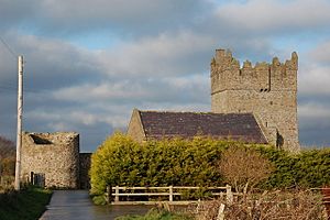
Kirkistown Castle, near Cloghy on the Ards Peninsula.
|
|

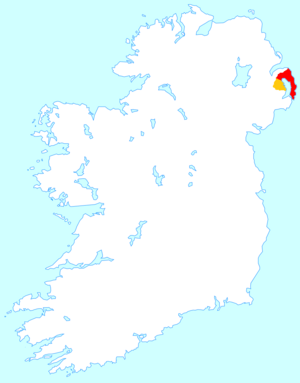
Location of the Ards Peninsula (red) within Ards Borough district (red & orange).
|
|
 |
|
| Country | United Kingdom |
| County | Down |
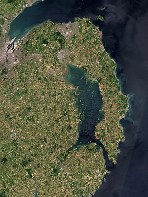
The Ards Peninsula is a long piece of land in County Down, Northern Ireland. It stretches out into the sea, separating Strangford Lough from the Irish Sea. The name "Ards" comes from an old Irish word meaning "peninsula of the Ulstermen."
Many towns and villages are found here, including Donaghadee, Millisle, Newtownards, and Portaferry. Newtownards is the biggest town on the peninsula. The Ards Peninsula has a mild climate, which means it's not too hot or too cold. Its soil is good for farming. The most eastern point of the island of Ireland is near Portavogie on this peninsula.
Contents
History of the Ards Peninsula
The Ards Peninsula was once simply known as "The Ards." In the 12th century, a group of people called the Normans took control of the area. The Savage family, who were Normans, built several castles and religious buildings here.
During the Second World War, the peninsula was home to airfields. These included RAF Ballyhalbert and RAF Kirkistown. Both airfields are now closed. Today, the RAF Kirkistown site is used for car and motorcycle races.
Fun Places to Visit on the Ards Peninsula
The Ards Peninsula has many interesting places to explore.
Scrabo Tower and Country Park
Scrabo Tower stands tall over Newtownards and the northern part of the peninsula. It is located in a lovely country park. The tower was built in 1857 to remember a person named Charles Stewart, 3rd Marquess of Londonderry.
Mount Stewart House and Gardens
Mount Stewart is an old house from the 18th century with beautiful gardens. The National Trust now looks after it. This house was once the home of the Vane-Tempest-Stewart family, who were important noblemen.
Grey Abbey Ruins
Grey Abbey is a ruined abbey that was once home to Cistercian monks. You can still see the remains of this historic building today.
Kirkistown Circuit for Racing
Kirkistown Circuit is the only permanent motorsport race track in Northern Ireland that is officially licensed. It's a great place to watch car and motorcycle races.
The Echlinville Distillery
Near Kircubbin, you can find The Echlinville Distillery. This was the first new whiskey distillery to open in Northern Ireland in over 125 years. It is set on the beautiful Echlinville Estate.
Towns and Villages of Ards Peninsula
Here are some of the main towns and villages on the Ards Peninsula:
- Newtownards
- Portaferry
- Ballyhalbert
- Ballywalter
- Carrowdore
- Cloghy
- Greyabbey
- Kircubbin
- Portavogie
Ancient Sites and Castles
The Ards Peninsula has many old sites that tell us about its past.
- Ballyfounder Rath is an ancient fort.
- Derry Churches are old church ruins.
- Grey Abbey is a ruined monastery.
- Kirkistown Castle is a historic castle.
- Portaferry Castle is another old castle.
- White House, Ballyspurge is an old house with history.
Climate of the Ards Peninsula
The Ards Peninsula has a mild climate because it is close to the sea. This means it usually doesn't get too hot or too cold. The area also gets a good amount of sunshine throughout the year.
Images for kids
See also
 In Spanish: Península de Ards para niños
 | Janet Taylor Pickett |
 | Synthia Saint James |
 | Howardena Pindell |
 | Faith Ringgold |


