
Arkansas Valley (ecoregion) facts for kids
Quick facts for kids Arkansas Valley ecoregion |
|
|---|---|

View from Mount Magazine, the highest point in Arkansas, looking down upon the low valleys and hills of the Arkansas Valley
|
|

Level III ecoregions in the region, with the Arkansas Valley ecoregion marked as (37) (full map)
|
|
| Ecology | |
| Borders |
List
|
| Geography | |
| Area | 28,422 km2 (10,974 sq mi) |
| Country | United States |
| States | Arkansas and Oklahoma |
| Climate type | Humid subtropical (Cwa) |
The Arkansas Valley is a special natural area. It is called an "ecoregion" by the Environmental Protection Agency (EPA). This means it has similar plants, animals, and land features. It stretches across parts of Arkansas and Oklahoma.
This valley follows the Arkansas River. It lies between the flat plains of western Oklahoma and the Arkansas Delta. It also separates the Ozark Mountains from the Ouachita Mountains. The river has created wide valleys here. You'll also see low hills, scattered ridges, and even some mountains. In Arkansas, people often call this area the Arkansas River Valley.
The Arkansas Valley is a mix of different landscapes. It has plains, hills, and river floodplains. There are also terraces and scattered mountains. The ground is mostly made of sandstone, shale, and siltstone. Long ago, the higher areas had forests, woodlands, and prairies. The river areas had thick forests.
Today, many less rugged areas are used for farms. Farmers raise chickens and other animals. They also grow hay. The water quality in streams is usually good. However, the Arkansas River itself is often cloudy. Smaller streams might dry up in summer.
Contents
What are Ecoregions?
The EPA divides the United States into different ecoregions. These are areas with similar ecosystems. The Arkansas Valley is a "Level III ecoregion." This means it's a large, general area. Inside it, there are smaller, more specific areas. These are called "Level IV ecoregions." The Arkansas Valley has five of these smaller ecoregions.
Exploring the Arkansas Valley's Different Areas

High Ridges and Mountains (37a)
This area is the most rugged part of the Arkansas Valley. It has many hills and mountains. It's covered with forests and woodlands. You'll find lots of oak and hickory trees. There are also shortleaf pine trees. The rocks here are mostly sandstone and shale.
Magazine Mountain is in this ecoregion. It is the highest point in Arkansas. Its flat top has unique, tough woodlands. This area is home to several state parks. These include Mount Magazine State Park, Mount Nebo State Park, and Petit Jean State Park. These parks protect beautiful mountains.
Arkansas River Floodplain (37b)
This ecoregion is the flat area along the Arkansas River. It's made of rich soil left by the river. You can see natural levees and old river bends here. This area used to have large forests. These forests had trees like bur oak, sycamore, and cottonwood.
Today, much of this land is used for farming. Farmers grow crops and hay. Some forests still remain in wet areas. This ecoregion is important for wildlife. Places like Holla Bend National Wildlife Refuge protect these areas. Bell Slough Wildlife Management Area is also here. It has wetlands and forests. Many birds stop here during their migrations.
Arkansas Valley Hills (37c)
This ecoregion is hillier than the plains but not as rugged as the mountains. It's made of sandstone and shale. The natural plants here are oak-hickory forests. Some areas also have pine trees. Today, much of this land is used for pastures. Farmers raise chickens and other animals. Logging is also an important activity.
This area is mostly in Arkansas. You can visit preserved parts of this ecoregion. Examples include Cove Creek Natural Area and Woolly Hollow State Park.
Arkansas Valley Plains (37d)
This ecoregion is mostly flat or gently rolling. It used to have a mix of prairies, savannas, and woodlands. The western parts are flatter and drier. They once had large prairies. Other areas had oak-hickory forests.
Today, much of this land is used for pastures and hay fields. Some parts of the original prairie still exist. The Cherokee Prairie near Fort Smith is one example. Poultry and livestock farming are very important here.
Lower Canadian Hills (37e)
This ecoregion is in Oklahoma. It's a transition area between drier lands to the west and moister parts of the Arkansas Valley. It has a mix of oak woodlands, tallgrass prairie, and oak-hickory forests. The hills here are more widespread than in the nearby plains.
Streams in this area have deeper pools. They also have more different types of habitats. You can find more kinds of fish and insects here.
Gallery
Landscapes
-
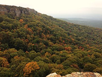
Mount Magazine, a high point in Ecoregion 37a
-
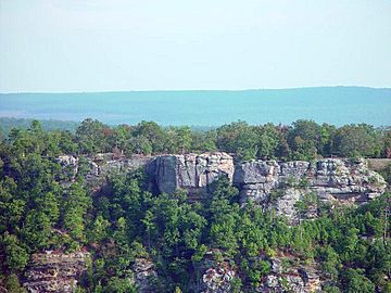
Bluffs at Petit Jean State Park, also in Ecoregion 37a
-
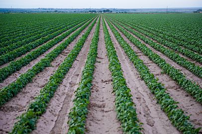
Farms in Ecoregion 37b, showing typical agriculture
-
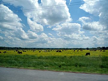
Cows grazing in a pasture in Ecoregion 37c
-
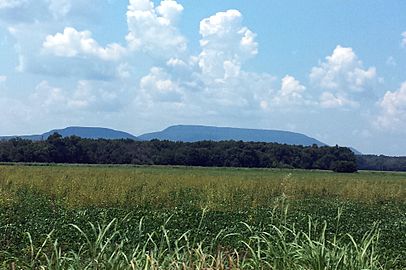
Mount Nebo rising from the plains of Ecoregion 37d
-
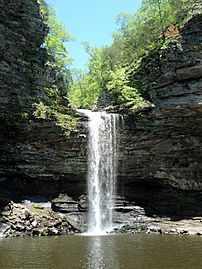
Cedar Falls, a beautiful waterfall
-
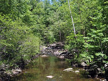
The calm Cedar River
-
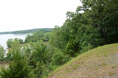
A view of the Arkansas River from Cadron Settlement Park


