Mount Magazine facts for kids
Quick facts for kids Mount Magazine |
|
|---|---|

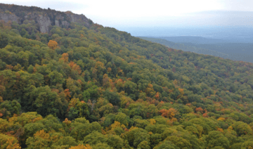
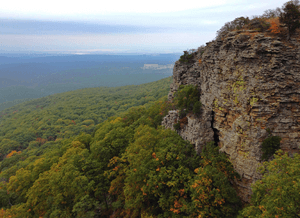
Looking west from Mount Magazine's Cameron Bluff (October 2013)
|
|
| Highest point | |
| Elevation | 2,753 ft (839 m) NAVD 88 |
| Prominence | 2,143 ft (653 m) |
| Listing |
|
| Geography | |
| Location | Logan County, Arkansas, U.S. |
| Parent range | Ouachita Mountains, U.S. Interior Highlands |
| Topo map | USGS Blue Mountain |
Mount Magazine, also known as Magazine Mountain, is the highest point in the state of Arkansas. It's also the tallest spot in the U.S. Interior Highlands. This special mountain is home to Mount Magazine State Park.
Mount Magazine is a unique flat-topped mountain, often called a mesa. It has a hard rock top and steep cliffs all around. There are two main peaks on the mountain. The highest one is Signal Hill, which is about 2,753 feet (839 meters) tall. The other peak is Mossback Ridge, reaching about 2,700 feet (823 meters).
People sometimes say Mount Magazine is "the highest point between the Alleghenies and the Rockies". While some areas in Texas, Oklahoma, and the Great Plains are higher above sea level, Mount Magazine is very prominent. This means it rises much higher from the ground around it compared to many other places. It's the second most prominent point between the two big mountain ranges.
Contents
What's in a Name?
Mount Magazine got its name from French explorers. They were traveling in the area when they saw a huge landslide on the mountain. The noise was so loud that one explorer thought it sounded like an ammunition magazine exploding. That's how the name "Magazine" came to be!
Even though it's commonly called "Mount Magazine," its official name is "Magazine Mountain." The U.S. Geological Survey (USGS) uses "Magazine Mountain" because it's a long ridge, not just a single peak. However, the Arkansas Department of Parks and Tourism and local people have always used "Mount Magazine."
Where is Mount Magazine?
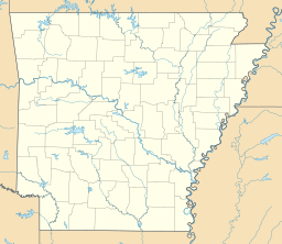
Mount Magazine is located in Logan County, Arkansas. It's just north of Blue Mountain Lake. The mountain is about 45 miles (72 kilometers) east of the border between Arkansas and Oklahoma.
The most beautiful way to reach the top is by driving along Arkansas Highway 309. This road is also known as the Mount Magazine Scenic Byway. It's a 10-mile (16-kilometer) drive from the town of Havana.
Many people think Mount Magazine is part of the Ouachita Mountains. However, it's actually part of the Arkansas River Valley. It's also within a southern part of the Ozark National Forest.
Climate and Weather
The weather on Mount Magazine is quite different from the valleys below. Temperatures here are usually about 10 degrees Fahrenheit (5.5 degrees Celsius) cooler. The average temperature for the year is around 56°F (13°C).
The park gets about 54 inches (137 cm) of rain every year. Because of low clouds, it's often foggy. You might experience limited visibility about eight days each month.
Summer Weather
During the summer, the temperature on the mountaintop rarely reaches 100 degrees Fahrenheit (38 degrees Celsius). The hottest average temperature in the park during summer is about 90 degrees Fahrenheit (32 degrees Celsius).
Winter Weather
The mountain has fewer trees in some areas because of the harsh winter weather. Things like frost, sleet, hail, snow, and freezing rain can cause tree branches to break. Higher up on the mountain, you might see beautiful frost flowers, ice crystals, hoarfrost, rime ice, and freezing fog.
How Mount Magazine Formed
Millions of years ago, the South American continent slowly crashed into the North American continent. This collision created a large basin called the Arkoma Basin. Tiny bits of dirt and rock filled this basin over time. These bits were pressed together and turned into sedimentary rock.
As the land slowly rose above the ocean, small streams formed. These streams eventually joined together to create the Arkansas River. Over millions of years, erosion wore away softer rocks. This left harder rock formations, like Mount Magazine, standing tall.
Mount Magazine is a wide, flat-topped mountain made of Pennsylvanian sedimentary rocks. These rocks formed in shallow water environments. The top of Mount Magazine is covered by a type of rock called the Savanna Formation. This formation includes shale, siltstone, and sandstone.
Nature and Fun Activities
Mount Magazine is a great place to explore nature and learn about protecting the environment. It has 18 campsites for people who love the outdoors. Every June, the nearby town of Paris hosts an annual butterfly festival.
Animals of Mount Magazine
The park is home to many interesting animals, including some that are endangered. You might find the shagreen snail here. There are also black bears, white-tailed deer, and rare rufous-crowned sparrows.
Mount Magazine is especially famous for its butterflies! Out of 134 types of butterflies in Arkansas, 94 species live in the park. The most special and rare butterfly found here is the Diana Fritillary.
Things to Do
There are many fun activities you can do at Mount Magazine:
- Hiking on trails
- Biking
- Watching birds
- Riding horses
- Hang gliding
- Rappelling (climbing down ropes)
- Rock climbing
- Sightseeing and enjoying the views
- Photography
You can also ride ATVs (all-terrain vehicles) on special trails with a guide.
 | James B. Knighten |
 | Azellia White |
 | Willa Brown |


