Armançon facts for kids
Quick facts for kids Armançon |
|
| River | |
|
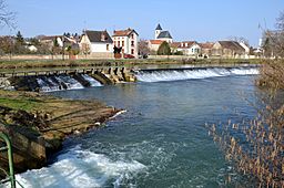
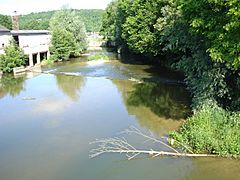
The Armançon river in Nuits
|
|
| Country | France |
|---|---|
| Regions | Bourgogne-Franche-Comté, Grand Est |
| Departments | Côte-d'Or, Yonne, Aube |
| Tributaries | |
| - right | Brenne, Armance |
| Cities | Semur-en-Auxois, Tonnerre, Saint-Florentin, Migennes |
| Source | Auxois |
| - location | Meilly-sur-Rouvres, Côte-d'Or, France |
| - elevation | 420 m (1,378 ft) |
| - coordinates | 47°13′06″N 4°32′53″E / 47.21833°N 4.54806°E |
| Mouth | Yonne |
| - location | Migennes, Yonne, France |
| - elevation | 79 m (259 ft) |
| - coordinates | ACoordinates: Unknown argument format Invalid arguments have been passed to the {{#coordinates:}} function |
| Length | 202 km (126 mi) |
| Basin | 3,077 km² (1,188 sq mi) |
| Discharge | for Brienon-sur-Armançon |
| - average | 28.90 m³/s (1,021 cu ft/s) |
The Armançon is a river in France. It is a tributary (a smaller river that flows into a larger one) of the Yonne river. The Armançon flows mostly through the Bourgogne-Franche-Comté region in central France.
Many towns and villages in France are called communes. Eight of these communes have the river's name in their own names. These include Aisy-sur-Armançon, Brienon-sur-Armançon, and Pacy-sur-Armançon.
River Facts
The Armançon river is about 202.1 km (125.6 mi) long. Its drainage basin (the area of land where all water flows into this river) covers about 3,077 km2 (1,188 sq mi).
The average amount of water flowing in the river is called its discharge. At Brienon-sur-Armançon, the Armançon's average discharge is 28.90 cubic metres per second. That's a lot of water moving every second!
Where the River Flows
The Armançon starts in a natural area called Auxois. This is in the Côte-d'Or department. The source (where the river begins) is near the town of Meilly-sur-Rouvres. It starts at a high point, about 420 m (1,378 ft) above sea level.
The river generally flows towards the northwest. It passes through two main regions and several departments:
- The Bourgogne-Franche-Comté region, including the departments of Côte-d'Or and Yonne.
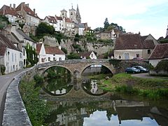
* In Côte-d'Or, it flows through towns like Semur-en-Auxois. * In Yonne, it passes through places such as Tonnerre, Saint-Florentin, and Migennes.
- A small part of the Grand Est region in the Aube department, near Marolles-sous-Lignières.
The Armançon finally joins the Yonne river. This meeting point is near the towns of Migennes and Cheny in the Yonne department. Here, the river is much lower, at about 81 m (266 ft) above sea level.
Main Tributaries
The Armançon has a few important tributaries that flow into it. These are rivers that are longer than 30 kilometers. The main ones are:
- The Brenne river, which is 71.7 km long.
- The Armance river, which is 47.7 km long.
Gallery
Related pages
See also
 In Spanish: Río Armançon para niños
 | May Edward Chinn |
 | Rebecca Cole |
 | Alexa Canady |
 | Dorothy Lavinia Brown |


