Ashland, California facts for kids
Quick facts for kids
Ashland
|
|
|---|---|

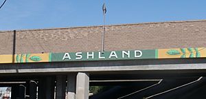
Ashland community marker painted on I-238 overpass at Mission Blvd
|
|

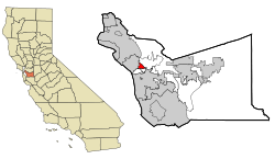
Location in Alameda County and the state of California
|
|
| Country | |
| State | |
| County | Alameda |
| Government | |
| • Type | Unincorporated community |
| Area | |
| • Total | 1.84 sq mi (4.77 km2) |
| • Land | 1.84 sq mi (4.77 km2) |
| • Water | 0.00 sq mi (0.00 km2) 0% |
| Elevation | 43 ft (13 m) |
| Population
(2020)
|
|
| • Total | 23,823 |
| • Density | 12,926.21/sq mi (4,992.00/km2) |
| Time zone | UTC-8 (Pacific (PST)) |
| • Summer (DST) | UTC-7 (PDT) |
| ZIP code |
94541, 94578, 94580
|
| Area codes | 510, 341 |
| FIPS code | 06-02980 |
| GNIS feature IDs | 1657955, 2407773 |
Ashland is a community in Alameda County, California, United States. It is known as a census-designated place (CDP). This means it is a place that the government counts for population, but it doesn't have its own city government.
In 2020, about 23,823 people lived in Ashland. It is located between several other communities. To the north is San Leandro. To the south is Cherryland. Castro Valley is to the east. And San Lorenzo is to the southwest.
Ashland shares its postal codes with nearby places. These include San Lorenzo, Hayward, and San Leandro. Because it doesn't have its own zip code, some people sometimes call it "unincorporated San Leandro" or "unincorporated Hayward."
Contents
Exploring Ashland's Location
Ashland is a small area of land. It covers about 1.8 square miles (4.7 square kilometers). The community sits at an elevation of 43 feet (13 meters) above sea level. This means it is not very high up.
Ashland's Rich History
Ashland has an interesting past. It started developing over a hundred years ago.
Early Transportation and Growth
In 1891, work began on an electric railway. This railway connected Oakland, San Leandro, and Hayward. By 1892, electric trains ran every half hour. This made it easier for people to travel.
The railway had smaller lines too. These lines went to areas like Ashland Avenue. At first, the area was known for its farms. But over time, land became more valuable. Farms and orchards were divided into smaller lots. New communities, including Ashland, grew along the railway.
San Lorenzo Grove Park
A popular spot was San Lorenzo Grove. This was an eight-acre park. It had a dance hall, picnic areas, and playing fields. People loved to visit this park for fun.
The park was open until 1917. Then, it was turned into apricot orchards. Later, houses were built on the land.
Post-War Development
After World War II, many new people moved to the area. Large housing developments were built. These new homes replaced most of the farms and nurseries. Ashland became a residential area.
The electric railway eventually closed. This made cars very important for getting around Ashland.
Impact of Freeways
In the late 1950s, new freeways were built. These included Interstate 880 and Interstate 238. Interstate 238 cut through Ashland. This changed how the community was connected.
Ashland is named after the Oregon ash tree. These trees grew a lot along the San Lorenzo Creek. The San Lorenzo Creek forms Ashland's southern border. It is also home to the oldest bay tree in the world!
People in Ashland
Ashland is a diverse community. People from many different backgrounds live here.
Population Overview
In 2020, the population of Ashland was 23,823. This number has grown over the years. For example, in 2010, there were 21,925 people.
The community is made up of many different groups. These include people who identify as White, African American, Native American, Asian, and Pacific Islander. A large part of the population is also of Hispanic or Latino background.
Ashland has a mix of ages. Many young people live here, as well as adults and seniors. The average age in 2010 was about 31 years old. Most people live in households, either with families or as individuals.
See also
 In Spanish: Ashland (California) para niños
 | Janet Taylor Pickett |
 | Synthia Saint James |
 | Howardena Pindell |
 | Faith Ringgold |


