San Leandro, California facts for kids
Quick facts for kids
San Leandro, California
|
|||
|---|---|---|---|
| City of San Leandro | |||
|
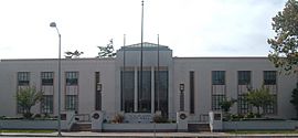
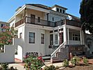
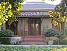
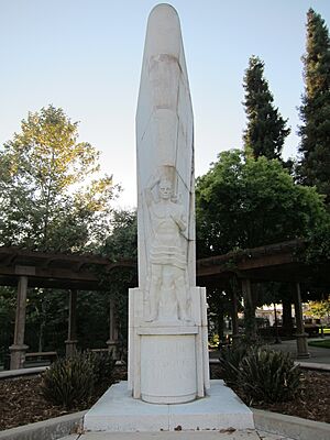
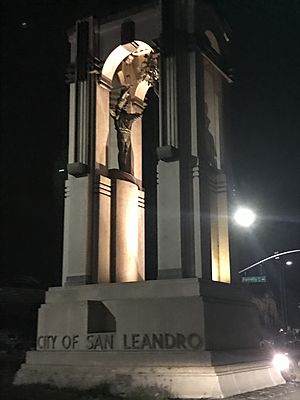
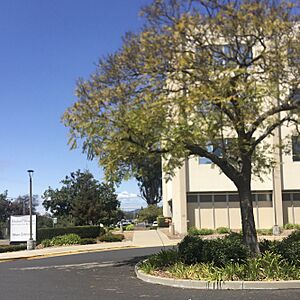
Clockwise, from top: San Leandro City Hall, Peralta Home, Casa Peralta
|
|||
|
|||
| Nickname(s):
SL, The 'Dro
|
|||
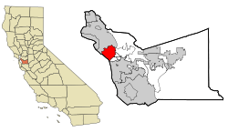
Location within Alameda County
|
|||
|
Location of San Leandro
|
|||
| Country | |||
| State | |||
| County | Alameda | ||
| Region | San Francisco Bay Area | ||
| Incorporated | March 21, 1872 | ||
| Named for | St. Leander of Seville | ||
| Government | |||
| • Type | Council–Manager | ||
| Area | |||
| • Total | 15.52 sq mi (40.19 km2) | ||
| • Land | 13.32 sq mi (34.51 km2) | ||
| • Water | 2.19 sq mi (5.68 km2) 14.81% | ||
| Elevation | 56 ft (17 m) | ||
| Population
(2020)
|
|||
| • Total | 91,008 | ||
| • Rank | 97th in California | ||
| • Density | 5,863.9/sq mi (2,264.44/km2) | ||
| Demonym(s) | San Leandran | ||
| Time zone | UTC–8 (Pacific (PST)) | ||
| • Summer (DST) | UTC–7 (PDT) | ||
| ZIP Codes |
94577–94579
|
||
| Area code(s) | 510, 341 | ||
| FIPS code | 06-68084 | ||
| GNIS feature IDs | 232427, 1659582, 2411794 | ||
San Leandro is a city in Alameda County, California, United States. Its name comes from the Spanish for "St. Leander". The city is located in the East Bay part of the San Francisco Bay Area. It sits between Oakland to the northwest and Ashland, Castro Valley, and Hayward to the southeast. In 2020, about 91,008 people lived here.
Contents
San Leandro's Past
Early History of San Leandro
The first people to live in the area that is now San Leandro were the ancestors of the Ohlone people. They arrived between 3500 and 2500 BC.
Spanish and Mexican Influence
Spanish settlers called these native people Costeños, meaning 'coast people'. English speakers later called them Costanoans. Europeans first visited San Leandro on March 20, 1772. This visit was made by Spanish soldier Captain Pedro Fages and Spanish Catholic priest Father Crespi.
San Leandro is located on two large land grants from Mexico: Rancho San Leandro and Rancho San Antonio. The city's name honors Leander of Seville, a Spanish bishop from the 6th century. Both land grants were along El Camino Viejo, which is now 14th Street / State Route 185.
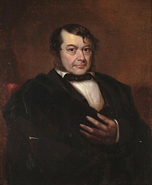
The smaller land grant, Rancho San Leandro, was about 9,000 acres. It was given to José Joaquín Estudillo in 1842. The larger one, Rancho San Antonio, was about 44,000 acres. It was given to another Spanish soldier, Don Luis Maria Peralta, in 1820.
Starting in 1855, two of Estudillo's sons-in-law, John B. Ward and William Heath Davis, planned the town of San Leandro. It was bordered by San Leandro Creek to the north, Watkins Street to the east, Castro Street to the south, and a block west of Alvarado Street to the west.
Many Portuguese American people settled in San Leandro starting in the 1880s. These were laborers from Hawaii or the Azores. They started farms and businesses. By 1910, they made up almost two-thirds of San Leandro's population.
San Leandro in the American Era
In 1856, San Leandro became the main city for Alameda County. However, the county courthouse was destroyed by the big 1868 earthquake. The county seat then moved to Brooklyn (now part of Oakland) in 1872.
After World War II, many new cities in California had rules that prevented certain groups, like African Americans, from buying property. San Leandro was one of these cities. In 1960, almost everyone in the city was white (99.3%). Meanwhile, nearby Oakland had a large African American population. The United States Supreme Court later said these rules could not be enforced.
San Leandro started to become more diverse in the 1980s. By 2010, Asian Americans became the largest group, making up about one-third of the population. Non-Hispanic Whites were 27.1% of the population.
San Leandro's Land and Earth
The San Leandro Hills are located northeast of the city. In the lower parts of the city, there is an underground water source (aquifer) about 50 to 100 feet (15 to 30 meters) below the ground. Another deeper aquifer is about 250 feet (75 meters) down. Some saltwater has mixed into the San Leandro water supply.
Underground water generally flows west, from the hills towards San Francisco Bay. In many lower areas of the city, this shallow groundwater has been polluted. This pollution includes gasoline, chemicals, and some heavy metals.
The Hayward Fault, a major earthquake fault line, runs under Foothill Boulevard in San Leandro.
San Leandro's People
| Historical population | |||
|---|---|---|---|
| Census | Pop. | %± | |
| 1870 | 426 | — | |
| 1880 | 1,369 | 221.4% | |
| 1900 | 2,253 | — | |
| 1910 | 3,471 | 54.1% | |
| 1920 | 5,703 | 64.3% | |
| 1930 | 11,455 | 100.9% | |
| 1940 | 14,601 | 27.5% | |
| 1950 | 27,542 | 88.6% | |
| 1960 | 65,962 | 139.5% | |
| 1970 | 68,698 | 4.1% | |
| 1980 | 63,952 | −6.9% | |
| 1990 | 68,223 | 6.7% | |
| 2000 | 79,452 | 16.5% | |
| 2010 | 84,950 | 6.9% | |
| 2020 | 91,008 | 7.1% | |
| U.S. Decennial Census | |||
Population in 2020
| Race / Ethnicity (NH = Non-Hispanic) | Pop 2000 | Pop 2010 | Pop 2020 | % 2000 | % 2010 | % 2020 |
|---|---|---|---|---|---|---|
| White alone (NH) | 33,646 | 23,006 | 17,865 | 42.35% | 27.08% | 19.63% |
| Black or African American alone (NH) | 7,622 | 10,052 | 9,708 | 9.59% | 11.83% | 10.67% |
| Native American or Alaska Native alone (NH) | 360 | 246 | 224 | 0.45% | 0.29% | 0.25% |
| Asian alone (NH) | 18,064 | 24,924 | 32,365 | 22.74% | 29.34% | 35.56% |
| Pacific Islander alone (NH) | 627 | 596 | 712 | 0.79% | 0.70% | 0.78% |
| Some Other Race alone (NH) | 175 | 198 | 440 | 0.22% | 0.23% | 0.48% |
| Mixed Race or Multi-Racial (NH) | 3,019 | 2,691 | 3,713 | 3.80% | 3.17% | 4.08% |
| Hispanic or Latino (any race) | 15,939 | 23,237 | 25,981 | 20.06% | 27.35% | 28.55% |
| Total | 79,452 | 84,950 | 91,008 | 100.00% | 100.00% | 100.00% |
Population in 2010
In 2010, San Leandro had 84,950 people. The population density was about 5,424 people per square mile. The city was made up of many different groups. About 37.6% were White, 12.3% African American, and 29.7% Asian. About 27.4% of the people were Hispanic or Latino.
Most people (99.2%) lived in homes. There were 30,717 households. About 34.2% of these had children under 18. The average household had 2.74 people. The average family had 3.36 people.
The population included 22.3% under 18 years old. About 27.6% were between 25 and 44. The median age was 39.3 years. For every 100 females, there were about 92.3 males.
San Leandro's Economy
San Leandro has a long history of food processing. Many companies have their businesses here. These include Ghirardelli chocolate, OSIsoft, and a Coca-Cola plant. Maxwell House used to roast coffee here until 2015.
The city has five main shopping centers. These are the Bayfair Center, Westgate Center, Greenhouse Shopping Center, Marina Square Center, and Pelton Plaza. The first Lucky's grocery store opened in San Leandro.
In 2012, San Leandro aimed to become a new center for new ideas in the San Francisco Bay Area. The city has attracted tech startups, artists, and breweries.
In 2011, the city started building Lit San Leandro. This is a very fast fiber optic internet network. By 2014, the network was over 18 miles long. It can transmit data very quickly, up to 10 gigabits per second. Currently, only businesses can use this network.
The Zero Net Energy Center opened in 2013. It is a 46,000 square foot training center for electricians. It teaches energy-efficient building methods. The building itself uses as much energy as it produces, making it a zero-energy building.
Top Employers in San Leandro
Here are the top employers in San Leandro, based on a 2015 report:
| # | Employer | # of Employees |
|---|---|---|
| 1 | San Leandro Unified School District | 1,380 |
| 2 | Kaiser Permanente Medical Group | 1,032 |
| 3 | City of San Leandro | 582 |
| 4 | Ghirardelli Chocolate Company | 487 |
| 5 | San Leandro Hospital | 460 |
| 6 | OSIsoft LLC | 364 |
| 7 | Costco Wholesale | 358 |
| 8 | BCI Coca-Cola Bottling Co. | 325 |
| 9 | Wal-Mart Store 2648 | 323 |
| 10 | Paramedics Plus LLC | 295 |
Learning in San Leandro
San Leandro has two school districts. The San Lorenzo Unified School District covers parts of Washington Manor. The San Leandro Unified School District covers most of San Leandro and a small part of Oakland.
In the past, San Leandro had three high schools. These were San Leandro High School, Pacific High School, and Marina High School. San Leandro High School opened in 1926. Pacific High School opened in 1960.
In the 1970s and 1980s, fewer students were enrolling in schools. Because public schools get money based on student numbers, the San Leandro and San Lorenzo school districts had to close some schools.
The San Leandro school district decided to close Pacific High School in 1983. The land where Pacific High School was located was sold in 1989. It was turned into the Marina Square Shopping Center. The school's sports fields, Burrell Field and the baseball fields, were kept. In 2012, voters approved money to fix up these fields.
Student numbers increased again in the 1990s and 2000s. San Leandro High School added a new science building and an Arts Education Center. In 2010, a separate campus for 9th graders opened. It is named after civil rights leader Fred T. Korematsu.
In 2018, James Madison Elementary was named a California Distinguished School. This is a special honor for schools.
San Leandro High School has special programs like the Business Academy and the San Leandro Academy of Multimedia (SLAM). Students from San Leandro High School have also won awards in national competitions like Distributed Education Clubs of America (DECA).
In 2018, the San Leandro Unified School District was named a "District of the Year" by the College Board Advanced Placement. This was for helping more students take challenging AP courses and do well on the exams. It was one of only three districts in the whole country to get this award.
Some students living in San Leandro go to schools in the San Lorenzo Unified School District. This is because these schools are closer to their homes.
Getting Around San Leandro
San Leandro is connected to other parts of the Bay Area by major highways. These include Interstate 880, 580, and 238. East 14th Street is a main road in downtown San Leandro.
Public transportation is available through Bay Area Rapid Transit (BART). The city has two BART stations: San Leandro and Bayfair. San Leandro LINKS offers free bus rides to the San Leandro BART station. AC Transit provides local bus service. There are also special bus services for seniors and people with disabilities.
Health Care in San Leandro
San Leandro has several health care facilities. The Alameda County Medical Center's psychiatric hospital, the John George Psychiatric Pavilion, is nearby. Fairmont Hospital is also close and offers rehabilitation and other care.
San Leandro Hospital is the city's main hospital. There is also Kindred Hospital – San Francisco Bay Area, which provides long-term care. A Kaiser Permanente Medical Center opened in 2014. It offers emergency medical services.
Parks and Recreation
The San Leandro Marina has picnic areas, trails, and places for boats. It is part of the San Leandro Shoreline Recreation Area.
The City of San Leandro has 16 other parks for everyone to enjoy. The Department of Recreation and Human Services also manages the Marina Community Center, the San Leandro Senior Community Center, and the San Leandro Family Aquatic Center.
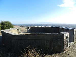
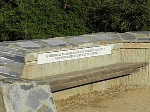
Nearby Lake Chabot Regional Park is popular for hiking, camping, and fishing. The Children's Memorial Grove is located at the Fairmont Ridge Staging Area. It has an oak grove and a stone circle. Plaques there list the names of children who have died from violence in Alameda County.
Famous People from San Leandro
- Joe Alves, film designer for Jaws movies, born in San Leandro.
- Richard Aoki, early member of the Black Panther Party, born in San Leandro.
- Lloyd Bridges, famous actor, born in San Leandro in 1913.
- Brian Copeland, comedian and writer, grew up in San Leandro.
- Dennis Dixon, NFL quarterback, attended San Leandro High School.
- Kathy Garver, actress from Family Affair, grew up in San Leandro.
- Chuck Hayes, NBA basketball player, born in San Leandro.
- Fred Korematsu, civil rights leader, lived near and was arrested in San Leandro.
- Tony Lema, professional golfer, a golf course in San Leandro is named after him.
- Bill Lockyer, former California State Treasurer and Attorney General, graduated from San Leandro High School.
- Todd Marinovich, former NFL quarterback, born in San Leandro.
- Russell Means, Native American activist, graduated from San Leandro High School.
- Russ Meyer, film director, born in San Leandro.
- Natali Morris, technology journalist, born in San Leandro.
- Arlen Ness, custom motorcycle designer.
- David Silveria, drummer for the band Korn, born in San Leandro.
Sister Cities
San Leandro has special connections with other cities around the world. These are called sister cities:
 Naga, Philippines (since 1989)
 Calabanga, Camarines Sur, Philippines (since 2007)
 Ponta Delgada, Azores, Portugal (since 1970)
 Ribeirão Preto, Brazil (since 1962)
Friendship city
 Yangchun, China (since 2007)
See also
 In Spanish: San Leandro (California) para niños
 | Selma Burke |
 | Pauline Powell Burns |
 | Frederick J. Brown |
 | Robert Blackburn |


