Cherryland, California facts for kids
Quick facts for kids
Cherryland
|
|
|---|---|
 |
|

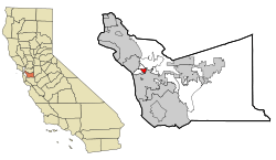
Location in Alameda County and the state of California
|
|
| Country | |
| State | |
| County | Alameda |
| Area | |
| • Total | 1.19 sq mi (3.09 km2) |
| • Land | 1.19 sq mi (3.09 km2) |
| • Water | 0.00 sq mi (0.00 km2) 0% |
| Elevation | 66 ft (20 m) |
| Population
(2020)
|
|
| • Total | 15,808 |
| • Density | 13,250.63/sq mi (5,114.51/km2) |
| Time zone | UTC-8 (Pacific) |
| • Summer (DST) | UTC-7 (PDT) |
| ZIP code |
94541
|
| Area code | 510, 341 |
| FIPS code | 06-12902 |
| GNIS feature IDs | 1867005, 2408020 |
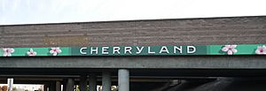
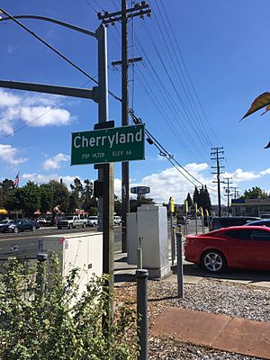
Cherryland is a community in Alameda County, California. It is an "unincorporated community," which means it does not have its own city government. Instead, it is managed by the county. Cherryland is located between Ashland to the north and the city of Hayward to the south. In 2020, about 15,808 people lived here.
Contents
History of Cherryland
Cherryland was once a very large farm. It had many orchards, which are like big fruit farms. A pioneer named William Meek owned this land. He was known as the "first farmer" of Alameda County.
In 1911, William Meek's family started to sell parts of the farm. They divided the land into smaller areas for homes. They called one of these new areas "Cherryland." The historic Meek Mansion is still in Cherryland today. It is looked after by the Hayward Area Recreation and Park District and the Hayward Area Historical Society.
Geography and Climate
Cherryland covers about 1.2 square miles (3.1 square kilometers) of land. There is no water area within the community. The San Lorenzo Creek flows partly through Cherryland. It also forms most of the community's northern border.
Cherryland's Climate
Cherryland has a climate known as a "warm-summer Mediterranean climate." This means it has warm, dry summers. The average monthly temperatures in summer are not very hot. Winters are generally mild and wet.
Population and People
Cherryland has grown over the years. Here is how the population has changed:
| Historical population | |||
|---|---|---|---|
| Census | Pop. | %± | |
| 1970 | 9,969 | — | |
| 1980 | 9,425 | −5.5% | |
| 1990 | 11,088 | 17.6% | |
| 2000 | 13,837 | 24.8% | |
| 2010 | 14,728 | 6.4% | |
| 2020 | 15,808 | 7.3% | |
| source: | |||
Who Lives in Cherryland?
According to the 2010 census, Cherryland is a diverse community. Many different groups of people live here. About 54% of the people were of Hispanic or Latino background. The community is made up of people from various racial and ethnic backgrounds.
Most people in Cherryland live in homes with their families. In 2010, the average household had about three people. The median age in Cherryland was about 32 years old. This means half the people were younger than 32, and half were older.
Parks and Fun
The Hayward Area Recreation and Park District helps provide parks and fun activities for the people in Cherryland.
Schools in Cherryland
Students in Cherryland attend schools in two different districts. The southern part of Cherryland is served by the Hayward Unified School District. The northern part is served by the San Lorenzo Unified School District.
Community Services
Cherryland receives important services from different organizations. The East Bay Municipal Utility District provides water to homes and businesses. The Oro Loma Sanitary District handles sanitation services. Other private companies provide services like electricity and gas.
Public Safety
The Alameda County Sheriff's Office helps keep Cherryland safe. The California Highway Patrol also works in the area. For emergencies like fires or medical help, the Alameda County Fire Department provides services.
Community Groups
Cherryland has several volunteer groups that help the community. These include the Cherryland Community Association and Padres Unidos. These groups work to make Cherryland a better place for everyone.
See also
 In Spanish: Cherryland para niños
 | Sharif Bey |
 | Hale Woodruff |
 | Richmond Barthé |
 | Purvis Young |


