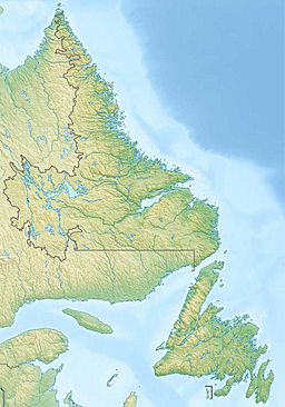
Ashuanipi Lake facts for kids
Quick facts for kids Ashuanipi Lake |
|
|---|---|
| Location | Southern Labrador, Newfoundland and Labrador, Canada |
| Coordinates | 52°39′N 66°08′W / 52.65°N 66.13°W |
| Primary outflows | Ashuanipi River |
| Basin countries | Canada |
| Surface area | 517 km2 (200 sq mi) |
| Surface elevation | 529 m (1,736 ft) |
Ashuanipi Lake is a large, unusually shaped lake located in southern Labrador, which is part of the Canadian province of Newfoundland and Labrador. It sits high up, about 529 m (1,736 ft) above sea level. The lake covers a big area of 517 km2 (200 sq mi). This measurement does not include the 79 km2 (31 sq mi) taken up by islands within the lake, like Grande Île or Grosse Île.
In the Innu language, the name ashuanipi means "a place to cross." This suggests the lake was an important travel spot long ago.
Lake Features and Surroundings
Ashuanipi Lake is known for its excellent fishing. You can find different types of fish here, including:
- Lake trout
- Pike
- Whitefish
- Landlocked salmon
The Lac Joseph caribou herd often visits the area around Ashuanipi Lake. They are usually seen there during the summer and fall months.
The land around the lake is mostly covered by forests. These forests are mainly made up of black spruce trees. However, there is a special place at the southern end of the lake called the Kapitagas Channel. This channel has the only jack pine forest found in all of Labrador. Because it is so unique, this area is protected as part of the Redfir Lake–Kapitagas Channel Ecological Reserve.
Water Flow and Transportation
The Ashuanipi River starts at the northern end of Ashuanipi Lake. This river flows into the Menihek Lakes. From there, the water eventually joins the Churchill River system. Finally, all this water flows into Lake Melville and then out to the Atlantic Ocean.
Two important transportation routes are near the lake. The Quebec North Shore and Labrador Railway runs along the eastern side of the lake. The Trans-Labrador Highway also crosses the Ashuanipi River. This crossing is about 10 km (6.2 mi) north of where the lake ends.
History of Human Presence
People have lived near Ashuanipi Lake for a very long time. Scientists have found evidence, using a method called radiocarbon dating, that humans were here as far back as 1600 years ago.
The lake was an important part of a travel route for the Innu people. They used this route, along with the nearby Moisie River, to reach the lower north shore of the St. Lawrence River. This shows how important the lake was for travel and trade in the past.
European colonists from New France knew about Ashuanipi Lake by the early 1700s. This means it was an important landmark even in early colonial times.
 | William L. Dawson |
 | W. E. B. Du Bois |
 | Harry Belafonte |


