Moisie River facts for kids
Quick facts for kids Moisie River |
|
|---|---|
 |
|
| Country | Canada |
| Province | Quebec |
| Region | Côte-Nord |
| Physical characteristics | |
| Main source | Lake Opocopa Rivière-Mouchalagane 52°30′50″N 66°33′56″W / 52.51389°N 66.56556°W |
| River mouth | Gulf of Saint Lawrence Sept-Îles 0 m (0 ft) 50°12′00″N 66°04′03″W / 50.20000°N 66.06750°W |
| Length | 410 km (250 mi) |
| Basin features | |
| Basin size | 19,273 km2 (7,441 sq mi) |
The Moisie River is a long and wild river in eastern Quebec, Canada. It is sometimes called the "Nahanni of the East" because it is one of North America's most beautiful and untouched rivers.
A large part of the river and its surrounding area is protected. This protection is part of the Moisie River Aquatic Reserve.
Contents
Where is the Moisie River located?
The Moisie River basin is the area of land that drains into the river. It covers about 19,273 square kilometres (7,441 sq mi). This area is found between the Rapides River to the west and the Matamec River to the east.
The Moisie River starts at Lake Opocopa, which is close to the border of Labrador. From there, it flows south. It ends by joining the Saint Lawrence River east of Sept-Îles, Quebec. The town of Moisie is right at the river's mouth.
The river is about 410 kilometres (250 mi) long. If you measure from the bridge on Quebec Route 389 over the Aux Pékans River, which is a common starting point for canoe trips, the river is about 373 km long.
Rivers that flow into the Moisie
Several smaller rivers flow into the Moisie River. These are called its tributaries:
- Aux Pékans River
- Carheil River (flows into the Pékans River)
- Nipissis River
- Caopacho River
- Ouapetec River
- Joseph River
What does the name Moisie mean?
The name of the river, Moisie, might come from a French word that means "moldy." However, this is not certain, and there might be other reasons for its name.
The Mishta-shipiunnu people, who are also known as the Innu from the Moisie River, have their own name for it. They call it Mishta-shipu, which means "Great River." In their language, mishau means "big" or "great," and shipu means "river."
For thousands of years, the Innu people have used the Moisie River. They travel along it to reach their traditional hunting and fishing areas in the north.
Protecting the river
In the past, parts of the river were owned by private groups for fishing. There were also plans to build hydroelectric power plants on the Moisie. These plants would use the river's water to make electricity.
However, in 2003, the Quebec government decided to protect a large part of the river's watershed. A watershed is the area of land where all the water drains into a river. This protected area is now an aquatic reserve. This means that certain activities are not allowed, such as:
- Logging (cutting down trees)
- Mining (digging for minerals)
- Building new power projects
But traditional activities are still allowed. These include hunting and fly-fishing.
River environment and animals
The Moisie River flows through different types of natural areas in Quebec. For example, its tributary, the Rivière aux Pékans, starts in an area with spruce trees and lichen. It then flows through a region with spruce trees and moss. The last part of the Moisie River flows through an area with fir trees and white birch. These are all parts of the large boreal forest.
The Moisie River is very important for Atlantic Salmon. It is the most important place for these salmon to lay their eggs in eastern North America. This makes the river a vital home for these fish.
How people use the Moisie River
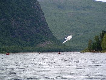
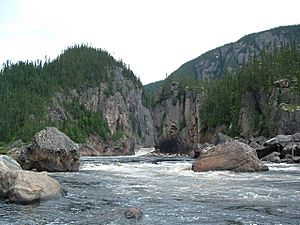
The Moisie River is very popular with experienced canoeists. It is known for its exciting whitewater rapids. The river flows through a deep valley that was formed by glaciers long ago. The valley changes in width, being very narrow in some places and wider where there are no rapids.
The beautiful views of mountains and cliffs make it a great place for canoe camping. The Quebec North Shore & Labrador Railway runs along the lower part of the Moisie River. This railway helps canoeists get to the higher parts of the river.
Because the river is in a remote area, there are not many places to get on or off the river. If a canoeist has an accident, the most common way to get help is by floatplane. However, because the valley is narrow, canoeists might have to travel several kilometers to find a spot where a plane can land.
The railway crosses the river at its last and largest whitewater rapid. This rapid is often called "train tracks" because it is so close to the railway above.
In the summer of 2014, a forest fire happened near the river. It damaged a lot of the surrounding nature. This made it unsafe for campers and canoeists to visit the area for a while. The Moisie River is very remote, and only a few cabins can be seen along its banks.
See also
 In Spanish: Río Moisie para niños
 | Ernest Everett Just |
 | Mary Jackson |
 | Emmett Chappelle |
 | Marie Maynard Daly |


