
Atoka, Tennessee facts for kids
Quick facts for kids
Atoka, Tennessee
|
|||
|---|---|---|---|
 |
|||
|
|||

Location of Atoka in Tipton County, Tennessee.
|
|||
| Country | |||
| State | |||
| County | Tipton | ||
| Incorporated | 1838 | ||
| Area | |||
| • Total | 12.17 sq mi (31.52 km2) | ||
| • Land | 12.13 sq mi (31.42 km2) | ||
| • Water | 0.04 sq mi (0.10 km2) | ||
| Elevation | 433 ft (132 m) | ||
| Population
(2020)
|
|||
| • Total | 10,008 | ||
| • Density | 824.93/sq mi (318.49/km2) | ||
| Time zone | UTC-6 (Central (CST)) | ||
| • Summer (DST) | UTC-5 (CDT) | ||
| ZIP code |
38004
|
||
| Area code(s) | 901 | ||
| FIPS code | 47-02340 | ||
| GNIS feature ID | 1275973 | ||


Atoka is a town in Tipton County, Tennessee, United States. It was officially started in 1838. Atoka was once an important stop on the Newport News & Mississippi Valley Railroad. Today, the famous Amtrak passenger train, the City of New Orleans, still travels through Atoka daily on its route between New Orleans and Chicago.
In 2020, Atoka had a population of 10,008 people. This makes it the largest town in Tipton County. The town has grown a lot since 1990, when only 659 people lived there.
Atoka adopted the original town rules, or "charter," from a nearby place called Portersville. A hero from World War I, Sgt. Joseph B. Adkison, who received the Medal of Honor, lived in Atoka and is buried close by. The town has five public parks for everyone to enjoy.
| Top - 0-9 A B C D E F G H I J K L M N O P Q R S T U V W X Y Z |
History of Atoka
How Atoka Started
Before Atoka became a town, a place called Portersville was the main trading center for the area. But everything changed when the railroad arrived in 1872. Stores opened in Atoka, and it quickly became more important than Portersville.
The railroad gave Atoka a big advantage. Because of this, Portersville slowly faded away. Today, no stores or buildings from old Portersville remain.
A man named John McLaughlin lived in both towns. He learned how to make carriages in South Carolina and Mississippi. Then, he moved to Portersville and continued his business. Later, he moved to Atoka and opened a store. This shows how Atoka grew as Portersville declined.
Important Dates for Atoka
- June 1, 1796 - The area became the 16th state, Tennessee.
- January 17, 1838 - Portersville was officially recognized as a town.
- March 24, 1875 - The name of Portersville was changed to Atoka.
- March 19, 1883 - The town's official recognition was temporarily stopped.
- 1911 - Atoka was officially recognized as a town again.
-
January 17, 1838 - Portersville incorporated.
-
March 24, 1875 - name of Portersville changed to Atoka.
-
March 19, 1883 - corporation of the town of Atoka repealed.


The Railroad's Arrival
The railroad came to Atoka in 1872, three years before Portersville changed its name to Atoka in 1875. This means that Atoka was a place with a railroad even before it became an officially recognized town. The railroad was very important for Atoka's growth.
-

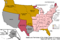
Map published around 1859. Shows Porterville on Shelby and Tipton County Lines. Portersville's town rules were adopted by Atoka in 1875.
-

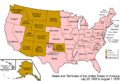
Map published in 1872. Shows Portersville in Tipton County.
-

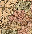
Map published in 1876. Shows a gap between Covington and Dyersburg railroad connections.
-
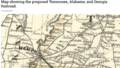
Map published in 1888. Shows the Newport News & Mississippi Valley Railroad running through Tipton and Lauderdale Counties in Tennessee.
-
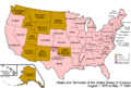
Map published around 1893, shows Atoka in Tipton County, Tennessee.


First Rural Mail Delivery
The United States Postal Service says that Atoka was the first place in Tennessee to have rural free mail delivery. This started on January 11, 1897. However, a local newspaper article from 1936 says it started in 1895.
This article claims Atoka had the third rural mail route in the entire United States. The Post Office Department was trying out rural routes back then. They set up one in the North, one in the East, and one in the South, which was in Atoka.
Atoka Route 1 was 16½ miles long. Later, it joined with Route 2, which covered the area from Atoka all the way to the Mississippi River.
D. Bowden was Atoka's first postmaster. As the mail delivery system grew, the Atoka post office became very important. In 1936, two rural routes went out from Atoka. They served the area from the Mississippi River in the west to Salem in the east.
Town's Official Rules

Atoka was officially recognized as a town again on June 24, 1911. The town's rules, or "charter," have been updated several times since then. The most recent changes were made in 2006, 1977, 1973, and 1969.
Atoka's Zip Code
The zip code for Atoka, Tennessee, is 38004. You can see the current area of the Atoka 38004 zip code on Zip Code Data Maps.
Parks and Fun Places in Atoka
Atoka has five town parks: Adkison Park, Atoka Greenway Trail, Nancy Lane Park, Pioneer Park, and Walker Park. Each park offers different ways to have fun and enjoy the outdoors.
Adkison Park
Adkison Park was Atoka's first park. It was created for the Tennessee Homecoming '86 celebration. The park is about one acre in size.
It has a lighted walking track, a playground shaped like a train, and picnic tables. There's also a special memorial area dedicated to Sgt. Joseph B. Adkison. The Bobby McDill Scout Hut, where Boy Scouts of America Troop 60 meets, is also in Adkison Park.
Atoka Greenway Trail
The Atoka Greenway Trail is a path planned to connect Walker Park and Pioneer Park. In 2013, Atoka received a grant to help fund the first part of this trail project.
Nancy Lane Park
Nancy Lane Park is a large park, almost 42 acres. It's named after Nancy Lane, who was an important town leader and park supporter. The park has a real caboose, a nature trail through the woods, a big playground, and picnic areas.
It also has an 18-hole disc golf course and a softball complex with four fields. Nancy Lane Park is home to the Atoka Dixie Youth Softball program. It even hosted the Dixie Youth Softball World Series in 2014!
Pioneer Park
Pioneer Park is more than 6.5 acres. It features a lighted walking track that goes around a nearly 2-acre pond with a fountain. The park also has a playground and picnic tables.
Walker Park
Walker Park is the largest park, covering over 60 acres. It's named after former Mayor Charles Walker. This park has restrooms, a 1.15-mile walking track, a playground, and picnic areas. It also has a concession stand, a splash pad for cooling off, a lighted sports field, and sand volleyball courts.
Transportation in Atoka
Railroad
The Canadian National Railway owns the train tracks that go through Atoka today. These tracks run all the way from New Orleans, Louisiana, to Chicago, Illinois, and even into Canada. The City of New Orleans Amtrak passenger train still uses these tracks daily. Even though it might look quiet, the railroad is busy with trains passing through regularly.
Highways
U.S. Route 51 runs along the western edge of Atoka. This highway connects Atoka to Shelby County, Tennessee and Memphis to the south. It also goes north through towns like Covington and Dyersburg.
Tennessee State Route 14, also known as Highway 14 or Austin Peay Highway, is west of Atoka. This highway goes south towards the Raleigh area and north towards Brownsville. About a twenty-minute drive south of Millington is Tennessee State Route 385. This highway helps drivers reach many areas in Shelby County.
Mississippi River Access
Atoka is only about 19 minutes away from the Mississippi River at Randolph, Tennessee. However, the closest bridge to cross the river into Arkansas is almost 40 minutes away. This bridge is the Hernando de Soto Bridge in Memphis, Tennessee. The next closest bridge is in Dyersburg, Tennessee.
Geography of Atoka
Atoka is located in Tipton County, Tennessee. The county just south of Tipton County is Shelby County, where the big city of Memphis is located. Tipton County is part of West Tennessee, one of the three main regions of the state.

The Mississippi River forms the western border of Tennessee. Atoka is located just east of the Mississippi River. Other Tennessee counties that border the Mississippi River include Shelby, Lauderdale, Dyer, and Lake Counties.

Population Data
| Historical population | |||
|---|---|---|---|
| Census | Pop. | %± | |
| 1920 | 245 | — | |
| 1930 | 222 | −9.4% | |
| 1940 | 255 | 14.9% | |
| 1950 | 334 | 31.0% | |
| 1960 | 357 | 6.9% | |
| 1970 | 446 | 24.9% | |
| 1980 | 691 | 54.9% | |
| 1990 | 659 | −4.6% | |
| 2000 | 3,235 | 390.9% | |
| 2010 | 8,387 | 159.3% | |
| 2020 | 10,008 | 19.3% | |
| Sources: | |||
2020 Census Information
| Race | Num. | Perc. |
|---|---|---|
| White (non-Hispanic) | 7,731 | 77.25% |
| Black or African American (non-Hispanic) | 1,189 | 11.88% |
| Native American | 33 | 0.33% |
| Asian | 118 | 1.18% |
| Pacific Islander | 16 | 0.16% |
| Other/Mixed | 594 | 5.94% |
| Hispanic or Latino | 327 | 3.27% |
According to the 2020 United States census, Atoka had 10,008 people living in the town. There were 2,942 households and 2,395 families.
Education in Atoka
Public schools in Atoka are part of the Tipton County Schools system. This school district has many schools: eight elementary schools, five middle schools, and four high schools. Atoka Elementary School opened in 2008 and is located right in Atoka. Younger students in the Atoka area can attend various public schools. Dr. John Combs is the leader of the Tipton County Schools.
Images for kids
-

Town of Atoka Sign, Atoka, Tennessee.
-

Flag of Atoka, Tennessee.
-

Seal of Atoka, Tennessee.
See also
 In Spanish: Atoka (Tennessee) para niños
