Randolph, Tennessee facts for kids
Quick facts for kids
Randolph, Tennessee
|
|
|---|---|
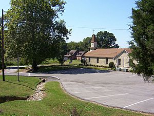
Randolph United Methodist Church (2008)
|
|
| Country | |
| State | |
| Counties | Tipton |
| Founded | 1820s |
| Area | |
| • Total | 1.46 sq mi (3.77 km2) |
| • Land | 1.45 sq mi (3.75 km2) |
| • Water | 0.01 sq mi (0.02 km2) |
| Elevation | 315 ft (96 m) |
| Population
(2020)
|
|
| • Total | 258 |
| • Density | 178.30/sq mi (68.86/km2) |
| Time zone | UTC-6 (CST) |
| • Summer (DST) | UTC-5 (CDT) |
| ZIP code |
38015 (Burlison, Tennessee)
|
| Area code(s) | 901 (Memphis metro area) |
| FIPS code | 47-61560 |
| GNIS feature ID | 1298899 |
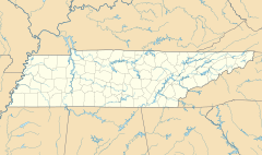
Randolph is a small, rural community in Tipton County, Tennessee. It sits right on the banks of the famous Mississippi River. Randolph was first settled in the 1820s. By 1827, it had its own post office.
In the 1830s, Randolph became a very important place for river trade in West Tennessee. It even shipped more cotton each year than Memphis until 1840. The first Methodist pastor was assigned here in 1834. However, the town's success started to fade in the late 1840s. This was due to problems with railroad plans and mail routes.
During the Civil War, Randolph was very important. The first Confederate fort in Tennessee was built here in 1861. Another fort was built later that year. Sadly, Union Army forces burned the town down twice during the war.
Randolph is located on the second Chickasaw Bluff. This area has many valleys formed by erosion. The top layer of soil is mostly silt loam, which comes from eroded loess. Below this, there is glacial gravel. Randolph is also near the New Madrid Seismic Zone, an area where earthquakes can happen. Many small earthquakes were recorded here between 1974 and 2004.
The climate in Randolph is humid subtropical. This means it has hot, sticky summers and cool, mild winters. In 2008, the Randolph Bluff Historic Park was opened. This park helps people learn about the town's Civil War history. It also offers amazing views of the Mississippi River. In 2008, Randolph had about 200 people living in roughly two dozen homes. The main way people make a living here is through agriculture, like farming. The Girl Scouts Heart of the South also has a camp nearby.
Randolph's Early History
How Randolph Began
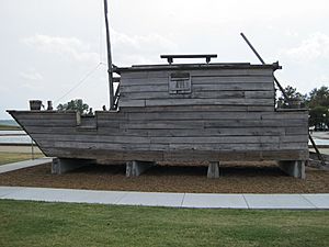
Around the year 1800, European settlers started moving into the land east of the Mississippi River. This land had been home to the Chickasaw Native Americans for hundreds of years. The Chickasaw land in West Tennessee and southwestern Kentucky was later given up in a deal called the Jackson Purchase. Both sides agreed to this transfer by signing the Treaty of Tuscaloosa in 1818.
In the early 1800s, the land around the Chickasaw Bluffs looked like a great spot for a harbor on the Mississippi River. By 1820, about 54 people lived in the area. In the early 1820s, two investors, John T. Brown and Robert Bedford, owned the land that would become Randolph. They said the area was "a good landing for Mississippi River flatboats." The Hatchie River, which joins the Mississippi just north of Randolph, was deep enough for steamboats to travel far upstream.
Brown and Bedford decided to plan a town here, hoping it would become a busy river port. The Tennessee Encyclopedia of History and Culture says Randolph was officially founded in 1823. Other records say it was founded in 1827 or 1828. The town was named after John Randolph (1773–1833), a leader in the United States Congress from Virginia.
Randolph's Cotton Trade
A Time of Success
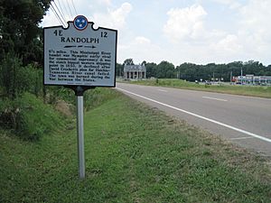
Randolph's location on the Mississippi River made it perfect for a harbor. Steamboats and flatboats could easily dock there at any river level. This made Randolph the most important place for steamboat trade in Tennessee. For a while, it was a big competitor with Memphis for river business.
By 1830, Randolph was the top shipping spot in Tennessee. In the mid-1830s, Randolph shipped up to 40,000 bales of cotton on the Mississippi River every year. It shipped more cotton than Memphis until 1840. When it was at its busiest, people called Randolph the "great steamboat depot of West Tennessee".
By 1829, Randolph had many businesses. It had warehouses, stores, doctors, and a tavern. By 1834, about 1,000 people lived there. The town had four hotels, nearly fifty businesses, private schools, and more than ten saloons. In the 1830s, two newspapers were printed in Randolph: the Randolph Recorder and the Randolph Whig. The first bank was also started then. A stagecoach line connected Randolph to Jackson twice a week.
Randolph's success in trade was partly due to the use of enslaved people. They were forced to work, mostly growing cotton. Other crops like corn, beans, and peas were also grown. Old newspapers from the 1830s show that landowners would announce public sales of enslaved people or offer rewards for those who had run away.
Why Randolph Declined
| Hist. Populations (est.) | |
|---|---|
| Year | Pop. |
| 1820 | 54 |
| 1834 | 1,000 |
| 1861 | 5,000 |
| 2008 | 2,020 |
| 258 | |
| Source: U.S. Decennial Census | |
Randolph's good fortune started to change in the late 1840s and 1850s. Problems began soon after the town was founded. Just five years after it was established, there was a legal fight over who owned the land. A problem with the land title involved a landowner from New York. This lawsuit "prevented the growth of population" until 1835. The people of Randolph eventually bought the land for $8,000 to settle the issue.
An inconvenient mail route also hurt the town early on. When the mail route was set up in 1829, Randolph was at the end of a side route. It only got mail once a week. Plans for a railroad also failed, which added to the town's decline. In 1852, Randolph residents tried to move the county seat from Covington to Randolph, but they were not successful.
Economic problems and David Crockett's failed attempt to dig a canal from the Hatchie River to the Tennessee River also hurt Randolph's future. Then, during the Civil War, the town was burned down twice. This happened in September 1862 and again in 1865. This made many people not want to rebuild their homes and businesses a second time.
Randolph During the Civil War
Building Forts
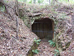
Fort Wright was the first Confederate Army fort built in Randolph. On January 20, 1861, a newspaper in Memphis suggested building a fort at Randolph to protect Memphis. In April 1861, Tennessee Governor Isham G. Harris ordered a camp and fort to be built at Randolph. About 5,000 soldiers from Tennessee, Arkansas, and the Confederate Army worked on this task. By June 1861, fifty cannons were ready at Fort Wright.
Nathan Bedford Forrest (1821–77), who would become a famous Confederate leader, trained at Fort Wright. Many future leaders in the Confederate Army learned how to build forts and set up artillery here. Fort Wright was the main defensive spot on the Mississippi River until July 1861. Today, only a powder magazine (a place to store gunpowder) is left of Fort Wright.
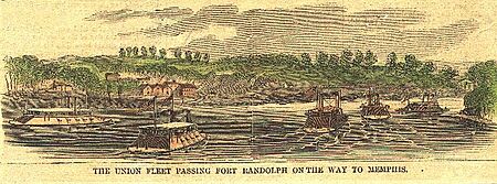
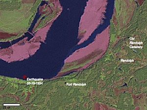
Fort Randolph was the second Confederate fort in the area. It was built in the fall of 1861. This fort was on the Mississippi River bluffs, about 1 mile (1.6 km) southwest of Fort Wright. A newspaper report from March 1862 described Fort Randolph as a "rough and incomplete earthwork" that was "more than 100 feet above the river." From this fort, soldiers could see the Mississippi River for 6 miles (9.7 km) in both directions. Fort Randolph no longer exists today.
The Town is Destroyed
In 1862, Union Army Major General William T. Sherman (1820–91) and his troops took control of Memphis and the areas around it. Sherman was frustrated by constant attacks from Confederate guerrillas in his area. These guerrillas from Randolph would weaken the Union forces along the Mississippi River.
In September 1862, a Union supply ship was shot at from Randolph. In response, Sherman ordered his soldiers to "destroy the place, leaving one house to mark the place." Union Army soldiers burned Randolph down to get back at the guerrillas. Sherman told his boss, General Ulysses S. Grant, that he had warned the public that repeated attacks would lead to "any measures of retaliation." Randolph was burned down a second time by federal soldiers in 1865.
Randolph's Geography and Climate
Understanding the Landscape
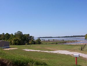
Randolph is located at 35°30′59″N 89°53′19″W / 35.51639°N 89.88861°W. It is about 315 feet (96 m) above sea level.
The top layer of soil in Randolph is mostly silt loam. This soil is found in different qualities and stages of erosion. About 15% of the soil is "Adler silt loam," found in flat areas that often flood. About 20% is badly eroded "Memphis silt loam" on steep slopes. Another 35% is "Memphis silt loam" on even steeper slopes. A smaller amount (less than 8%) is "Memphis silt loam" with less erosion on gentler slopes. The rest of the soil is made of other silts, sands, or clays. The "Memphis silt loam" comes from Pleistocene loess. Loess is a fine, windblown sediment. When it erodes, it forms silt in places with enough moisture, like from floods or rain.
The Natural Surroundings
Randolph sits on top of the second Chickasaw Bluff, on the east bank of the Mississippi River. The four Chickasaw Bluffs are high areas above the Mississippi River flood plains. They are made of eroded pre-historic loess over glacial gravel. The landscape around Randolph has the bluffs to the west, by the river, and flat cotton fields to the east.
The general look of the land around Randolph has not changed much in the last 150 years. In 1862, the area behind the town was described as "full of ravines and gorges." Ravines and gorges are valleys or canyons carved by erosion. This erosion is caused by streams, rivers, or seasonal rain. The landscape carved into the Mississippi River bluffs by water erosion is still visible today.
Roads and Travel
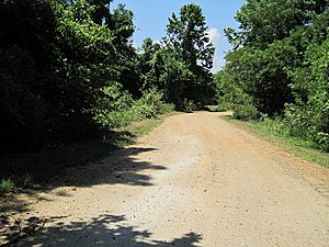
In 1833, a stagecoach road was built from Randolph to Jackson, about 70 miles (110 km) east. This old route connected the two towns and villages along the way twice a week. Randolph and Memphis were connected by a direct road later in the 1830s. This road was part of a mail route where mail was delivered weekly on horseback. The exact path of the road between Randolph and Memphis is not known. A small part of the old road, about 1,000 feet (300 m) long, existed until about 2005. This piece of Old Randolph Road was near the Wolf River in Memphis. By 2010, this part of the road was gone, replaced by an industrial area. In 1862, it was reported that Randolph could be reached by "several good roads."
In 2008, Randolph still had "good roads," but now they are mostly paved. U.S. Route 51 passes about 5 miles (8.0 km) southeast of Randolph. Tennessee State Route 59 (TN 59) passes about 0.5 miles (0.80 km) southeast. Four county roads meet at Randolph. Part of Ballard Slough Road is in the flood plains, so it can flood and is not paved.
| County roads at Randolph connect to ... | Direction | Road name | Surface |
|---|---|---|---|
| Jamestown below the bluff | North | Ballard Slough Rd | partially paved |
| Jamestown on top of the bluff | Northeast | Randolph Rd | fully paved |
| Tennessee State Route 59 (TN 59) | Southeast | Randolph Rd | fully paved |
| TN 59, continues to Drummonds and Dixonville | Southwest | Needham Rd | fully paved |
Rivers and Waterways
Randolph is on the east bank of the Mississippi River. It is just south of where the Hatchie River flows into the Mississippi. In the 1820s, steamboats could travel about 60 miles (97 km) up the Hatchie River from Randolph.
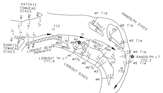
The United States Army Corps of Engineers (USACE) is a government agency that manages navigable waters and flood protection. From 2005 to 2007, the USACE spent a lot of money to keep the Mississippi River at Randolph open for boats and barges. They also worked to protect the area from floods. This work included dredging the river channel to remove sand and mud. They also built dikes to protect low-lying areas from flooding and erosion. A report from 2006 mentioned a stone dike built at Randolph that was about 25 feet (7.6 m) high.
Earthquake Risks
Randolph is on the edge of the New Madrid Seismic Zone. This means it is in an area with a high risk of earthquakes. Between 1974 and 2004, ten earthquakes were recorded within 10 miles (16 km) of Randolph. Their strength ranged from 1.5 to 3.2 on the Richter scale. The deepest part of these earthquakes was between 3.1 miles (5.0 km) and 8.2 miles (13.2 km) underground.
In the same time period, 45 earthquakes were reported within 20 miles (32 km) of Randolph. Their strengths ranged from 1.0 to 3.2. The strongest earthquake since 1974 happened on August 19, 1994. It was a 3.2 on the Richter scale. Its center was about 2 miles (3.2 km) west of Randolph, 6.6 miles (10.6 km) deep.
On January 16, 2009, a small earthquake shook parts of Tipton County. It was a 2.8 on the Richter scale. Its center was about 8 miles (13 km) northeast of Randolph. No damage was reported from this earthquake. Small earthquakes are common along the New Madrid Seismic Zone.
Randolph's Climate
Randolph has a humid subtropical climate. This means summers are hot and humid, while winters are chilly but mild. It rains a good amount throughout the year. July is usually the warmest month. In 1930, the highest temperature ever recorded was 108 °F (42 °C). January is usually the coolest month. In 1951, the lowest temperature ever recorded was -11 °F (-24 °C). December usually has the most rain.
| Climate data for Randolph, Tennessee | |||||||||||||
|---|---|---|---|---|---|---|---|---|---|---|---|---|---|
| Month | Jan | Feb | Mar | Apr | May | Jun | Jul | Aug | Sep | Oct | Nov | Dec | Year |
| Mean daily maximum °F (°C) | 46 (8) |
52 (11) |
61 (16) |
71 (22) |
80 (27) |
88 (31) |
91 (33) |
90 (32) |
84 (29) |
74 (23) |
61 (16) |
50 (10) |
71 (22) |
| Mean daily minimum °F (°C) | 28 (−2) |
32 (0) |
40 (4) |
49 (9) |
58 (14) |
66 (19) |
70 (21) |
67 (19) |
60 (16) |
49 (9) |
40 (4) |
31 (−1) |
49 (9) |
| Average precipitation inches (mm) | 4.21 (107) |
4.27 (108) |
5.41 (137) |
5.34 (136) |
5.22 (133) |
4.20 (107) |
4.13 (105) |
2.75 (70) |
3.62 (92) |
3.26 (83) |
5.28 (134) |
5.61 (142) |
53.3 (1,354) |
| Source: The Weather Channel | |||||||||||||
Life and Community in Randolph
How People Make a Living
Farming is the main way people earn money around Randolph, especially growing cotton. In the past, people also grew corn, beans, and peas. After slavery ended in 1865, many low-income families worked as sharecroppers. This meant they used land to grow crops and gave a part of their harvest to the landowner. Over time, modern machines like the cotton picker took over the work that people used to do by hand.
In 2008, Randolph had about 200 people living in roughly two dozen homes. The community's economy is mostly based on farming. There are no big factories or businesses here.
Churches in Randolph
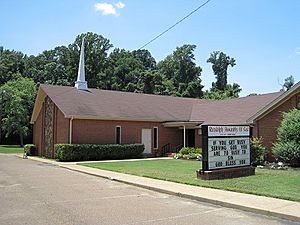
Randolph United Methodist Church
In 1834, Reverend Samuel R. Davidson became the first pastor at Randolph. He was sent by the Tennessee Conference of the United Methodist Church. After he arrived, a group of people formed a church around him and built a church building. The second church building was built in 1883. In 1953, a new church was finished. This building was updated in 1975 and is still used for worship by the Methodist community today.
By 1983, the United Methodist Church at Randolph had 78 different pastors over the years. In 2008, Reverend Thomas M. Yoder and Reverend Ben Rainey were the pastors. The Randolph United Methodist Church is located at 98 Ballard Slough Road. On average, about 76 people attend worship services there.
Randolph Assembly of God
Randolph Assembly of God is another church in the town. It was started in 2001. In 2008, Pastor Larry Rose and Pastor Frank Russell led the church. Randolph Assembly of God is located at 1135 Randolph Road.
Randolph Bluff Historic Park
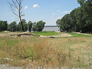
On October 11, 2008, the Tennessee Parks and Greenways Foundation opened the Randolph Bluff Historic Park. This was a celebration with politicians, conservationists, historians, and community members. The park is 19 acres (7.7 ha) and was bought for $378,000. The park aims to share the community's Civil War history. It also lets more people enjoy the amazing views of the Mississippi River. The park hopes to bring more tourism and money to Randolph. When finished, Randolph Bluff Historic Park will be part of the Mississippi River Corridor Tennessee. This project wants to create a scenic route that connects historic sites along the Mississippi River. It also helps with economic growth and protecting land and wildlife.
Girl Scouts in Randolph
Girl Scouts Heart of the South is a Girl Scout organization. It serves 16,500 girls in the Memphis metropolitan area. This includes counties in West Tennessee, North Mississippi, and Crittenden County, Arkansas. Girl Scouts Heart of the South runs six camps and one training center. One of these is "Camp Annemeekee," a 104-acre (42 ha) property in Tipton County. The scout camp is located on Girl Scout Road, south of Randolph.
Cemeteries in Randolph
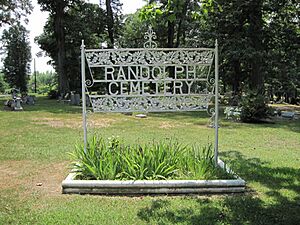
- Old Randolph Cemetery is at coordinates 35°31′25″N 89°53′08″W / 35.523693°N 89.885643°W.
- Historic Randolph Cemetery is on McClerkin Lane at coordinates 35°31′18″N 89°52′45″W / 35.52163°N 89.87909°W. Graves in this cemetery date from the early 1800s to today.
Postal Information
A post office was opened in Randolph in 1827. The Randolph Post Office stayed open until 1932. We do not know the exact location of the old post office.
In 2008, the U.S. ZIP code for Randolph was 38015. This ZIP code is shared with Burlison, Tennessee. The telephone area code is 901, which is part of the Memphis metro area.
Famous People from Randolph
 | John T. Biggers |
 | Thomas Blackshear |
 | Mark Bradford |
 | Beverly Buchanan |


