Atoko Point facts for kids
Quick facts for kids Atoko Point |
|
|---|---|

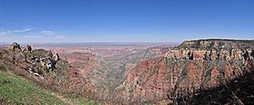
Kwagunt Canyon, Atoko Point (right)
|
|
| Highest point | |
| Elevation | 8,382 ft (2,555 m) |
| Prominence | 50 ft (15 m) |
| Isolation | 0.5 mi (0.80 km) |
| Parent peak | prominence 8442 ft |
| Geography | |
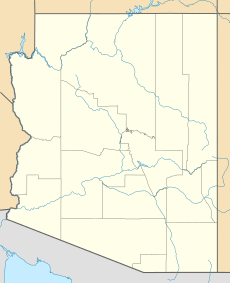
| Location | Grand Canyon National Park, (Walhalla Plateau) Coconino County, Arizona, US |
| Parent range | Kaibab Plateau (Walhalla Plateau) Colorado Plateau |
| Topo map | USGS Walhalla Plateau |
| Geology | |
| Age of rock | Permian |
| Mountain type | sedimentary rock: limestone-(prominence-cliff) |
| Type of rock | Kaibab Limestone |
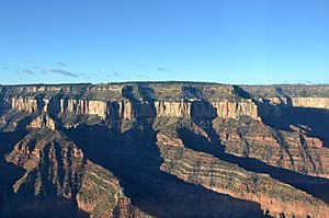
Atoko Point is a tall cliff located in the eastern part of the Grand Canyon in Arizona, United States. It stands at an elevation of 8,382 feet (about 2,555 meters). This amazing natural landmark is found within the Grand Canyon National Park.
Atoko Point is part of a special area called the Walhalla Plateau. It offers incredible views of the vast canyon landscape.
Contents
Where is Atoko Point?
Atoko Point is in Coconino County, Arizona. It is about 6.5 miles (10.5 km) south-southeast of Point Imperial. Point Imperial is the northernmost spot on the east side of the North Rim of the Grand Canyon.
Nearby Landmarks
Atoko Point is close to other famous spots. It is 1.3 miles (2.1 km) southeast of Roosevelt Point. It is also 2.6 miles (4.2 km) southeast of the Vista Encantada viewpoint.
Water Features
Two small canyons, which are the beginnings of Upper Kwagunt Creek, surround Atoko Point. These creeks flow east towards the Colorado River. The Colorado River is about 6.5 miles (10.5 km) east, in the southern part of Marble Canyon.
Access to Atoko Point
You can find Atoko Point about one mile east of the Cape Royal Road. This road helps visitors get to different viewpoints in the Grand Canyon.
What is Atoko Point Made Of?
The cliff of Atoko Point is made up of several layers of rock. These layers show the long history of the Earth.
Rock Layers
- Kaibab Limestone: This is the very top layer of the cliff. It is a type of rock often seen at the rim of the Grand Canyon.
- Toroweap Formation: Below the Kaibab Limestone, you will find this layer.
- Coconino Sandstone: This layer forms white cliffs. It is known for its bright, sandy appearance.
- Hermit Shale: Underneath the Coconino Sandstone is a softer, reddish-brown rock. This layer is easy to erode, meaning it wears away over time.
- Supai Group: At the very bottom are four layers of bright red-orange rocks. These layers make up the Supai Group.


