For the peak of the same name in Arizona's Aubrey Peak Wilderness, see Aubrey Peak (Rawhide Mountains).
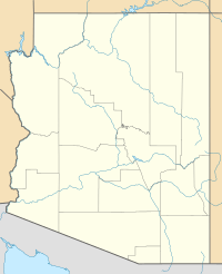
Aubrey Peak, also called Grooms Peak, is a notable mountain in Arizona. It is located about 35 miles east of Lake Havasu City. This peak is found in Mohave County and is part of the Hualapai Mountains.
Exploring Aubrey Peak
Aubrey Peak stands tall at 5,080 feet (about 1,548 meters) above sea level. It is made mostly of granite rock, which is a very hard type of rock. This granite also contains a mineral called feldspar. The mountain itself formed a very long time ago, between 1.7 and 1.4 million years ago.
How to Reach the Peak
You can get close to Aubrey Peak from the town of Wikieup. Wikieup is located on U.S. Route 93. From Wikieup, you can take Chicken Springs Road. This road goes up to a flatter area, called a saddle, on the mountain's southeast side. From there, it's about a 1-mile hike to the top.


