Baker Run facts for kids
Quick facts for kids Baker Run |
|
|---|---|

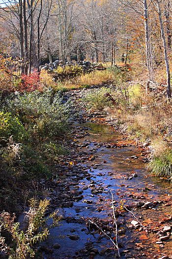
Baker Run looking upstream in its lower reaches
|
|
| Other name(s) | Windfall Run |
| Physical characteristics | |
| Main source | Stone Mountain in Noxen Township, Wyoming County, Pennsylvania between 1,580 and 1,600 feet (482 and 488 m) |
| River mouth | Bowman Creek in Noxen Township, Wyoming County, Pennsylvania 1,227 ft (374 m) 41°24′03″N 76°06′50″W / 41.40095°N 76.11389°W |
| Length | 1.1 mi (1.8 km) |
| Basin features | |
| Progression | Bowman Creek → Susquehanna River → Chesapeake Bay |
| Basin size | 2.28 sq mi (5.9 km2) |
| Tributaries |
|
Baker Run is a small stream, also known as Windfall Run. It flows into Bowman Creek in Wyoming County, Pennsylvania, USA. This stream is about 1.1 miles (1.8 km) long. It travels through Noxen Township. The area of land that drains into Baker Run is 2.28 square miles (5.9 km2). This stream is very clean and healthy. It is a great place for fish that like cold water. It also helps fish that travel to different places.
Contents
Where Does Baker Run Flow?
Baker Run starts high up on Stone Mountain in Noxen Township. It flows downhill, generally heading south. The stream soon enters a deep valley. Here, it meets its only named branch, Windfall Run. Windfall Run joins Baker Run from the right side. After this, Baker Run makes a few turns. It then flows east-northeast for a short distance. Finally, it joins Bowman Creek. Baker Run meets Bowman Creek about 17.58 miles (28.29 km) before Bowman Creek reaches its own end.
What Are Baker Run's Branches?
Baker Run has one main branch called Windfall Run. Windfall Run is about 1.7-mile (2.7 km) long. It flows into Baker Run about 0.66 miles (1.06 km) upstream from Baker Run's mouth. Windfall Run drains an area of 1.68 square miles (4.4 km2).
How Clean Is Baker Run?
Baker Run is a very healthy stream. It is not listed as a polluted or "impaired" waterbody. This means its water quality is good.
What Is the Land Around Baker Run Like?
The land around Baker Run changes as you move along the stream. Near where Baker Run joins Bowman Creek, the ground is made of alluvium. This is a type of soil with layers of sand, silt, and gravel left by flowing water. There are also flat areas called alluvial terraces. Further upstream, in the middle and upper parts of the stream, you'll find Wisconsinan Till. This is a type of soil left behind by glaciers. In some spots, this till is on top of clays from old glacial lakes.
The highest point near the stream's start is between 1,580 and 1,600 feet (482 and 488 m) above sea level. Near where it ends, the elevation is about 1,227 feet (374 m) above sea level.
What Is Baker Run's History?
Baker Run was officially named on August 2, 1979. Its official ID number is 1198348. The stream has also been known as Windfall Run for a long time. This other name even appeared on a map from 1946.
What Animals Live in Baker Run?
The area that drains into Baker Run is special. It is known as a High-Quality Coldwater Fishery. This means it's a great place for fish that need cold, clean water. It's also a Migratory Fishery. This means it's important for fish that travel to different places to lay their eggs. Wild trout naturally live and reproduce in Baker Run. You can find them from the very start of the stream all the way to its mouth.
 | Misty Copeland |
 | Raven Wilkinson |
 | Debra Austin |
 | Aesha Ash |

