Bald Peak facts for kids
Quick facts for kids Bald Peak |
|
|---|---|
 |
|
| Highest point | |
| Elevation | 1624+ ft (495+ m) NAVD 88 |
| Prominence | 1,400 feet (427 m) |
| Geography | |
| Location | Yamhill County, Oregon, U.S. |
| Parent range | Chehalem Mountains |
| Topo map | USGS Laurelwood |
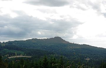
Bald Peak is a cool mountain in Oregon, USA. It's the highest point in the Chehalem Mountains. You can find it in Yamhill County, close to the border of Washington County. The very top of Bald Peak is super high, over 1,624 feet (495 meters)! It's the tallest spot in the whole Willamette Valley. There's even a state park called Bald Peak State Scenic Viewpoint right on the mountain. It's a great place to visit!
How Bald Peak Was Formed
The mountains around Bald Peak, including the peak itself, are made of one big piece of land. Imagine giant puzzle pieces making up Earth's surface. These pieces are called tectonic plates. Bald Peak and its mountain range were formed when one of these huge pieces of land slowly pushed upwards. This process is called uplift.
Because of this uplift, Bald Peak became the tallest part of the Chehalem Mountains. It's also the highest spot in the entire Willamette Valley.


