Ballaroo, Queensland facts for kids
Quick facts for kids BallarooQueensland |
|||||||||||||||
|---|---|---|---|---|---|---|---|---|---|---|---|---|---|---|---|

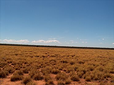
Ballaroo landscape
|
|||||||||||||||
| Population | 51 (2021 census) | ||||||||||||||
| • Density | 0.02855/km2 (0.0739/sq mi) | ||||||||||||||
| Postcode(s) | 4455 | ||||||||||||||
| Area | 1,786.5 km2 (689.8 sq mi) | ||||||||||||||
| Time zone | AEST (UTC+10:00) | ||||||||||||||
| Location | |||||||||||||||
| LGA(s) | Maranoa Region | ||||||||||||||
| State electorate(s) | Warrego | ||||||||||||||
| Federal Division(s) | Maranoa | ||||||||||||||
|
|||||||||||||||
Ballaroo is a small, quiet rural area in Queensland, Australia. It's part of the Maranoa Region. In 2021, only 51 people lived there, making it a very small community.
Contents
Exploring Ballaroo's Geography
Rivers and Mountains in Ballaroo
Ballaroo is home to the Cogoon River, also known as Muckadilla Creek. This river usually has a gentle flow. It travels through the area from the north, near Mount Abundance, towards the south-east, eventually joining the larger Balonne River.
Right in the middle of Ballaroo, you'll find Mount First View. This mountain stands about 326 meters (or 1,070 feet) above sea level. It got its name on May 3, 1846, from Sir Thomas Livingstone Mitchell. He was an important surveyor for New South Wales back then.
Ballaroo's Past: A Glimpse into History
Early Explorers in Ballaroo
A long time ago, in 1846, a famous explorer named Thomas Mitchell traveled through this area. He was the colonial surveyor-general. Mitchell and his team followed the Cogoon River from the Balonne River all the way to Mount Abundance during their journey.
Who Lives in Ballaroo?
Ballaroo's Population Over Time
Ballaroo is a very small community. In 2016, there were 41 people living there. By 2021, the population had grown slightly to 51 people.
Learning in Ballaroo
Schooling Options for Kids
There are no schools directly in Ballaroo. Students usually travel to nearby towns for their education. The closest primary schools are Dunkeld State School in Dunkeld (to the west) and Begonia State School in Begonia (to the south-west).
For both primary and secondary school, Roma State College in Roma is an option. However, Roma is quite far away. Because of the distance, many students in Ballaroo might choose to learn through distance education (learning from home) or attend a boarding school.


