Ballyryan facts for kids
Quick facts for kids Ballyryan (Ballyreen) |
|
|---|---|
| Irish: Baile Uí Rinn; Ring's homestead | |

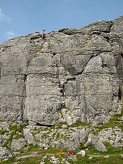
Climbers on Right Crack (VDiff) in Ballyran
|
|
| Location | |
| Nearest city | 6 km south of Fanore 8 km north of Doolin |
| Range | The Burren |
| Coordinates | 53°04′00″N 9°21′32″W / 53.06661°N 9.3589°W |
| Climbing type |
|
| Height | 15 metres at highest point |
| Pitches | Single pitch |
| Ratings |
|
| Rock type | Limestone |
| Quantity of rock |
|
| Development |
|
| Cliff aspect | West |
| Elevation | circa 25 metres above sea level |
| Ownership | Private property |
| Camping |
|
| Classic climbs |
|
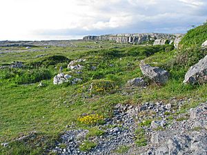
Ballyryan or Ballyreen is a small rock climbing spot in County Clare, Ireland. It's known as a "crag," which is a rugged cliff or rock face. This crag is made of limestone and faces mostly west. It's a popular place for rock climbers because it's easy to get to. It also has many short climbs that are good for beginners and those with some experience. Ballyryan is very close to a much bigger and more famous sea-cliff called Ailladie. Ailladie is sometimes called the Ballyreen Cliffs or Ballyreen Point by local people.
Rock Climbing at Ballyryan
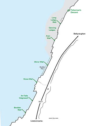
The Ballyryan crag is right next to the Ailladie Car Park. This car park is on the R477 road. Climbers started making paths, or "routes," on Ballyryan in the early 1970s. Some of the first routes were Whose Corner and Whacky. Even before these were officially recorded, climbing groups used Ballyryan for training.
Most of the climbing routes at Ballyryan are about 10 to 12 meters high. They range from easy (Diff) to quite challenging (HVS). Because Ballyryan is so close to Ailladie, which has many very difficult climbs, some harder routes have also been created here. These include Agony Aunt and Crack 90.
Sometimes, climbers say that Ballyryan's routes can be "difficult to protect" when a climber is "leading" (going up first). This means it can be tricky to place safety gear. So, climbers need to be extra careful. Newer climbers can use a technique called "toproping" for safety. This is where the rope goes through an anchor at the top of the climb, making it safer.
The cliff gets its name from the local area, Ballyryan. The name Ballyreen is also used by people living nearby.
 | Valerie Thomas |
 | Frederick McKinley Jones |
 | George Edward Alcorn Jr. |
 | Thomas Mensah |


